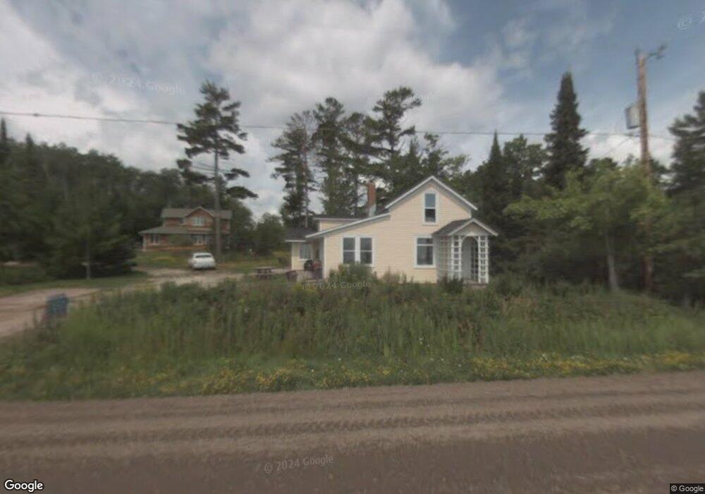
1370 Middle Rd La Pointe, WI 54850
Estimated Value: $431,000 - $532,000
2
Beds
1
Bath
1,400
Sq Ft
$344/Sq Ft
Est. Value
About This Home
This home is located at 1370 Middle Rd, La Pointe, WI 54850 and is currently estimated at $480,916, approximately $343 per square foot. 1370 Middle Rd is a home with nearby schools including Bayfield High School.
Ownership History
Date
Name
Owned For
Owner Type
Purchase Details
Closed on
May 9, 2011
Sold by
Demorest Harry
Bought by
Martin Douglas M and Martin Diane L
Current Estimated Value
Purchase Details
Closed on
Apr 12, 2006
Sold by
Demorest Harry
Bought by
Balck Dog Properties
Create a Home Valuation Report for This Property
The Home Valuation Report is an in-depth analysis detailing your home's value as well as a comparison with similar homes in the area
Purchase History
| Date | Buyer | Sale Price | Title Company |
|---|---|---|---|
| Martin Douglas M | $200,000 | None Available | |
| Balck Dog Properties | -- | None Available | |
| Dernorest Harry | -- | None Available | |
| Demorest Harry | -- | None Available |
Source: Public Records
Mortgage History
| Date | Status | Borrower | Loan Amount |
|---|---|---|---|
| Closed | Demorest Harry | -- |
Source: Public Records
Tax History
| Year | Tax Paid | Tax Assessment Tax Assessment Total Assessment is a certain percentage of the fair market value that is determined by local assessors to be the total taxable value of land and additions on the property. | Land | Improvement |
|---|---|---|---|---|
| 2025 | $8,878 | $408,600 | $175,100 | $233,500 |
| 2024 | $8,412 | $408,600 | $175,100 | $233,500 |
| 2023 | $5,882 | $233,200 | $124,700 | $108,500 |
| 2022 | $5,445 | $233,200 | $124,700 | $108,500 |
| 2021 | $5,425 | $233,200 | $124,700 | $108,500 |
| 2020 | $5,277 | $233,200 | $124,700 | $108,500 |
| 2019 | $5,003 | $233,200 | $124,700 | $108,500 |
| 2018 | $3,533 | $176,100 | $124,700 | $51,400 |
| 2017 | $3,865 | $196,100 | $124,700 | $71,400 |
| 2016 | $3,872 | $196,100 | $124,700 | $71,400 |
| 2015 | $4,124 | $196,100 | $124,700 | $71,400 |
| 2014 | $3,783 | $210,000 | $138,600 | $71,400 |
| 2013 | $3,924 | $210,000 | $138,600 | $71,400 |
Source: Public Records
Map
Nearby Homes
- 1161 Middle Rd
- 1117 S Shore Rd
- 804 Middle Rd
- Lot 5 Raspberry Trail
- Lot 1, Block 1 Raspberry Trail
- Lot 6, Block 1 Raspberry Trail
- Lot 3, Block 1 Raspberry Trail
- Lot 2, Block 2 Raspberry Trail
- 83XXX State Highway 13
- 83XX State Highway 13
- 231 N 1st St Unit 302
- 0 N 2nd St Unit Tax ID 31588 6118828
- 107 S 4th St
- 33 S 4th St
- Lots 1-5 Wilson Ave
- 401 N 2nd St
- 321 Rice Ave
- xxx Rice Ave
- 86360 Meyers Olson Rd
- 11XXX Old Military Rd
- 1360 Middle Rd
- 1414 Chebomnicon Rd
- 1350 Middle Rd
- 1382 Middle Rd
- 1344 Middle Rd
- 1390 Middle Rd
- 1335 Middle Rd
- 1394 Middle Rd
- 1400 Middle Rd
- 1328 Middle Rd
- 1414 Middle Rd
- 1300 Middle Rd
- 1323 Middle Rd
- 1300 Chebomnicon Bay Rd
- 1414 Middle Rd
- 1414 Chebomnicon Bay Rd
- 1418 Middle Rd
- 1424 Chebomnicon Rd
- 1298 S Shore Rd
- 1424 Middle Rd
Your Personal Tour Guide
Ask me questions while you tour the home.