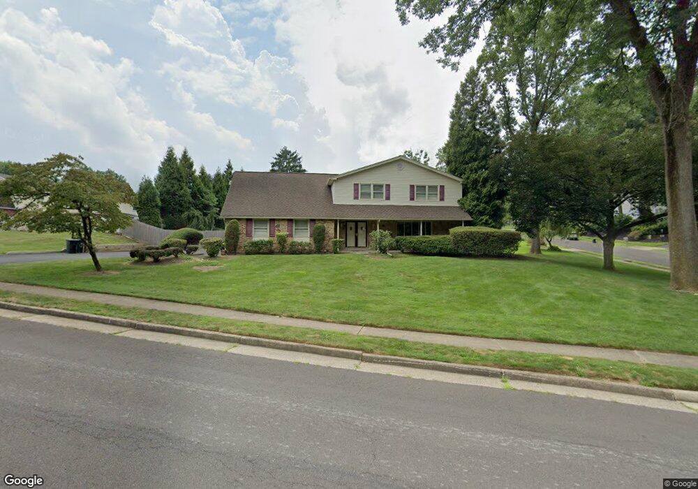
1370 Rhoades Dr Huntingdon Valley, PA 19006
Lower Moreland NeighborhoodEstimated Value: $727,000 - $774,000
4
Beds
3
Baths
3,050
Sq Ft
$245/Sq Ft
Est. Value
About This Home
This home is located at 1370 Rhoades Dr, Huntingdon Valley, PA 19006 and is currently estimated at $747,644, approximately $245 per square foot. 1370 Rhoades Dr is a home located in Montgomery County with nearby schools including Pine Road Elementary School, Murray Avenue School, and Lower Moreland High School.
Ownership History
Date
Name
Owned For
Owner Type
Purchase Details
Closed on
Aug 31, 2007
Sold by
Cohen Alan
Bought by
Berman Stephen M and Berman Mary Ann
Current Estimated Value
Home Financials for this Owner
Home Financials are based on the most recent Mortgage that was taken out on this home.
Original Mortgage
$47,100
Outstanding Balance
$30,019
Interest Rate
6.7%
Estimated Equity
$717,625
Create a Home Valuation Report for This Property
The Home Valuation Report is an in-depth analysis detailing your home's value as well as a comparison with similar homes in the area
Home Values in the Area
Average Home Value in this Area
Purchase History
| Date | Buyer | Sale Price | Title Company |
|---|---|---|---|
| Berman Stephen M | $472,500 | None Available |
Source: Public Records
Mortgage History
| Date | Status | Borrower | Loan Amount |
|---|---|---|---|
| Open | Berman Stephen M | $47,100 | |
| Open | Berman Stephen M | $378,000 |
Source: Public Records
Tax History Compared to Growth
Tax History
| Year | Tax Paid | Tax Assessment Tax Assessment Total Assessment is a certain percentage of the fair market value that is determined by local assessors to be the total taxable value of land and additions on the property. | Land | Improvement |
|---|---|---|---|---|
| 2025 | $12,275 | $243,130 | $62,800 | $180,330 |
| 2024 | $12,275 | $243,130 | $62,800 | $180,330 |
| 2023 | $11,731 | $243,130 | $62,800 | $180,330 |
| 2022 | $11,387 | $243,130 | $62,800 | $180,330 |
| 2021 | $11,153 | $243,130 | $62,800 | $180,330 |
| 2020 | $10,822 | $243,130 | $62,800 | $180,330 |
| 2019 | $10,659 | $243,130 | $62,800 | $180,330 |
| 2018 | $2,243 | $243,130 | $62,800 | $180,330 |
| 2017 | $10,053 | $243,130 | $62,800 | $180,330 |
| 2016 | $9,959 | $243,130 | $62,800 | $180,330 |
| 2015 | $9,356 | $243,130 | $62,800 | $180,330 |
| 2014 | $9,356 | $243,130 | $62,800 | $180,330 |
Source: Public Records
Map
Nearby Homes
- 1291 Mettler Rd
- 1427 Byberry Rd
- 3843 Loop Rd
- 1439 Byberry Rd
- 3505 Heaton Rd
- 3617 Sipler Ln
- 3370 Paper Mill Rd
- 3541 Reading Way
- 1011 Milkweed Rd
- 1018 Corn Crib Dr
- 985 Milkweed Ln
- 1035 Wright Dr
- 3750 Wheatsheaf Rd
- 377 Holly Dr
- 2015 Butternut Dr
- 530 Andrew Dr
- 3567 Oriole Dr
- 3660 Spring Run Rd
- 415 New Rd
- 43 Davisville Rd
- 3659 Holt Ln
- 1356 Rhoades Dr
- 1347 Rhoades Dr
- 1384 Rhoades Dr
- 1344 Gantt Dr
- 1369 Rhoades Dr
- 3645 Holt Ln
- 3658 Holt Ln
- 1361 Wright Dr
- 1381 Rhoades Dr
- 1387 Greenawalt Rd
- 1341 Mettler Rd
- 1402 Rhoades Dr
- 1357 Gantt Dr
- 1332 Gantt Dr
- 3631 Holt Ln
- 1354 Wright Dr
- 1341 Gantt Dr
- 1405 Greenawalt Rd
- 1332 Wright Dr