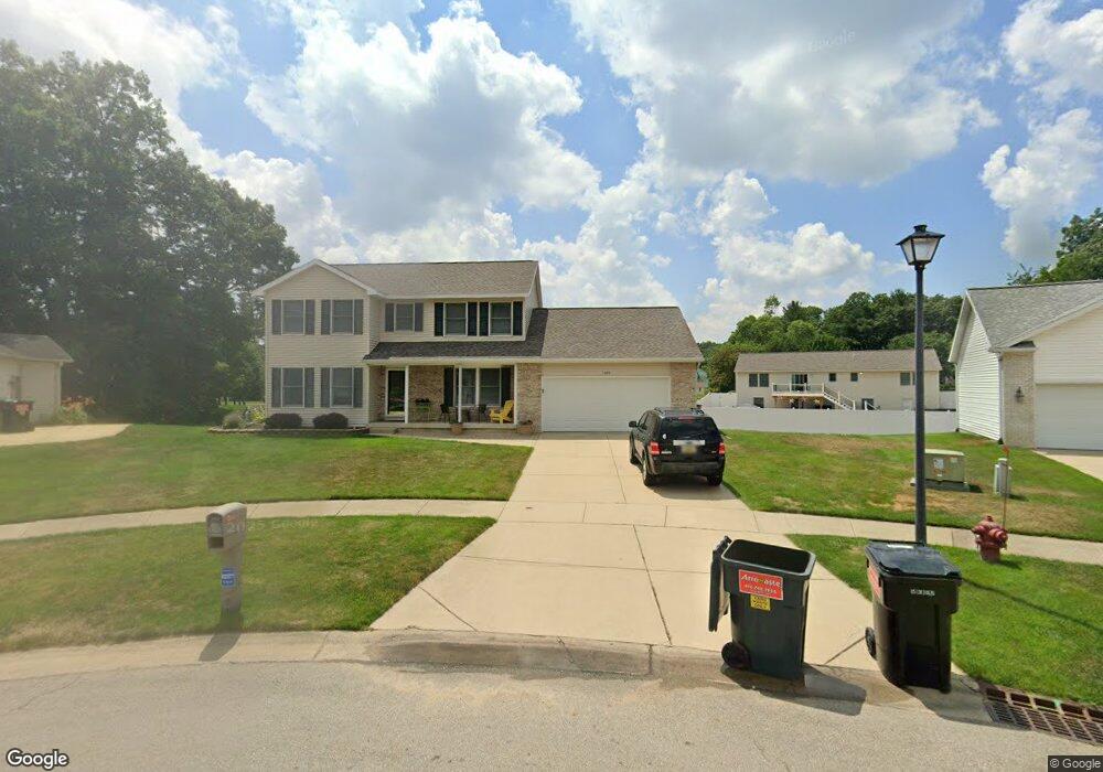
1370 Safety Ct NE Belmont, MI 49306
Estimated Value: $462,000 - $515,000
--
Bed
--
Bath
--
Sq Ft
0.32
Acres
About This Home
This home is located at 1370 Safety Ct NE, Belmont, MI 49306 and is currently estimated at $483,188. 1370 Safety Ct NE is a home located in Kent County with nearby schools including Pine Island Elementary School, Stoney Creek Elementary School, and Mill Creek Middle School.
Ownership History
Date
Name
Owned For
Owner Type
Purchase Details
Closed on
Jul 18, 2012
Sold by
Macka Joseph D and Macka Laura A
Bought by
Macka Joseph D and Macka Joseph D
Current Estimated Value
Purchase Details
Closed on
Oct 1, 2002
Sold by
Brinks Builders Inc
Bought by
Macka Joseph D and Macka Laura A
Home Financials for this Owner
Home Financials are based on the most recent Mortgage that was taken out on this home.
Original Mortgage
$185,250
Interest Rate
6.24%
Mortgage Type
Purchase Money Mortgage
Purchase Details
Closed on
Sep 26, 2002
Sold by
Northbrook Inc
Bought by
Brinks Builders Inc
Home Financials for this Owner
Home Financials are based on the most recent Mortgage that was taken out on this home.
Original Mortgage
$185,250
Interest Rate
6.24%
Mortgage Type
Purchase Money Mortgage
Purchase Details
Closed on
Jun 16, 2000
Bought by
Northbrook Inc and Macka Joseph D
Create a Home Valuation Report for This Property
The Home Valuation Report is an in-depth analysis detailing your home's value as well as a comparison with similar homes in the area
Home Values in the Area
Average Home Value in this Area
Purchase History
| Date | Buyer | Sale Price | Title Company |
|---|---|---|---|
| Macka Joseph D | -- | None Listed On Document | |
| Macka Joseph D | $195,000 | -- | |
| Brinks Builders Inc | $37,000 | -- | |
| Northbrook Inc | -- | -- |
Source: Public Records
Mortgage History
| Date | Status | Borrower | Loan Amount |
|---|---|---|---|
| Previous Owner | Macka Joseph D | $185,250 |
Source: Public Records
Tax History Compared to Growth
Tax History
| Year | Tax Paid | Tax Assessment Tax Assessment Total Assessment is a certain percentage of the fair market value that is determined by local assessors to be the total taxable value of land and additions on the property. | Land | Improvement |
|---|---|---|---|---|
| 2025 | $3,640 | $230,700 | $0 | $0 |
| 2024 | $3,640 | $208,900 | $0 | $0 |
| 2023 | $3,478 | $182,400 | $0 | $0 |
| 2022 | $4,219 | $162,600 | $0 | $0 |
| 2021 | $4,106 | $153,200 | $0 | $0 |
| 2020 | $3,194 | $143,300 | $0 | $0 |
| 2019 | $4,006 | $115,700 | $0 | $0 |
| 2018 | $3,923 | $129,200 | $0 | $0 |
| 2017 | $3,822 | $118,800 | $0 | $0 |
| 2016 | $3,699 | $110,700 | $0 | $0 |
| 2015 | $3,694 | $110,700 | $0 | $0 |
| 2013 | -- | $100,800 | $0 | $0 |
Source: Public Records
Map
Nearby Homes
- 5856 Hillbrook Ct NE
- VL Par C Buth Dr NE
- VL Par B Buth Dr NE
- VL Par D Buth Dr NE
- 6396 Bentley Dr NE
- 5555 Skyway Dr NE
- 5788 W River Dr NE
- 824 Scott View Dr NE
- 980 River Rock Dr NE
- 605 Scott View Ct NE
- 6150 Rogue River Meadows Dr NE
- 1772 Post Dr NE
- 2142 Belmont Farms Cir NE
- 2179 Drew Dr
- 1970 Post Dr NE
- 446 Windchime Dr
- 7215 Chandler Dr NE
- 5011 Coit Ave NE
- 5621 Pine Island Dr NE
- 5819 Grand Oaks Dr NE
- 1382 Safety Ct NE
- 1373 Safety Ct NE
- 1250 Millwood Dr NE
- 1264 Millwood Dr NE
- 1230 Millwood Dr NE
- 1272 Millwood Dr NE
- 1381 Safety Ct NE
- 1398 Safety Ct NE
- 1224 Millwood Dr NE
- 1324 Millwood Ct NE
- 1395 Safety Ct NE
- 1200 Millwood Dr NE
- 1300 Millwood Ct NE
- 1338 Millwood Ct NE
- 1253 Millwood Dr NE
- 1265 Millwood Dr NE
- 6041 Safety Dr NE
- 1271 Millwood Dr NE
- 1290 Hillbrook Ct NE
- 5959 Daybrook Ct NE