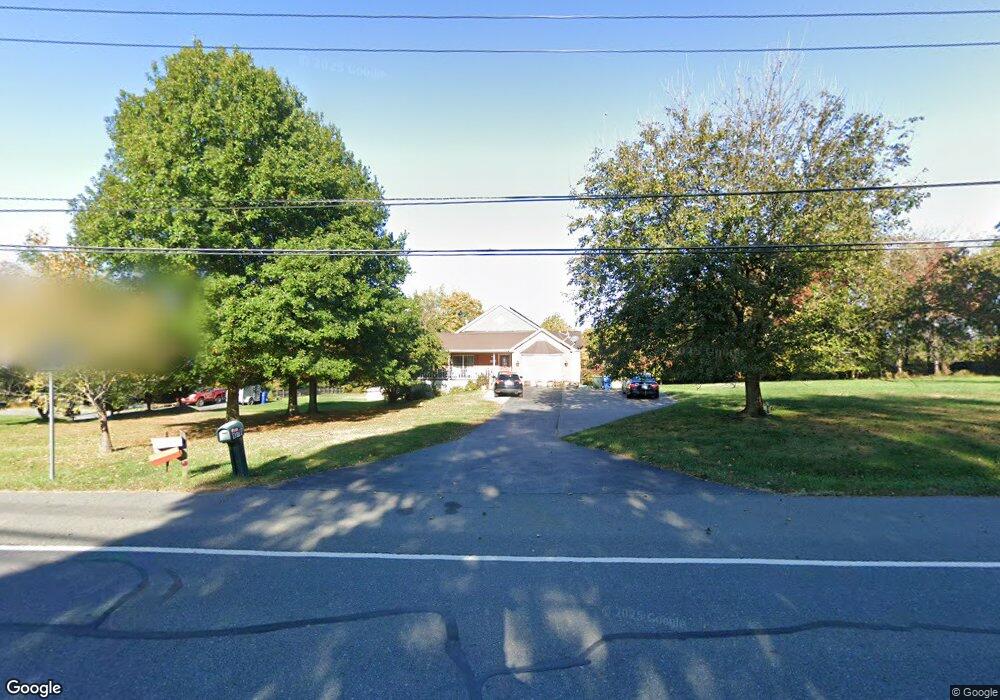
13701 Darnestown Rd Gaithersburg, MD 20878
Estimated Value: $649,000 - $830,200
2
Beds
2
Baths
1,235
Sq Ft
$600/Sq Ft
Est. Value
About This Home
This home is located at 13701 Darnestown Rd, Gaithersburg, MD 20878 and is currently estimated at $741,550, approximately $600 per square foot. 13701 Darnestown Rd is a home located in Montgomery County with nearby schools including Darnestown Elementary School, Lakelands Park Middle School, and Northwest High School.
Ownership History
Date
Name
Owned For
Owner Type
Purchase Details
Closed on
Nov 30, 2010
Sold by
Estate Of Charles L Washington
Bought by
Narain Roy Atul and Bharti Kumari
Current Estimated Value
Home Financials for this Owner
Home Financials are based on the most recent Mortgage that was taken out on this home.
Original Mortgage
$320,000
Outstanding Balance
$211,740
Interest Rate
4.25%
Mortgage Type
New Conventional
Estimated Equity
$529,810
Create a Home Valuation Report for This Property
The Home Valuation Report is an in-depth analysis detailing your home's value as well as a comparison with similar homes in the area
Home Values in the Area
Average Home Value in this Area
Purchase History
| Date | Buyer | Sale Price | Title Company |
|---|---|---|---|
| Narain Roy Atul | $400,000 | -- | |
| Estate Of Charles L Washington | -- | -- |
Source: Public Records
Mortgage History
| Date | Status | Borrower | Loan Amount |
|---|---|---|---|
| Open | Estate Of Charles L Washington | $320,000 | |
| Closed | Narain Roy Atul | $320,000 |
Source: Public Records
Tax History Compared to Growth
Tax History
| Year | Tax Paid | Tax Assessment Tax Assessment Total Assessment is a certain percentage of the fair market value that is determined by local assessors to be the total taxable value of land and additions on the property. | Land | Improvement |
|---|---|---|---|---|
| 2025 | $8,208 | $643,567 | -- | -- |
| 2024 | $8,208 | $624,200 | $276,000 | $348,200 |
| 2023 | $7,255 | $604,367 | $0 | $0 |
| 2022 | $6,724 | $584,533 | $0 | $0 |
| 2021 | $6,353 | $564,700 | $262,700 | $302,000 |
| 2020 | $6,353 | $553,733 | $0 | $0 |
| 2019 | $6,213 | $542,767 | $0 | $0 |
| 2018 | $6,095 | $531,800 | $262,700 | $269,100 |
| 2017 | $5,028 | $427,400 | $0 | $0 |
| 2016 | -- | $427,400 | $0 | $0 |
| 2015 | $4,983 | $443,000 | $0 | $0 |
| 2014 | $4,983 | $441,033 | $0 | $0 |
Source: Public Records
Map
Nearby Homes
- 13309 Chestnut Oak Dr
- 0 Darnestown Rd
- 13300 Wye Oak Dr
- 15602 Bondy Ln
- 13330 Darnestown Rd
- 14824 Turkey Foot Rd
- 14209 Seneca Rd
- 15205 Quail Run Dr
- 12907 Quail Run Ct
- 12902 Quail Run Ct
- Millie Plan at Quail Run Landing - Estates at Quail Run
- Chito Plan at Quail Run Landing - Estates at Quail Run
- Chandler Plan at Quail Run Landing - Estates at Quail Run
- 15613 Ancient Oak Dr
- 14503 Falling Leaf Ct
- 13429 Scottish Autumn Ln
- 12827 Tern Dr
- 14516 Pioneer Hills Dr
- 15612 Norman Dr
- 14421 Brookmead Dr
- 13711 Darnestown Rd
- 13706 Darnestown Rd
- 15300 Masonwood Dr
- 13721 Darnestown Rd
- 15201 Country Glen Ct
- 15200 Country Glen Ct
- 13731 Darnestown Rd
- 13704 Darnestown Rd
- 15201 Turkey Foot Rd
- 15304 Masonwood Dr
- 13735 Darnestown Rd
- 15141 Turkey Foot Rd
- 15121 Turkey Foot Rd
- 13612 Darnestown Rd
- 15301 Masonwood Dr
- 11 Turkey Foot Ct
- 15308 Masonwood Dr
- 15204 Country Glen Ct
- 13702 Darnestown Rd
- 15111 Turkey Foot Rd