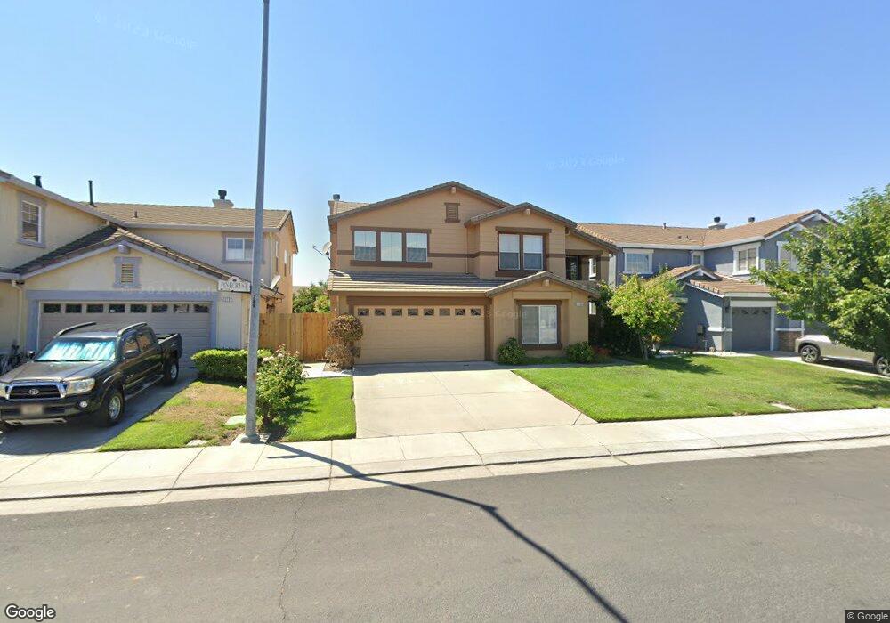
13701 Pinecrest St Lathrop, CA 95330
East Lathrop NeighborhoodEstimated Value: $605,650 - $621,000
3
Beds
3
Baths
2,763
Sq Ft
$222/Sq Ft
Est. Value
About This Home
This home is located at 13701 Pinecrest St, Lathrop, CA 95330 and is currently estimated at $613,413, approximately $222 per square foot. 13701 Pinecrest St is a home located in San Joaquin County with nearby schools including Joseph Widmer, Jr. Elementary School, Lathrop High School, and BE.TECH Charter High School.
Ownership History
Date
Name
Owned For
Owner Type
Purchase Details
Closed on
Apr 11, 2001
Sold by
Albert Robert M and Albert Judith E
Bought by
Albert Robert M and Albert Judith E
Current Estimated Value
Purchase Details
Closed on
Oct 4, 1999
Sold by
William Lyon Homes Inc
Bought by
Albert Robert M and Albert Judith E
Home Financials for this Owner
Home Financials are based on the most recent Mortgage that was taken out on this home.
Original Mortgage
$99,700
Outstanding Balance
$27,901
Interest Rate
6.87%
Estimated Equity
$585,512
Create a Home Valuation Report for This Property
The Home Valuation Report is an in-depth analysis detailing your home's value as well as a comparison with similar homes in the area
Home Values in the Area
Average Home Value in this Area
Purchase History
| Date | Buyer | Sale Price | Title Company |
|---|---|---|---|
| Albert Robert M | -- | -- | |
| Albert Robert M | $210,000 | First American Title Co |
Source: Public Records
Mortgage History
| Date | Status | Borrower | Loan Amount |
|---|---|---|---|
| Open | Albert Robert M | $99,700 |
Source: Public Records
Tax History
| Year | Tax Paid | Tax Assessment Tax Assessment Total Assessment is a certain percentage of the fair market value that is determined by local assessors to be the total taxable value of land and additions on the property. | Land | Improvement |
|---|---|---|---|---|
| 2025 | $5,376 | $322,355 | $61,473 | $260,882 |
| 2024 | $5,214 | $316,035 | $60,268 | $255,767 |
| 2023 | $5,029 | $309,839 | $59,087 | $250,752 |
| 2022 | $4,907 | $303,765 | $57,929 | $245,836 |
| 2021 | $4,794 | $297,810 | $56,794 | $241,016 |
| 2020 | $4,606 | $294,757 | $56,212 | $238,545 |
| 2019 | $4,524 | $288,978 | $55,110 | $233,868 |
| 2018 | $4,430 | $283,313 | $54,030 | $229,283 |
| 2017 | $4,384 | $277,759 | $52,971 | $224,788 |
| 2016 | $4,310 | $272,314 | $51,932 | $220,382 |
| 2014 | $4,100 | $262,969 | $50,150 | $212,819 |
Source: Public Records
Map
Nearby Homes
- 827 Saint Andrew St
- 960 Kirkwood Way
- 774 Sugar Pine Dr
- 14310 Cedar Valley Dr
- 13410 Brookwood Way
- 808 Prairie Dunes Dr
- 162 Ravenwood Ct
- 127 Argillite Ave
- 14129 Reverend Maurice Cotton Dr
- 272 Olivine Ave
- 467 Calcite Ave
- 15055 Hollyhock Ct
- 20 Shilling Ave
- 292 W Lathrop Rd
- 15150 Hollyhock Ct
- 710 Sunflower Dr
- 15810 Mckinley Ave
- 15804 Cambridge Dr
- 2105 N Airport Way
- 307 Mercantile St
- 13641 Onyx Ct
- 13711 Pinecrest St
- 13721 Pinecrest St
- 13631 Onyx Ct
- 13710 Peridot St
- 13700 Peridot St
- 13720 Peridot St
- 13730 Peridot St
- 13621 Onyx Ct
- 13731 Pinecrest St
- 910 Onyx Ave
- 13640 Onyx Ct
- 837 Limestone Ave
- 13740 Peridot St
- 13630 Onyx Ct
- 13611 Onyx Ct
- 920 Onyx Ave
- 13730 Pinecrest St
- 13620 Onyx Ct
- 831 Limestone Ave
Your Personal Tour Guide
Ask me questions while you tour the home.