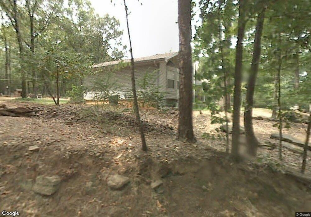
13704 Barth Rd Alexander, AR 72002
Estimated Value: $353,000 - $464,759
Studio
3
Baths
2,903
Sq Ft
$134/Sq Ft
Est. Value
About This Home
This home is located at 13704 Barth Rd, Alexander, AR 72002 and is currently estimated at $388,690, approximately $133 per square foot. 13704 Barth Rd is a home located in Saline County with nearby schools including Robert L. Davis Elementary School.
Ownership History
Date
Name
Owned For
Owner Type
Purchase Details
Closed on
May 11, 2021
Sold by
Moore Mary Ann and Moore Ralph Eugene
Bought by
Ralph And Mary Ann Moore Living Trust and Moore
Current Estimated Value
Purchase Details
Closed on
Aug 26, 2016
Sold by
Power John L and Power Sharon K
Bought by
Moore Mary Ann and Moore Ralph Eugene
Home Financials for this Owner
Home Financials are based on the most recent Mortgage that was taken out on this home.
Original Mortgage
$198,000
Interest Rate
3.42%
Mortgage Type
VA
Purchase Details
Closed on
Aug 10, 2010
Sold by
Power John L and Power Sharon K
Bought by
Power John L and Power Sharon K
Purchase Details
Closed on
Jun 24, 1999
Bought by
Power
Purchase Details
Closed on
Dec 19, 1997
Bought by
Keathley
Purchase Details
Closed on
Jul 16, 1996
Bought by
Keathley
Create a Home Valuation Report for This Property
The Home Valuation Report is an in-depth analysis detailing your home's value as well as a comparison with similar homes in the area
Home Values in the Area
Average Home Value in this Area
Purchase History
| Date | Buyer | Sale Price | Title Company |
|---|---|---|---|
| Ralph And Mary Ann Moore Living Trust | -- | None Listed On Document | |
| Ralph And Mary Ann Moore Living Trust | -- | None Listed On Document | |
| Moore Mary Ann | $220,000 | First National Title Co | |
| Power John L | -- | -- | |
| Power | $92,000 | -- | |
| Keathley | -- | -- | |
| Keathley | $82,000 | -- |
Source: Public Records
Mortgage History
| Date | Status | Borrower | Loan Amount |
|---|---|---|---|
| Previous Owner | Moore Mary Ann | $198,000 |
Source: Public Records
Tax History
| Year | Tax Paid | Tax Assessment Tax Assessment Total Assessment is a certain percentage of the fair market value that is determined by local assessors to be the total taxable value of land and additions on the property. | Land | Improvement |
|---|---|---|---|---|
| 2025 | $2,366 | $77,247 | $6,785 | $70,462 |
| 2024 | $2,206 | $77,247 | $6,785 | $70,462 |
| 2023 | $2,056 | $77,247 | $6,785 | $70,462 |
| 2022 | $2,056 | $77,247 | $6,785 | $70,462 |
| 2021 | $2,066 | $50,890 | $9,220 | $41,670 |
| 2020 | $2,066 | $50,890 | $9,220 | $41,670 |
| 2019 | $2,066 | $50,890 | $9,220 | $41,670 |
| 2018 | $2,091 | $50,890 | $9,220 | $41,670 |
| 2017 | $1,784 | $44,820 | $9,220 | $35,600 |
| 2016 | $1,407 | $32,240 | $7,620 | $24,620 |
| 2015 | $1,407 | $32,240 | $7,620 | $24,620 |
| 2014 | $1,122 | $29,990 | $7,620 | $22,370 |
Source: Public Records
Map
Nearby Homes
- 2000 Reagan Cove
- 14200 Cherylwood Rd
- 1015 Clinton Ct
- 13701 Dynasty Dr
- 12104 Big Ridge Cir
- 5010 Boulder Point Dr
- 14556 Skyline Dr
- 14025 Cottontail Ln
- 14908 E Azalea
- 1002 Katy Ln
- 14914 E Azalea Dr
- 12601 County Line Rd
- 26 Mountain Vista Dr
- 15522 Vimy Ridge Rd
- 12332 Loganberry Dr
- 14902 Alexander Rd
- 27 Pointer Dr
- 13200 Vimy Ridge Rd
- 21 Ponds Edge Ln
- 15315 Birch Dr
- 14617 Sweet Gum Dr
- 14701 Sweet Gum Dr
- 13615 Barth Rd
- 13626 Barth Rd
- 0 Woodsgate Cove Unit 21002407
- 0 Woodsgate Cove Unit 20039319
- 0 Woodsgate Cove Unit 20036146
- 0 Woodsgate Cove Unit 20035426
- 0 Woodsgate Cove Unit 20033271
- 0 Woodsgate Cove Unit 20033247
- 0 Woodsgate Cove Unit 20032142
- 0 Woodsgate Cove Unit 20030017
- 0 Woodstream Drives Unit 20029693
- 0 Woodsgate Cove Unit 20028163
- 0 Woodsgate Cove Unit 20022543
- 0 Woodsgate Cove Unit 20021956
- 0 Woodsgate Cove Unit 20019529
- 0 Woodsgate Cove Unit 20019518
- 0 Woodsgate Cove Unit 20019050
- 0 Woodsgate Cove Unit 20019038
Your Personal Tour Guide
Ask me questions while you tour the home.