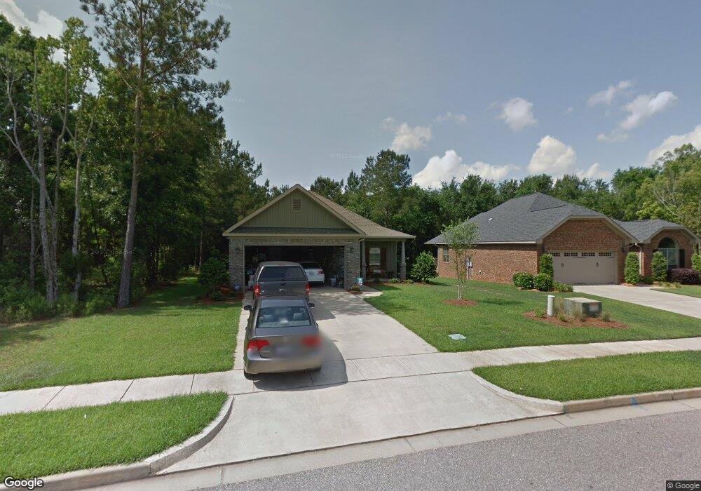
13704 Kearney Dr Loxley, AL 36551
Estimated Value: $325,657 - $366,000
3
Beds
3
Baths
2,122
Sq Ft
$163/Sq Ft
Est. Value
About This Home
This home is located at 13704 Kearney Dr, Loxley, AL 36551 and is currently estimated at $345,914, approximately $163 per square foot. 13704 Kearney Dr is a home located in Baldwin County with nearby schools including Loxley Elementary School, Central Baldwin Middle School, and Robertsdale High School.
Ownership History
Date
Name
Owned For
Owner Type
Purchase Details
Closed on
Dec 5, 2009
Sold by
Smith Bruce K and Smith Arrvlynn L
Bought by
Tucker Charles D and Tucker Angela N
Current Estimated Value
Home Financials for this Owner
Home Financials are based on the most recent Mortgage that was taken out on this home.
Original Mortgage
$174,284
Interest Rate
4.75%
Mortgage Type
FHA
Purchase Details
Closed on
Jul 20, 2007
Sold by
Scott Tew Homes Inc
Bought by
Smith Bruce K and Smith Arrvlynn L
Home Financials for this Owner
Home Financials are based on the most recent Mortgage that was taken out on this home.
Original Mortgage
$240,750
Interest Rate
6.65%
Mortgage Type
Purchase Money Mortgage
Create a Home Valuation Report for This Property
The Home Valuation Report is an in-depth analysis detailing your home's value as well as a comparison with similar homes in the area
Home Values in the Area
Average Home Value in this Area
Purchase History
| Date | Buyer | Sale Price | Title Company |
|---|---|---|---|
| Tucker Charles D | $177,500 | None Available | |
| Smith Bruce K | $267,500 | Preffered Title Agency Inc |
Source: Public Records
Mortgage History
| Date | Status | Borrower | Loan Amount |
|---|---|---|---|
| Previous Owner | Tucker Charles D | $174,284 | |
| Previous Owner | Smith Bruce K | $240,750 |
Source: Public Records
Tax History Compared to Growth
Tax History
| Year | Tax Paid | Tax Assessment Tax Assessment Total Assessment is a certain percentage of the fair market value that is determined by local assessors to be the total taxable value of land and additions on the property. | Land | Improvement |
|---|---|---|---|---|
| 2024 | $874 | $29,640 | $4,500 | $25,140 |
| 2023 | $853 | $28,960 | $2,800 | $26,160 |
| 2022 | $803 | $27,360 | $0 | $0 |
| 2021 | $620 | $23,520 | $0 | $0 |
| 2020 | $600 | $23,040 | $0 | $0 |
| 2019 | $586 | $22,520 | $0 | $0 |
| 2018 | $555 | $21,440 | $0 | $0 |
| 2017 | $531 | $20,560 | $0 | $0 |
| 2016 | $494 | $19,260 | $0 | $0 |
| 2015 | $465 | $18,220 | $0 | $0 |
| 2014 | $494 | $19,260 | $0 | $0 |
| 2013 | -- | $18,520 | $0 | $0 |
Source: Public Records
Map
Nearby Homes
- 27447 Yorkshire Dr
- 27695 County Road 66 N
- 13393 J B Williams Rd
- 27447 Curry Ln
- 13291 Us Highway 90
- 13717 County Road 66
- 13747 County Road 64
- 14150 County Road 64 Unit A
- 13101 Valerie Ln
- 27078 Avian Dr W
- 15040 Black Griffin Rd
- 12099 U S 90
- 15071 Timber Ridge Dr
- 12099 Us Highway 90
- 14316 Timber Ridge Dr
- 124 Richmond Rd
- 109 Shiloh Dr
- 17341 Log Cabin Rd
- 2036 W Union Ave
- 26716 Montelucia Way
- 13696 Kearney Dr
- 13710 Kearney Dr
- 27635 Yorkshire Dr
- 5 Yorkshire Dr
- 27387 Yorkshire Dr
- 13720 Kearney Dr
- 0 Yorkshire Dr Unit 263374
- 0 Yorkshire Dr Unit 260957
- 0 Yorkshire Dr Unit 168696
- 0 Yorkshire Dr Unit 172878
- 0 Yorkshire Dr Unit 194656
- 0 Yorkshire Dr Unit 220018
- 0 Yorkshire Dr Unit 220499
- 0 Yorkshire Dr Unit 242503
- 0 Yorkshire Dr Unit 242502
- 0 Yorkshire Dr Unit 361692
- 0 Yorkshire Dr Unit 326636
- 0 Yorkshire Dr Unit 514887
- 0 Yorkshire Dr Unit 16 0222085
- 0 Yorkshire Dr Unit 217121