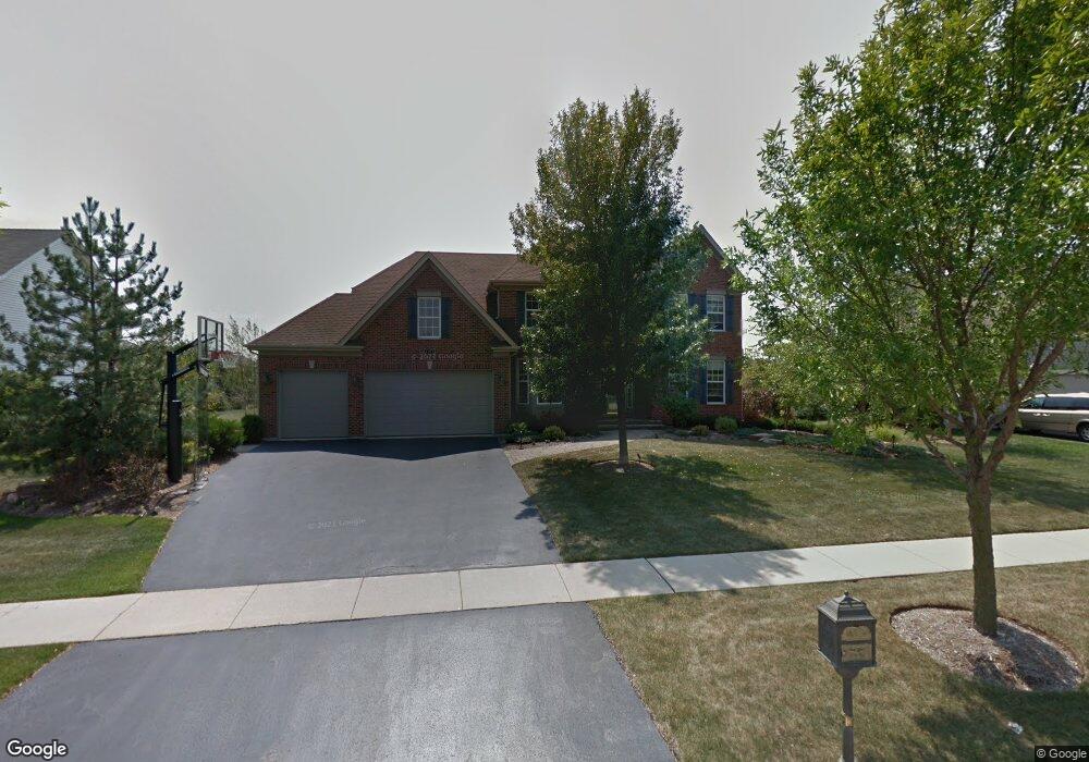
1371 Gander Ln Unit 2 Crystal Lake, IL 60014
Estimated Value: $536,298 - $609,000
--
Bed
--
Bath
3,000
Sq Ft
$194/Sq Ft
Est. Value
About This Home
This home is located at 1371 Gander Ln Unit 2, Crystal Lake, IL 60014 and is currently estimated at $582,075, approximately $194 per square foot. 1371 Gander Ln Unit 2 is a home located in McHenry County with nearby schools including Woods Creek Elementary School, Richard F Bernotas Middle School, and Crystal Lake Central High School.
Ownership History
Date
Name
Owned For
Owner Type
Purchase Details
Closed on
Jan 15, 2019
Sold by
Mlaka Joseph F
Bought by
Mlaka Liane C
Current Estimated Value
Purchase Details
Closed on
Oct 26, 2001
Sold by
Summit Glen Llc
Bought by
Mlaka Joseph F and Mlaka Liane C
Home Financials for this Owner
Home Financials are based on the most recent Mortgage that was taken out on this home.
Original Mortgage
$250,000
Outstanding Balance
$98,864
Interest Rate
6.88%
Estimated Equity
$483,211
Create a Home Valuation Report for This Property
The Home Valuation Report is an in-depth analysis detailing your home's value as well as a comparison with similar homes in the area
Home Values in the Area
Average Home Value in this Area
Purchase History
| Date | Buyer | Sale Price | Title Company |
|---|---|---|---|
| Mlaka Liane C | -- | Attorney | |
| Mlaka Joseph F | $348,067 | First American | |
| Summit Glen Llc | -- | First American |
Source: Public Records
Mortgage History
| Date | Status | Borrower | Loan Amount |
|---|---|---|---|
| Open | Mlaka Joseph F | $250,000 |
Source: Public Records
Tax History Compared to Growth
Tax History
| Year | Tax Paid | Tax Assessment Tax Assessment Total Assessment is a certain percentage of the fair market value that is determined by local assessors to be the total taxable value of land and additions on the property. | Land | Improvement |
|---|---|---|---|---|
| 2024 | $13,564 | $169,782 | $11,180 | $158,602 |
| 2023 | $13,176 | $152,517 | $10,043 | $142,474 |
| 2022 | $12,465 | $138,879 | $9,145 | $129,734 |
| 2021 | $11,941 | $130,796 | $8,613 | $122,183 |
| 2020 | $11,755 | $127,307 | $8,383 | $118,924 |
| 2019 | $11,618 | $124,057 | $8,169 | $115,888 |
| 2018 | $10,891 | $113,964 | $9,193 | $104,771 |
| 2017 | $10,849 | $107,402 | $8,664 | $98,738 |
| 2016 | $10,737 | $102,112 | $8,237 | $93,875 |
| 2013 | -- | $96,043 | $16,406 | $79,637 |
Source: Public Records
Map
Nearby Homes
- 1484 Rolling Hills Dr
- 9012 Swanson Rd
- 1578 Grouse Way
- 1657 Flagstone Dr
- 1582 Dogwood Dr Unit 4
- 10 Ronan Ct
- 10 Barrington Ct
- 3218 Impressions Dr
- 9103 Miller Rd Unit 4
- 9103 Miller Rd Unit 5
- 9103 Miller Rd Unit 3
- 9103 Miller Rd Unit 2
- 9103 Miller Rd Unit 1
- 1677 Driftwood Ln
- 2948 Impressions Dr
- 1849 Moorland Ln
- 20 Dogwood Ct
- 1839 Kings Gate Ln
- 9520 Lenox Ln Unit 26C
- 3975 Peartree Dr
- 1379 Gander Ln
- 1363 Gander Ln Unit 2
- 1387 Gander Ln
- 1355 Gander Ln Unit 2
- 1535 Gander Ct Unit 2
- 1556 Rolling Hills Dr Unit 2
- 1524 Rolling Hills Dr
- 1587 Grouse Way Unit 2
- 1395 Gander Ln
- 1581 Grouse Way
- 1564 Rolling Hills Dr Unit 2
- 1530 Gander Ct
- 1525 Gander Ct
- 1575 Grouse Way Unit 2
- 1516 Rolling Hills Dr
- 1572 Rolling Hills Dr
- 1520 Gander Ct Unit 2
- 1403 Gander Ln
- 1537 Rolling Hills Dr Unit 2
- 1545 Rolling Hills Dr