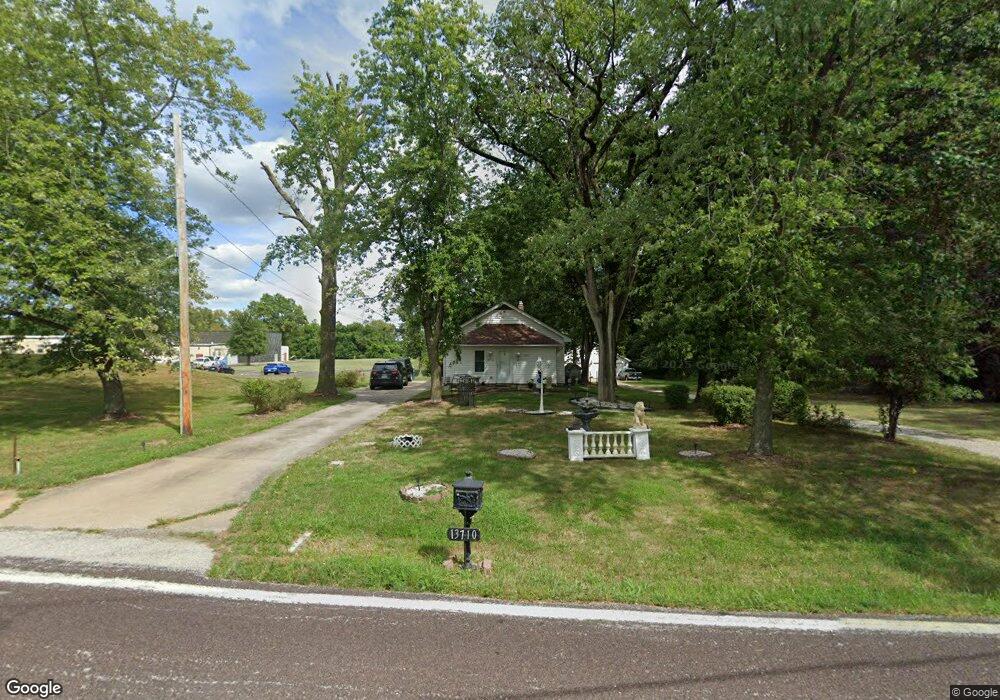
13710 Old Jamestown Rd Black Jack, MO 63033
Estimated Value: $144,000 - $181,000
2
Beds
1
Bath
864
Sq Ft
$192/Sq Ft
Est. Value
About This Home
This home is located at 13710 Old Jamestown Rd, Black Jack, MO 63033 and is currently estimated at $165,822, approximately $191 per square foot. 13710 Old Jamestown Rd is a home located in St. Louis County with nearby schools including Jamestown Elementary School, Central Middle School, and Hazelwood Central High School.
Ownership History
Date
Name
Owned For
Owner Type
Purchase Details
Closed on
Mar 31, 1997
Sold by
Albers Edwin P and Albers Richard J
Bought by
Grant Walter and Grant Nora J
Current Estimated Value
Home Financials for this Owner
Home Financials are based on the most recent Mortgage that was taken out on this home.
Original Mortgage
$118,400
Outstanding Balance
$14,690
Interest Rate
8%
Estimated Equity
$151,132
Create a Home Valuation Report for This Property
The Home Valuation Report is an in-depth analysis detailing your home's value as well as a comparison with similar homes in the area
Home Values in the Area
Average Home Value in this Area
Purchase History
| Date | Buyer | Sale Price | Title Company |
|---|---|---|---|
| Grant Walter | -- | -- |
Source: Public Records
Mortgage History
| Date | Status | Borrower | Loan Amount |
|---|---|---|---|
| Open | Grant Walter | $118,400 |
Source: Public Records
Tax History Compared to Growth
Tax History
| Year | Tax Paid | Tax Assessment Tax Assessment Total Assessment is a certain percentage of the fair market value that is determined by local assessors to be the total taxable value of land and additions on the property. | Land | Improvement |
|---|---|---|---|---|
| 2025 | $2,519 | $30,360 | $6,460 | $23,900 |
| 2024 | $2,519 | $27,930 | $7,450 | $20,480 |
| 2023 | $2,519 | $27,930 | $7,450 | $20,480 |
| 2022 | $2,778 | $26,320 | $12,390 | $13,930 |
| 2021 | $2,657 | $26,320 | $12,390 | $13,930 |
| 2020 | $1,871 | $17,480 | $7,070 | $10,410 |
| 2019 | $1,845 | $17,480 | $7,070 | $10,410 |
| 2018 | $1,921 | $16,800 | $4,160 | $12,640 |
| 2017 | $1,918 | $16,800 | $4,160 | $12,640 |
| 2016 | $1,834 | $15,770 | $5,360 | $10,410 |
| 2015 | $1,792 | $15,770 | $5,360 | $10,410 |
| 2014 | $2,009 | $17,570 | $7,160 | $10,410 |
Source: Public Records
Map
Nearby Homes
- 12705 Stubwood Dr
- 12750 Needle Point Ct
- 12582 Springtrail Dr
- 12456 Sea Lane Dr Unit A
- 12435 Sea Lane Dr Unit 5
- 5226 Suntrail Dr
- 5618 Madlar Ln
- 6470 White Cap Ln Unit D
- 6595 Dolphin Cir E Unit 131A
- 13032 Kinsley Heights Dr
- 12225 Tarpon Dr
- 12991 Mourville Ct
- 6587 Dolphin Cir E Unit 110B
- 13107 Ambrose Ct
- 13001 Kinsley Heights Dr
- 4681 Richmond Forest Dr
- 5220 Delcastle Dr
- 210 Behlmann Meadows Way
- 4846 Trees Edge Ln
- 4847 Trees Edge Ln
- 13680 Old Jamestown Rd
- 13650 Old Jamestown Rd
- 13580 Old Jamestown Rd
- 13615 Old Jamestown Rd
- 13585 Old Jamestown Rd
- 13540 Old Jamestown Rd
- 13579 Old Jamestown Rd
- 13595 Old Jamestown Rd
- 13520 Old Jamestown Rd
- 6134 Janet Ln
- 6095 Janet Ln
- 13500 Old Jamestown Rd
- 13480 Old Jamestown Rd
- 6101 Janet Ln
- 14000 Old Jamestown Rd
- 13525 Old Jamestown Rd
- 13465 Old Jamestown Rd
- 6140 Janet Ln
- 6349 Janet Ln
- 13425 Old Jamestown Rd