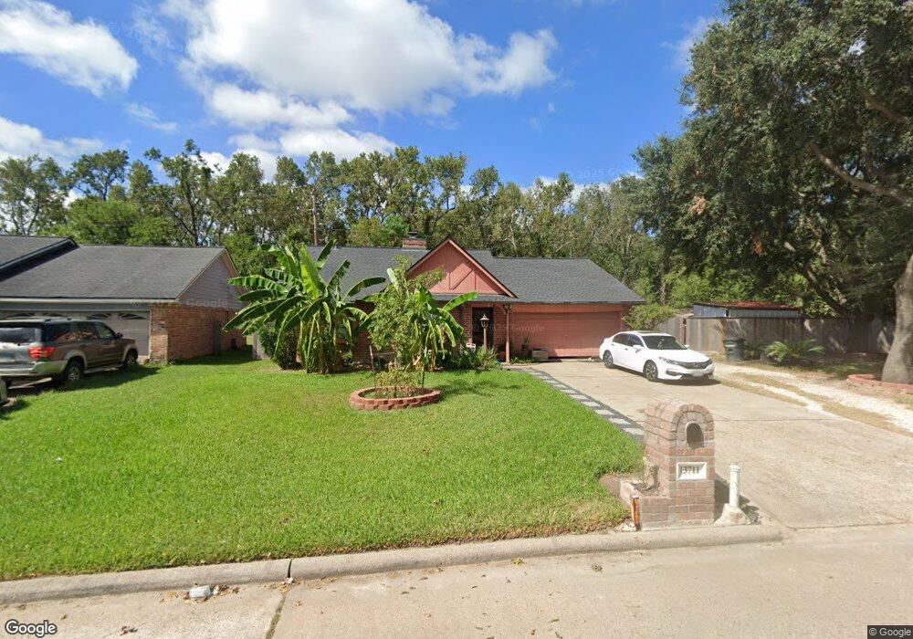
13711 Larwood Ln Houston, TX 77038
North Houston NeighborhoodEstimated Value: $205,320 - $231,000
3
Beds
2
Baths
1,436
Sq Ft
$155/Sq Ft
Est. Value
About This Home
This home is located at 13711 Larwood Ln, Houston, TX 77038 and is currently estimated at $222,080, approximately $154 per square foot. 13711 Larwood Ln is a home located in Harris County with nearby schools including Gloria B. Sammons Elementary School, Stovall School, and Dr. Viola K. Garcia Middle School.
Ownership History
Date
Name
Owned For
Owner Type
Purchase Details
Closed on
Jan 3, 2007
Sold by
Ventura Jose and Ventura Jose A
Bought by
Ventura Clemente P
Current Estimated Value
Home Financials for this Owner
Home Financials are based on the most recent Mortgage that was taken out on this home.
Original Mortgage
$60,000
Outstanding Balance
$35,836
Interest Rate
6.2%
Mortgage Type
Purchase Money Mortgage
Estimated Equity
$186,244
Purchase Details
Closed on
Feb 15, 2001
Sold by
Hickman James R and Hickman Pamela
Bought by
Ventura Jose and Ventura Jose A
Home Financials for this Owner
Home Financials are based on the most recent Mortgage that was taken out on this home.
Original Mortgage
$64,000
Interest Rate
7.75%
Create a Home Valuation Report for This Property
The Home Valuation Report is an in-depth analysis detailing your home's value as well as a comparison with similar homes in the area
Home Values in the Area
Average Home Value in this Area
Purchase History
| Date | Buyer | Sale Price | Title Company |
|---|---|---|---|
| Ventura Clemente P | -- | Startex Title Company | |
| Ventura Jose | -- | First American Title |
Source: Public Records
Mortgage History
| Date | Status | Borrower | Loan Amount |
|---|---|---|---|
| Open | Ventura Clemente P | $60,000 | |
| Previous Owner | Ventura Jose | $64,000 |
Source: Public Records
Tax History Compared to Growth
Tax History
| Year | Tax Paid | Tax Assessment Tax Assessment Total Assessment is a certain percentage of the fair market value that is determined by local assessors to be the total taxable value of land and additions on the property. | Land | Improvement |
|---|---|---|---|---|
| 2025 | $3,123 | $178,305 | $36,914 | $141,391 |
| 2024 | $3,123 | $177,051 | $36,914 | $140,137 |
| 2023 | $3,123 | $177,051 | $36,914 | $140,137 |
| 2022 | $3,781 | $158,880 | $36,914 | $121,966 |
| 2021 | $3,562 | $138,491 | $22,148 | $116,343 |
| 2020 | $3,432 | $138,491 | $22,148 | $116,343 |
| 2019 | $3,236 | $121,578 | $22,148 | $99,430 |
| 2018 | $989 | $115,499 | $22,148 | $93,351 |
| 2017 | $2,626 | $115,499 | $22,148 | $93,351 |
| 2016 | $2,387 | $94,540 | $22,148 | $72,392 |
| 2015 | $1,753 | $97,174 | $22,148 | $75,026 |
| 2014 | $1,753 | $64,124 | $14,765 | $49,359 |
Source: Public Records
Map
Nearby Homes
- 12611 Landon Light Ln
- 2919 Sunwood Dr
- 13803 Bearwood Rd
- 2530 Woodtown Dr
- 2322 Hadden Hollow Dr
- 10915 Meadow Walk Ln
- 2719 Magnolia Hill Trail
- 2410 Irish Spring Dr
- 2222 Irish Spring Dr
- 2315 Tomlinson Trail Dr
- 10915 Chelsea Knoll Ln
- 14003 Valley Grove Dr
- 1807 Live Oak Hill St
- 1922 Tomlinson Trail Dr
- 2606 Owens Cross Dr
- 2614 Lemonwood Ln
- 12114 Mckamy Dr
- 2811 Oakland Brook St
- 2831 Oakland Brook St
- 2835 Oakland Brook St
- 13707 Larwood Ln
- 13714 Larwood Ln
- 13710 Larwood Ln
- 13703 Larwood Ln
- 13706 Larwood Ln
- 13702 Larwood Ln
- 13631 Larwood Ln
- 13634 Larwood Ln
- 13630 Larwood Ln
- 2610 Larwood Ct
- 2701 Brownie Campbell Rd
- 2606 Larwood Ct
- 13626 Larwood Ln
- 2614 Larwood Ct
- 2803 Sunwood Dr
- 2709 Brownie Campbell Rd
- 13622 Larwood Ln
- 2807 Sunwood Dr
- 13802 Stepwood Dr
- 2615 Larwood Ct