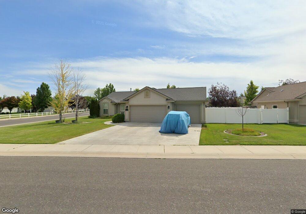
1372 Silver Creek Way Twin Falls, ID 83301
Estimated Value: $377,441 - $397,000
3
Beds
2
Baths
1,577
Sq Ft
$246/Sq Ft
Est. Value
About This Home
This home is located at 1372 Silver Creek Way, Twin Falls, ID 83301 and is currently estimated at $387,860, approximately $245 per square foot. 1372 Silver Creek Way is a home located in Twin Falls County with nearby schools including Rock Creek Elementary School, Robert Stuart Junior High School, and Canyon Ridge High School.
Ownership History
Date
Name
Owned For
Owner Type
Purchase Details
Closed on
Sep 25, 2007
Sold by
Kacak Loan T
Bought by
Quach Anna Nhung and Quach Chau Phuoc
Current Estimated Value
Purchase Details
Closed on
Jun 22, 2007
Sold by
Cypher Joseph D
Bought by
Mccarron Llc
Purchase Details
Closed on
Feb 17, 2006
Sold by
Wills Inc
Bought by
Kacak Gerald
Home Financials for this Owner
Home Financials are based on the most recent Mortgage that was taken out on this home.
Original Mortgage
$179,869
Interest Rate
6.15%
Mortgage Type
FHA
Create a Home Valuation Report for This Property
The Home Valuation Report is an in-depth analysis detailing your home's value as well as a comparison with similar homes in the area
Home Values in the Area
Average Home Value in this Area
Purchase History
| Date | Buyer | Sale Price | Title Company |
|---|---|---|---|
| Quach Anna Nhung | -- | -- | |
| Mccarron Llc | -- | None Available | |
| Kacak Gerald | -- | -- |
Source: Public Records
Mortgage History
| Date | Status | Borrower | Loan Amount |
|---|---|---|---|
| Previous Owner | Kacak Gerald | $179,869 |
Source: Public Records
Tax History Compared to Growth
Tax History
| Year | Tax Paid | Tax Assessment Tax Assessment Total Assessment is a certain percentage of the fair market value that is determined by local assessors to be the total taxable value of land and additions on the property. | Land | Improvement |
|---|---|---|---|---|
| 2025 | $3,654 | $340,359 | $73,143 | $267,216 |
| 2024 | $3,691 | $343,702 | $73,143 | $270,559 |
| 2023 | $3,769 | $360,397 | $73,143 | $287,254 |
| 2022 | $4,101 | $358,110 | $70,856 | $287,254 |
| 2021 | $4,261 | $283,027 | $70,856 | $212,171 |
| 2020 | $3,639 | $238,562 | $60,570 | $177,992 |
| 2019 | $4,261 | $238,518 | $65,848 | $172,670 |
| 2018 | $4,092 | $216,615 | $40,673 | $175,942 |
| 2017 | $3,722 | $198,526 | $40,673 | $157,853 |
| 2016 | $3,511 | $175,144 | $0 | $0 |
| 2015 | $3,416 | $175,144 | $40,673 | $134,471 |
| 2012 | -- | $162,080 | $0 | $0 |
Source: Public Records
Map
Nearby Homes
- 1378 Misty Meadows Ct
- 831 Grace Dr W
- 1085 Easy Ave
- 1087 Easy Ave
- 1605 Grandview Dr N
- 805 Drayton Ave
- 1143 Langford Way
- 1139 Frank Henry Rd
- 1295 Terra Ave
- 1228 Creekside Way
- 1196 Creekside Way
- 1207 Frank Henry Rd
- 1295 Starlight Loop
- 916 Kenbrook Loop
- 612 Northern Pine Ct
- 1146 Creekside Way
- 1196 Ira Burton Rd Unit Lot 20 Block 12
- 1210 Ira Burton Rd Unit Lot 21 Block 12
- 1266 Crestview Dr
- 905 Birchton Loop
- 1364 Silver Creek Way
- 920 Misty Meadows Trail
- 1380 Silver Creek Way
- 1373 Silver Creek Way
- 1336 Silver Creek Way
- 1365 Silver Creek Way
- 932 Misty Meadows Trail
- 913 River Mist Path
- 1337 Silver Creek Way
- 1381 Silver Creek Way
- 1388 Silver Creek Way
- 982 Misty Meadows Trail
- 1325 Silver Creek
- 944 Misty Meadows Trail
- 1325 Silver Creek Way
- 927 River Mist Path
- 919 Misty Meadows Trail
- 1392 Misty Meadows Ct
- 1017 Cobble Creek Rd
- 1396 Silver Creek Way