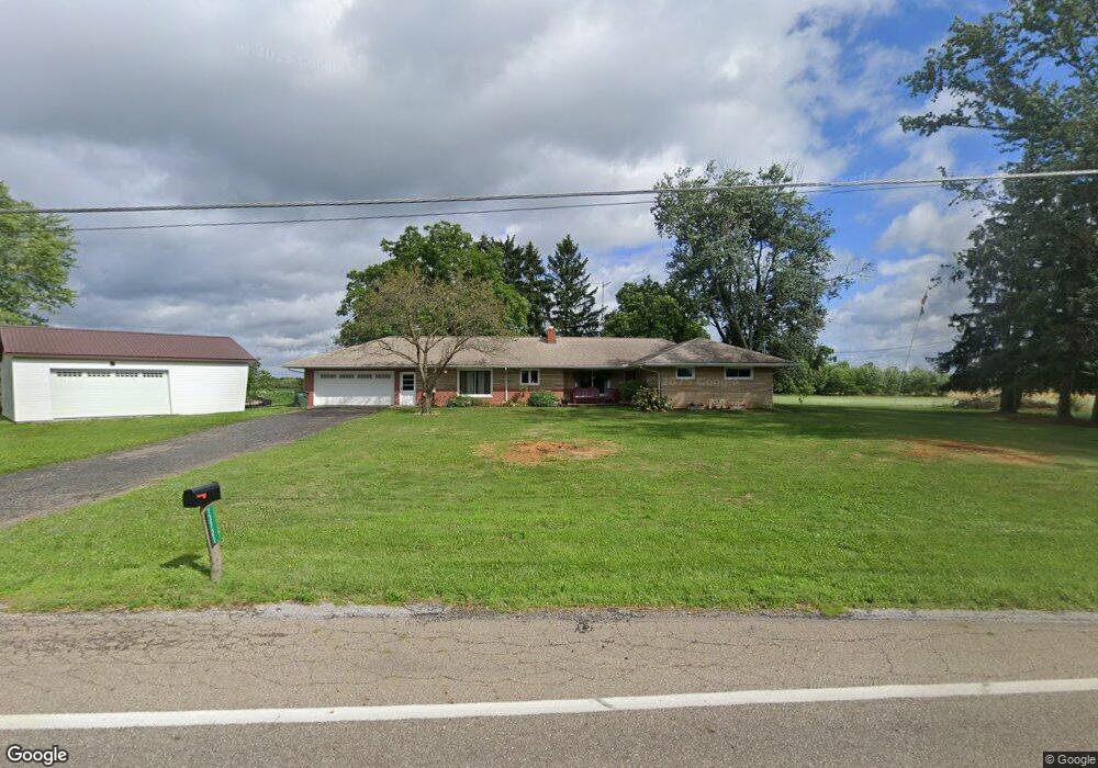
13721 Millersburg Rd SW Massillon, OH 44647
Estimated Value: $304,000 - $379,000
4
Beds
3
Baths
2,433
Sq Ft
$138/Sq Ft
Est. Value
About This Home
This home is located at 13721 Millersburg Rd SW, Massillon, OH 44647 and is currently estimated at $336,156, approximately $138 per square foot. 13721 Millersburg Rd SW is a home located in Stark County with nearby schools including Tuslaw Elementary School, Tuslaw Middle School, and Tuslaw High School.
Ownership History
Date
Name
Owned For
Owner Type
Purchase Details
Closed on
Jun 17, 2013
Sold by
Weirich Robert W
Bought by
Shonk Mark and Shonk Rebecca
Current Estimated Value
Purchase Details
Closed on
Nov 4, 2005
Sold by
Weirich Richard W and Weirich Margaret
Bought by
Weirich Richard W and Weirich Margaret M
Purchase Details
Closed on
Jul 10, 1992
Create a Home Valuation Report for This Property
The Home Valuation Report is an in-depth analysis detailing your home's value as well as a comparison with similar homes in the area
Home Values in the Area
Average Home Value in this Area
Purchase History
| Date | Buyer | Sale Price | Title Company |
|---|---|---|---|
| Shonk Mark | $93,800 | None Available | |
| Weirich Richard W | -- | None Available | |
| -- | -- | -- |
Source: Public Records
Tax History Compared to Growth
Tax History
| Year | Tax Paid | Tax Assessment Tax Assessment Total Assessment is a certain percentage of the fair market value that is determined by local assessors to be the total taxable value of land and additions on the property. | Land | Improvement |
|---|---|---|---|---|
| 2025 | -- | $84,080 | $11,800 | $72,280 |
| 2024 | -- | $84,080 | $11,800 | $72,280 |
| 2023 | $2,808 | $71,540 | $8,190 | $63,350 |
| 2022 | $2,805 | $71,540 | $8,190 | $63,350 |
| 2021 | $2,651 | $66,750 | $8,190 | $58,560 |
| 2020 | $2,267 | $53,730 | $6,720 | $47,010 |
| 2019 | $2,183 | $53,730 | $6,720 | $47,010 |
| 2018 | $2,155 | $53,730 | $6,720 | $47,010 |
| 2017 | $2,101 | $49,320 | $7,280 | $42,040 |
| 2016 | $2,125 | $49,320 | $7,280 | $42,040 |
| 2015 | $2,151 | $49,320 | $7,280 | $42,040 |
| 2014 | $128 | $46,700 | $6,900 | $39,800 |
| 2013 | $1,006 | $42,570 | $6,900 | $35,670 |
Source: Public Records
Map
Nearby Homes
- 0 Alabama Rd SW Unit 5104465
- 645 Tuscarawas Ave NW
- 2480 Deerford Ave SW
- 1174 Manchester Ave SW
- 4860 SW Lebanon Rd
- 11904 Lochwood St SW
- 383 2nd St SE
- 450 Wabash Ave S
- 2424 SW Lebanon Rd
- 1200 Kenyon Ave SW
- 3130 Meadowcrest St NW
- 14656 Lincoln St
- 982 Lanedale St NW
- 1220 Ben Fulton Ave NW
- 15299 Lincoln Way W
- 2760 Relda Cir SW
- 3056 Bent Creek Cir SW
- 3241 Lincoln Way NW
- 822 32nd St NW
- 2853 Autumn Ave NW
- 13771 Millersburg Rd SW
- 13720 Millersburg Rd SW
- 0 Muffly Ave SW
- 13789 Millersburg Rd SW
- 13760 Millersburg Rd SW
- 13630 Millersburg Rd SW
- 13601 Millersburg Rd SW
- 13900 Millersburg Rd SW
- 13550 Millersburg Rd SW
- 13935 Millersburg Rd SW
- 13935 Millersburg Rd SW
- 13935 Millersburg Rd SW
- 13951 Millersburg Rd SW
- 13854 Stanwood St SW
- 3736 Muffly Rd SW
- 14010 Stanwood St SW
- 13966 Stanwood St SW
- 13477 Millersburg Rd SW
- 13893 Stanwood St SW
- 13424 Millersburg Rd SW