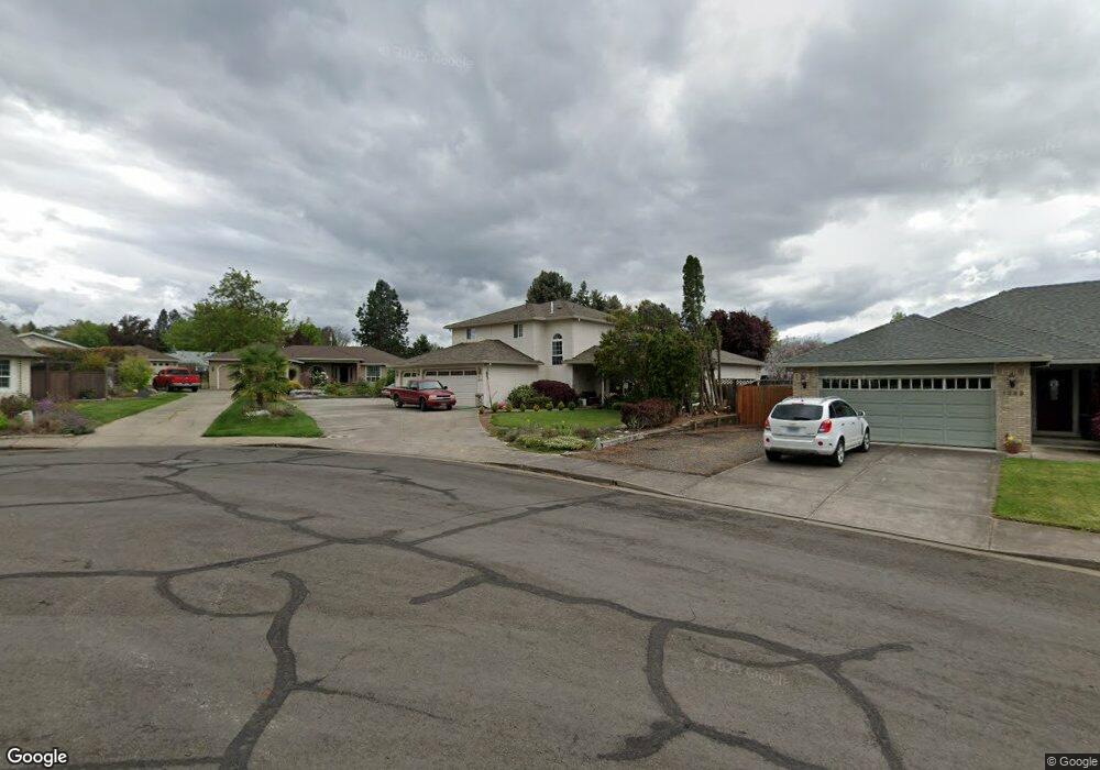
1373 Foxwood Dr Medford, OR 97504
Estimated Value: $538,376 - $625,000
4
Beds
3
Baths
3,870
Sq Ft
$152/Sq Ft
Est. Value
About This Home
This home is located at 1373 Foxwood Dr, Medford, OR 97504 and is currently estimated at $589,344, approximately $152 per square foot. 1373 Foxwood Dr is a home located in Jackson County with nearby schools including Lone Pine Elementary School, Hedrick Middle School, and North Medford High School.
Ownership History
Date
Name
Owned For
Owner Type
Purchase Details
Closed on
Sep 19, 2017
Sold by
Heath Dale E and Heath Ruth F
Bought by
Heath Dale E and Heath Ruth F
Current Estimated Value
Purchase Details
Closed on
Apr 13, 1998
Sold by
Turner Dale E and Turner Rita M
Bought by
Heath Dale E and Heath Ruth F
Home Financials for this Owner
Home Financials are based on the most recent Mortgage that was taken out on this home.
Original Mortgage
$160,000
Interest Rate
7.18%
Create a Home Valuation Report for This Property
The Home Valuation Report is an in-depth analysis detailing your home's value as well as a comparison with similar homes in the area
Home Values in the Area
Average Home Value in this Area
Purchase History
| Date | Buyer | Sale Price | Title Company |
|---|---|---|---|
| Heath Dale E | -- | None Available | |
| Heath Dale E | $220,000 | Amerititle |
Source: Public Records
Mortgage History
| Date | Status | Borrower | Loan Amount |
|---|---|---|---|
| Closed | Heath Dale E | $160,000 |
Source: Public Records
Tax History Compared to Growth
Tax History
| Year | Tax Paid | Tax Assessment Tax Assessment Total Assessment is a certain percentage of the fair market value that is determined by local assessors to be the total taxable value of land and additions on the property. | Land | Improvement |
|---|---|---|---|---|
| 2025 | $4,357 | $300,460 | $85,940 | $214,520 |
| 2024 | $4,357 | $345,900 | $128,830 | $217,070 |
| 2023 | $5,009 | $335,830 | $125,080 | $210,750 |
| 2022 | $4,886 | $335,830 | $125,080 | $210,750 |
| 2021 | $4,760 | $326,050 | $121,430 | $204,620 |
| 2020 | $4,659 | $316,560 | $117,900 | $198,660 |
| 2019 | $4,549 | $298,390 | $111,130 | $187,260 |
| 2018 | $4,433 | $289,700 | $107,890 | $181,810 |
| 2017 | $4,353 | $289,700 | $107,890 | $181,810 |
| 2016 | $4,381 | $273,080 | $101,700 | $171,380 |
| 2015 | $4,211 | $273,080 | $101,700 | $171,380 |
| 2014 | $4,137 | $257,410 | $95,870 | $161,540 |
Source: Public Records
Map
Nearby Homes
- 1277 Gardendale Ave
- 1569 Papago Dr
- 1501 Brookdale Ave
- 1224 N Modoc Ave Unit 57
- 1460 Brookdale Ave
- 1258 Paulita Dr
- 1089 Brookdale Ave
- 1813 Cascadia Cir
- 1841 Cascadia Cir
- 1928 Hannah Ln
- 2327 Derry Ct
- 1759 Carrera Cir
- 2777 Roberts Rd
- 3228 Auburn Way
- 889 Valley View Dr
- 3079 Sycamore Way
- 2020 Ridge Way
- 1876 Inglewood Dr
- 721 Brookdale Ave
- 451 S Stoneham Cir
- 1389 Foxwood Dr
- 1351 Foxwood Dr
- 1374 Papago Dr
- 1360 Foxwood Dr
- 1350 Papago Dr
- 2920 Ruby Dr
- 1326 Papago Dr
- 3030 Ruby Dr
- 2969 E McAndrews Rd
- 1362 Foxwood Dr
- 1376 Foxwood Dr
- 1433 Foxwood Dr
- 2935 E McAndrews Rd
- 2947 Ruby Dr
- 1302 Papago Dr
- 3040 Ruby Dr
- 2929 Ruby Dr
- 2981 E McAndrews Rd
- 1359 Papago Dr
- 3035 Ruby Dr