Estimated Value: $466,000 - $506,000
3
Beds
2
Baths
944
Sq Ft
$514/Sq Ft
Est. Value
About This Home
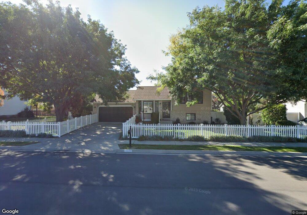
This home is located at 1373 W 1870 N, Lehi, UT 84043 and is currently estimated at $484,768, approximately $513 per square foot. 1373 W 1870 N is a home located in Utah County with nearby schools including Lehi Elementary School, Lehi Junior High School, and Lehi High School.
Ownership History
Date
Name
Owned For
Owner Type
Purchase Details
Closed on
Jun 30, 2025
Sold by
Marian A Connelly Family Trust and Connelly Marian A
Bought by
Coty Joseph Duran Irrevocable Trust and Connelly
Current Estimated Value
Purchase Details
Closed on
Mar 22, 2023
Sold by
Connelly Marian A
Bought by
Marian A Connelley Family Trust and Connelley
Purchase Details
Closed on
Jul 10, 2003
Sold by
Connelly Marian A
Bought by
Connelly Kellie K
Create a Home Valuation Report for This Property
The Home Valuation Report is an in-depth analysis detailing your home's value as well as a comparison with similar homes in the area
Home Values in the Area
Average Home Value in this Area
Purchase History
| Date | Buyer | Sale Price | Title Company |
|---|---|---|---|
| Coty Joseph Duran Irrevocable Trust | -- | None Listed On Document | |
| Marian A Connelley Family Trust | -- | None Listed On Document | |
| Connelly Kellie K | -- | -- |
Source: Public Records
Tax History Compared to Growth
Tax History
| Year | Tax Paid | Tax Assessment Tax Assessment Total Assessment is a certain percentage of the fair market value that is determined by local assessors to be the total taxable value of land and additions on the property. | Land | Improvement |
|---|---|---|---|---|
| 2025 | $1,859 | $224,785 | $175,200 | $233,500 |
| 2024 | $1,859 | $217,525 | $0 | $0 |
| 2023 | $1,728 | $219,505 | $0 | $0 |
| 2022 | $1,752 | $215,875 | $0 | $0 |
| 2021 | $1,552 | $289,100 | $101,300 | $187,800 |
| 2020 | $1,463 | $269,300 | $93,800 | $175,500 |
| 2019 | $1,288 | $246,400 | $93,800 | $152,600 |
| 2018 | $1,335 | $241,500 | $88,900 | $152,600 |
| 2017 | $1,270 | $122,155 | $0 | $0 |
| 2016 | $1,305 | $116,435 | $0 | $0 |
| 2015 | $1,232 | $104,335 | $0 | $0 |
| 2014 | $1,208 | $101,695 | $0 | $0 |
Source: Public Records
Map
Nearby Homes
- 1272 W 1800 N
- 1249 W 1800 N
- 1332 W 1500 N
- 1610 N 1125 W
- 1011 W Mountain Way Unit 316
- 1627 W Boxwood Dr Unit 110
- 1659 W Boxwood Dr Unit 109
- 1094 W 1425 N
- 1542 N 1900 W
- 1817 W Bad Rock Cir
- 5312 N Springview Ct Unit 106
- 1027 N 3685 W Unit 248
- 2191 W Swift Fox Dr Unit 274
- 999 Empire St
- 2184 W Cape Fox Way N Unit 220
- 1060 N Canvasback Dr Unit 405
- 1089 N 3685 W Unit 253
- 500 S Center St E
- 1077 N 3685 W Unit 252
- 1672 S 70 W