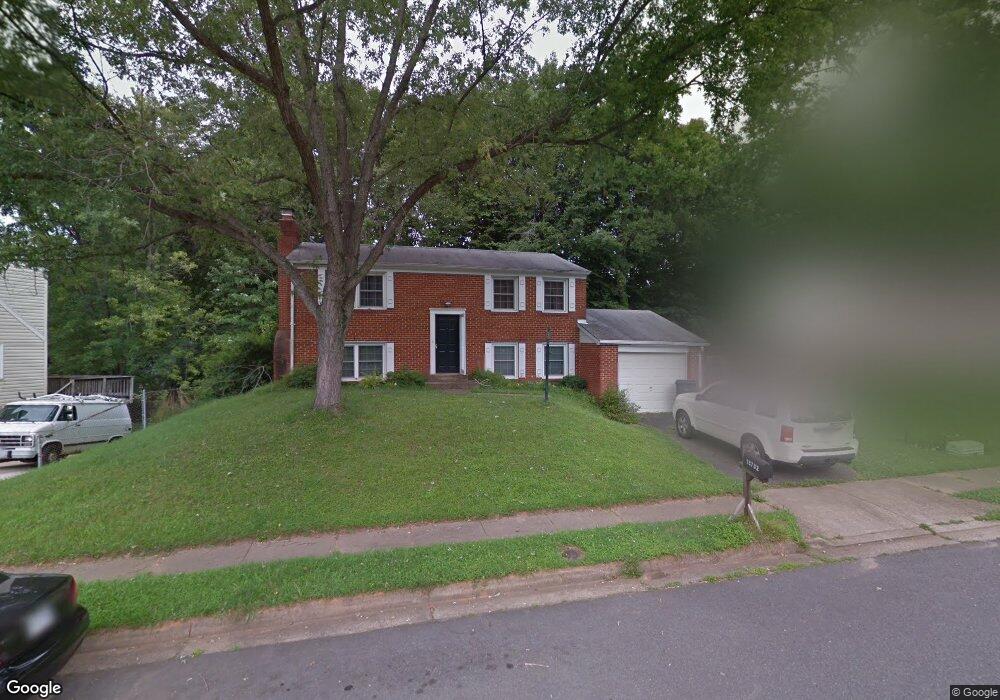
13732 Mellowdew Ct Woodbridge, VA 22193
Mapledale NeighborhoodEstimated Value: $431,000 - $464,000
3
Beds
2
Baths
816
Sq Ft
$547/Sq Ft
Est. Value
About This Home
This home is located at 13732 Mellowdew Ct, Woodbridge, VA 22193 and is currently estimated at $446,000, approximately $546 per square foot. 13732 Mellowdew Ct is a home located in Prince William County with nearby schools including Rosa Parks Elementary School, C.D. Hylton High School, and Stuart M. Beville Middle School.
Ownership History
Date
Name
Owned For
Owner Type
Purchase Details
Closed on
Jan 31, 2007
Sold by
Laroe Dale R
Bought by
Assefa Woudineh
Current Estimated Value
Home Financials for this Owner
Home Financials are based on the most recent Mortgage that was taken out on this home.
Original Mortgage
$305,000
Outstanding Balance
$182,682
Interest Rate
6.16%
Mortgage Type
VA
Estimated Equity
$263,318
Purchase Details
Closed on
Jul 26, 2002
Sold by
Jame Sliptak
Bought by
Laroe Dale and Laroe Elliott,Lorie
Home Financials for this Owner
Home Financials are based on the most recent Mortgage that was taken out on this home.
Original Mortgage
$161,100
Interest Rate
6.73%
Create a Home Valuation Report for This Property
The Home Valuation Report is an in-depth analysis detailing your home's value as well as a comparison with similar homes in the area
Home Values in the Area
Average Home Value in this Area
Purchase History
| Date | Buyer | Sale Price | Title Company |
|---|---|---|---|
| Assefa Woudineh | $305,000 | -- | |
| Laroe Dale | $179,000 | -- |
Source: Public Records
Mortgage History
| Date | Status | Borrower | Loan Amount |
|---|---|---|---|
| Open | Assefa Woudineh | $305,000 | |
| Previous Owner | Laroe Dale | $161,100 |
Source: Public Records
Tax History Compared to Growth
Tax History
| Year | Tax Paid | Tax Assessment Tax Assessment Total Assessment is a certain percentage of the fair market value that is determined by local assessors to be the total taxable value of land and additions on the property. | Land | Improvement |
|---|---|---|---|---|
| 2025 | $3,656 | $398,100 | $145,100 | $253,000 |
| 2024 | $3,656 | $367,600 | $135,100 | $232,500 |
| 2023 | $3,705 | $356,100 | $132,300 | $223,800 |
| 2022 | $3,878 | $339,900 | $122,500 | $217,400 |
| 2021 | $3,824 | $310,200 | $110,300 | $199,900 |
| 2020 | $4,143 | $267,300 | $104,000 | $163,300 |
| 2019 | $4,047 | $261,100 | $100,000 | $161,100 |
| 2018 | $2,993 | $247,900 | $97,100 | $150,800 |
| 2017 | $2,906 | $231,800 | $91,600 | $140,200 |
| 2016 | $2,792 | $224,500 | $89,000 | $135,500 |
| 2015 | $2,576 | $214,200 | $86,000 | $128,200 |
| 2014 | $2,576 | $202,100 | $83,600 | $118,500 |
Source: Public Records
Map
Nearby Homes
- 5308 Macwood Dr
- 13737 Moccasin Ct
- 13871 Langstone Dr
- 13441 Kerr Ct
- 13918 Lynhurst Dr
- 14010 Mapledale Ave
- 5678 Roundtree Dr
- 5655 Roundtree Dr
- 5710 Rhode Island Dr
- 5020 Quinlan Dr
- 13501 Photo Dr
- 14072 Oxbridge Inn Ct
- 4903 Kenyon Ct
- 5611 Roundtree Dr
- 14160 Landon Ln
- 13454 Princedale Dr
- 13652 Kingsman Rd
- 5876 Pontiac Dr
- 13540 Kaslo Dr
- 13546 Kaslo Dr
- 13730 Mellowdew Ct
- 13734 Mellowdew Ct
- 13767 Meadowbrook Rd
- 13733 Marilyn Ct
- 13731 Marilyn Ct
- 13728 Mellowdew Ct
- 13773 Meadowbrook Rd
- 13729 Mellowdew Ct
- 13765 Meadowbrook Rd
- 13727 Mellowdew Ct
- 13730 Marilyn Ct
- 13726 Mellowdew Ct
- 13760 Mellowdew Ct
- 13737 Marilyn Ct
- 13725 Mellowdew Ct
- 13763 Meadowbrook Rd
- 13716 Mayfair Ct
- 13772 Meadowbrook Rd
- 13732 Marilyn Ct
- 13724 Mellowdew Ct