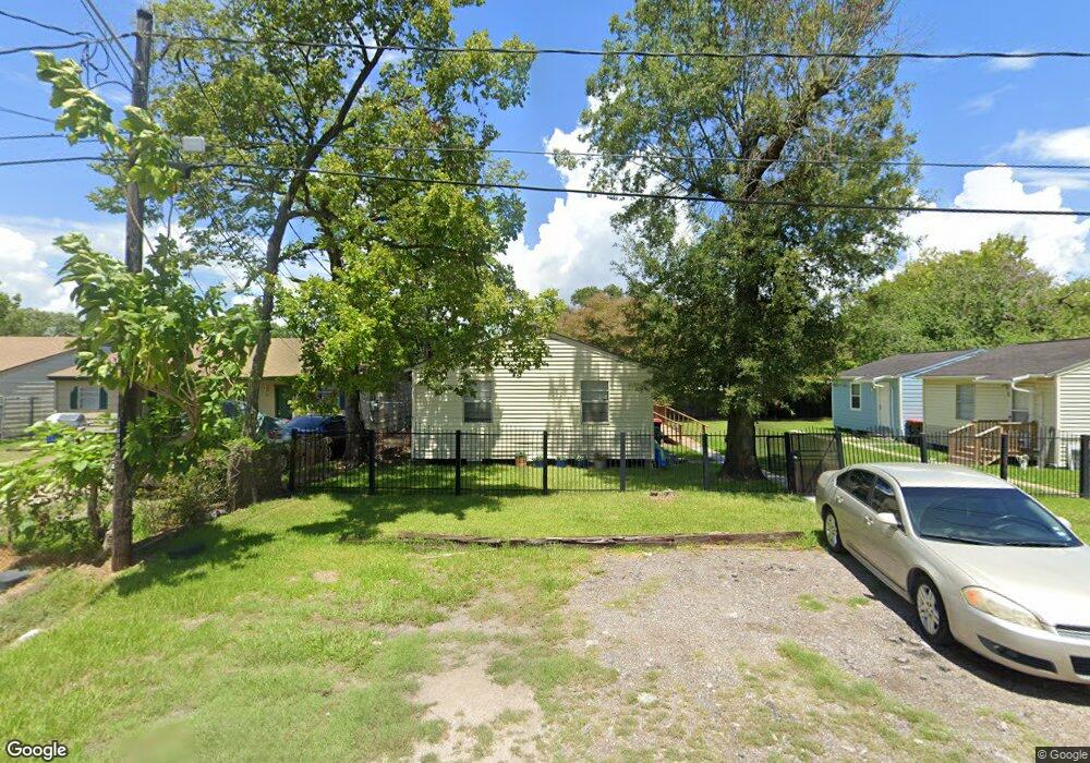
13733 Duncum St Unit 1 Houston, TX 77015
North Shore NeighborhoodEstimated Value: $170,000 - $248,000
1
Bed
1
Bath
480
Sq Ft
$461/Sq Ft
Est. Value
About This Home
This home is located at 13733 Duncum St Unit 1, Houston, TX 77015 and is currently estimated at $221,261, approximately $460 per square foot. 13733 Duncum St Unit 1 is a home located in Harris County with nearby schools including Cloverleaf Elementary School, Cobb 6th Grade Campus, and North Shore Middle School.
Ownership History
Date
Name
Owned For
Owner Type
Purchase Details
Closed on
Aug 22, 2006
Sold by
Rogers Mark E
Bought by
Carreon Perla M and Carreon Don E
Current Estimated Value
Home Financials for this Owner
Home Financials are based on the most recent Mortgage that was taken out on this home.
Original Mortgage
$74,000
Outstanding Balance
$44,404
Interest Rate
6.75%
Mortgage Type
Purchase Money Mortgage
Estimated Equity
$176,857
Create a Home Valuation Report for This Property
The Home Valuation Report is an in-depth analysis detailing your home's value as well as a comparison with similar homes in the area
Home Values in the Area
Average Home Value in this Area
Purchase History
| Date | Buyer | Sale Price | Title Company |
|---|---|---|---|
| Carreon Perla M | -- | First American Title |
Source: Public Records
Mortgage History
| Date | Status | Borrower | Loan Amount |
|---|---|---|---|
| Open | Carreon Perla M | $74,000 |
Source: Public Records
Tax History Compared to Growth
Tax History
| Year | Tax Paid | Tax Assessment Tax Assessment Total Assessment is a certain percentage of the fair market value that is determined by local assessors to be the total taxable value of land and additions on the property. | Land | Improvement |
|---|---|---|---|---|
| 2025 | $5,427 | $191,000 | $105,000 | $86,000 |
| 2024 | $5,427 | $241,052 | $105,000 | $136,052 |
| 2023 | $5,427 | $256,256 | $63,000 | $193,256 |
| 2022 | $5,022 | $209,942 | $63,000 | $146,942 |
| 2021 | $4,100 | $158,594 | $49,876 | $108,718 |
| 2020 | $3,586 | $135,342 | $49,876 | $85,466 |
| 2019 | $3,033 | $108,464 | $49,876 | $58,588 |
| 2018 | $1,436 | $91,284 | $49,876 | $41,408 |
| 2017 | $2,363 | $84,724 | $49,876 | $34,848 |
| 2016 | $2,363 | $84,724 | $49,876 | $34,848 |
| 2015 | $1,322 | $84,724 | $49,876 | $34,848 |
| 2014 | $1,322 | $70,172 | $36,750 | $33,422 |
Source: Public Records
Map
Nearby Homes
- 1035 Nadolney St
- 13522 Boise St
- 13434 Duluth St
- 13430 Duluth St
- 13842 Laredo St
- 13430 Orleans St
- 13505 Orleans St
- 13362 Emporia St
- 1402 W Victorson St
- 13331 Emporia St
- 13210 Rockglen St
- TBD Gainesville St
- 13326 Joliet St
- 816 Barbara Mae St
- 14615 Victoria St
- 0 Victoria St
- 13379 Louisville St
- 813 Barbara Mae St
- 14307 Laredo St
- 13122 Emporia St
- 13733 Duncum St
- 13725 Duncum St
- 13725 Duncum St Unit 2
- 13736 Bonham St
- 13726 Bonham St
- 1038 Nadolney St
- 13752 Duncum St
- 13730 Duncum St
- 1102 Nadolney St
- 13740 Duncum St
- 13721 Duncum St
- 13720 Duncum St
- 1037 Nadolney St
- 13805 Duncum St
- 13713 Duncum St
- 13713 Duncum St Unit A
- 13713 Duncum St Unit 4
- 13713 Duncum St
- 13731 Bonham St
- 13729 Renault St