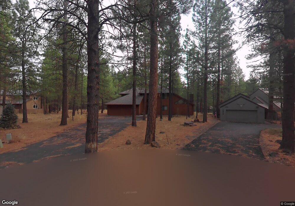
13734 Twayblade Sm101 Black Butte Ranch, OR 97759
Estimated Value: $1,162,000 - $1,365,000
4
Beds
3
Baths
2,402
Sq Ft
$531/Sq Ft
Est. Value
About This Home
This home is located at 13734 Twayblade Sm101, Black Butte Ranch, OR 97759 and is currently estimated at $1,275,952, approximately $531 per square foot. 13734 Twayblade Sm101 is a home located in Deschutes County with nearby schools including Sisters Elementary School, Sisters Middle School, and Sisters High School.
Ownership History
Date
Name
Owned For
Owner Type
Purchase Details
Closed on
Oct 4, 2021
Sold by
Caner Mark A and Caner Amelia L
Bought by
Burns Adam and The Adam G Burns Trust
Current Estimated Value
Purchase Details
Closed on
Sep 16, 2013
Sold by
Columbia Property Resources Llc
Bought by
Carter Mark A and Carter Amelia L
Home Financials for this Owner
Home Financials are based on the most recent Mortgage that was taken out on this home.
Original Mortgage
$417,000
Interest Rate
4.46%
Mortgage Type
New Conventional
Purchase Details
Closed on
Nov 29, 2011
Sold by
Cox Harold N and Cox Cathy R
Bought by
Columbia Property Resources Llc
Purchase Details
Closed on
Aug 8, 2008
Sold by
Kusyk Peter A
Bought by
Cox Harold N and Cox Cathy R
Home Financials for this Owner
Home Financials are based on the most recent Mortgage that was taken out on this home.
Original Mortgage
$750,000
Interest Rate
6.37%
Mortgage Type
Unknown
Create a Home Valuation Report for This Property
The Home Valuation Report is an in-depth analysis detailing your home's value as well as a comparison with similar homes in the area
Home Values in the Area
Average Home Value in this Area
Purchase History
| Date | Buyer | Sale Price | Title Company |
|---|---|---|---|
| Burns Adam | $1,175,000 | Western Title & Escrow | |
| Carter Mark A | $575,000 | Amerititle | |
| Columbia Property Resources Llc | -- | Amerititle | |
| Cox Harold N | $739,500 | Amerititle |
Source: Public Records
Mortgage History
| Date | Status | Borrower | Loan Amount |
|---|---|---|---|
| Previous Owner | Carter Mark A | $417,000 | |
| Previous Owner | Cox Harold N | $750,000 |
Source: Public Records
Tax History Compared to Growth
Tax History
| Year | Tax Paid | Tax Assessment Tax Assessment Total Assessment is a certain percentage of the fair market value that is determined by local assessors to be the total taxable value of land and additions on the property. | Land | Improvement |
|---|---|---|---|---|
| 2024 | $8,820 | $561,750 | -- | -- |
| 2023 | $8,461 | $545,390 | $0 | $0 |
| 2022 | $7,857 | $514,090 | $0 | $0 |
| 2021 | $7,939 | $499,120 | $0 | $0 |
| 2020 | $7,366 | $499,120 | $0 | $0 |
| 2019 | $7,217 | $484,590 | $0 | $0 |
| 2018 | $6,903 | $470,480 | $0 | $0 |
| 2017 | $6,649 | $456,780 | $0 | $0 |
| 2016 | $6,536 | $443,480 | $0 | $0 |
| 2015 | $6,309 | $443,480 | $0 | $0 |
| 2014 | $5,958 | $418,610 | $0 | $0 |
Source: Public Records
Map
Nearby Homes
- 70665 Buck Brush Unit SM 89
- 70686 Buck Brush Unit SM85
- 70701 Pasque Flower Unit SM94
- 70684 Steeple Bush Unit SM 153
- 70661 Steeple Bush
- 70755 Ponderosa Ln Unit SM 177
- 70474 Alum Root
- 70786 Blazing Star Unit RR 64
- 13584 Nine Bark
- 13579 Sundew Unit SM34
- 13637 Wolfberry Unit GM 142
- 70780 Bitter Root
- 70340 Sword Fern Gm246
- 70332 Sword Fern Unit GM 245
- 13699 Speedwell Unit GM90
- 13461 Hawks Beard Unit SH43
- 70347 Cinquefoil Unit GM 188
- 14023 Hawks Beard Unit B
- 14023 Hawks Beard Unit A
- 70311 Forsythia Unit GM277
- 13734 Twayblade Unit SM 101
- 13738 Twayblade
- 70652 Ponderosa Ln Unit SM99
- 70652 Ponderosa Ln
- 13730 Twayblade Sm 100
- 70667 Buck Brush
- 13743 Twayblade
- 13735 Twayblade Unit SM104
- 13735 Twayblade
- 70660 Ponderosa Ln
- 13764 Madrona Unit SM 74
- 13764 Madrona
- 70673 Buck Brush
- 13729 Twayblade
- 13767 Madrona Sm 73
- 13767 Madrona
- 13767 Madrona Unit SM 73
- 70670 Ponderosa Ln
- 70657 Ponderosa Ln Unit SM142