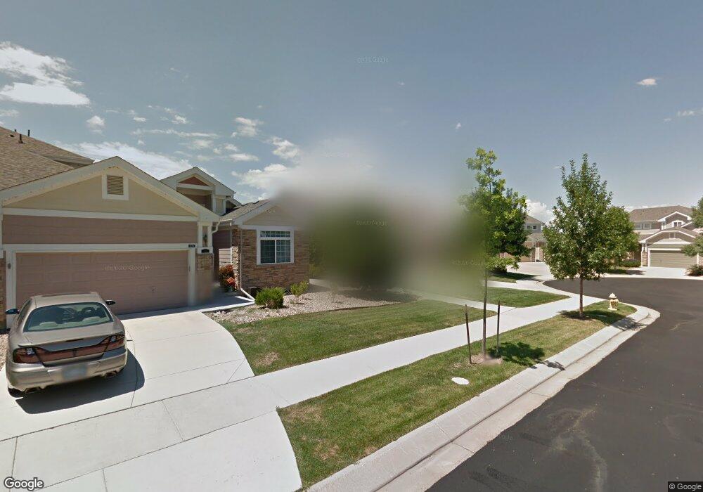
13737 Rock Point Unit 101 Broomfield, CO 80023
Broadlands NeighborhoodEstimated Value: $607,000 - $673,000
3
Beds
4
Baths
2,359
Sq Ft
$267/Sq Ft
Est. Value
About This Home
This home is located at 13737 Rock Point Unit 101, Broomfield, CO 80023 and is currently estimated at $630,005, approximately $267 per square foot. 13737 Rock Point Unit 101 is a home located in Broomfield County with nearby schools including Meridian Elementary School, Westlake Middle School, and Legacy High School.
Ownership History
Date
Name
Owned For
Owner Type
Purchase Details
Closed on
Jan 20, 2016
Sold by
Wither Candyce L
Bought by
Mitchell Thomas L and Mitchell Denise S
Current Estimated Value
Home Financials for this Owner
Home Financials are based on the most recent Mortgage that was taken out on this home.
Original Mortgage
$235,000
Outstanding Balance
$187,023
Interest Rate
3.98%
Mortgage Type
New Conventional
Estimated Equity
$442,982
Purchase Details
Closed on
Nov 26, 2003
Sold by
Genesee Communities Vii Llc
Bought by
Wither Candyce I
Home Financials for this Owner
Home Financials are based on the most recent Mortgage that was taken out on this home.
Original Mortgage
$182,300
Interest Rate
5.25%
Mortgage Type
Purchase Money Mortgage
Create a Home Valuation Report for This Property
The Home Valuation Report is an in-depth analysis detailing your home's value as well as a comparison with similar homes in the area
Home Values in the Area
Average Home Value in this Area
Purchase History
| Date | Buyer | Sale Price | Title Company |
|---|---|---|---|
| Mitchell Thomas L | $350,000 | First American | |
| Wither Candyce I | $232,300 | North American Title |
Source: Public Records
Mortgage History
| Date | Status | Borrower | Loan Amount |
|---|---|---|---|
| Open | Mitchell Thomas L | $235,000 | |
| Previous Owner | Wither Candyce I | $182,300 |
Source: Public Records
Tax History Compared to Growth
Tax History
| Year | Tax Paid | Tax Assessment Tax Assessment Total Assessment is a certain percentage of the fair market value that is determined by local assessors to be the total taxable value of land and additions on the property. | Land | Improvement |
|---|---|---|---|---|
| 2025 | $4,078 | $40,130 | $8,380 | $31,750 |
| 2024 | $4,078 | $35,350 | $7,580 | $27,770 |
| 2023 | $4,044 | $40,500 | $8,690 | $31,810 |
| 2022 | $3,625 | $29,500 | $6,260 | $23,240 |
| 2021 | $3,737 | $30,350 | $6,440 | $23,910 |
| 2020 | $3,574 | $28,690 | $6,080 | $22,610 |
| 2019 | $3,576 | $28,890 | $6,120 | $22,770 |
| 2018 | $3,307 | $25,730 | $5,330 | $20,400 |
| 2017 | $3,037 | $28,440 | $5,890 | $22,550 |
| 2016 | $2,787 | $23,060 | $4,940 | $18,120 |
| 2015 | $2,787 | $19,860 | $4,940 | $14,920 |
| 2014 | $2,496 | $19,860 | $4,940 | $14,920 |
Source: Public Records
Map
Nearby Homes
- 13689 Boulder Point Unit 102
- 13676 Rock Point Unit 101
- 3420 Boulder Cir Unit 201
- 3220 Boulder Cir Unit 103
- 3751 W 136th Ave Unit C4
- 3751 W 136th Ave
- 3751 W 136th Ave Unit 1
- 3751 W 136th Ave Unit E4
- 13648 Plaster Point Unit 102
- 13755 Troon Ct
- 3860 Broadlands Ln
- 13895 Sandtrap Cir
- 3574 Buffalo Ave
- 13380 Red Deer Trail
- 13872 Legend Way Unit 101
- 3686 Glacier Rim Trail Unit E
- 3083 W 134th Cir
- 14189 Sun Blaze Loop Unit F
- 3223 W 133rd Ave
- 3213 W 133rd Ave
- 13737 Rock Point Unit 102
- 13737 Rock Point Unit 2
- 13739 Rock Point Unit 101
- 13739 Rock Point Unit 102
- 13739 Rock Point
- 13717 Rock Point Unit 101
- 13717 Rock Point Unit 102
- 13719 Boulder Point Unit 101
- 13719 Boulder Point Unit 102
- 13708 Boulder Point Unit 102
- 13708 Boulder Point Unit 101
- 13689 Rock Point Unit 101
- 13689 Rock Point Unit 102
- 13689 Rock Point
- 13749 Rock Point Unit 101
- 13747 Rock Point Unit 102
- 13747 Rock Point Unit 101
- 13738 Rock Point Unit 101
- 13738 Rock Point Unit 102
- 13718 Rock Point Unit 102