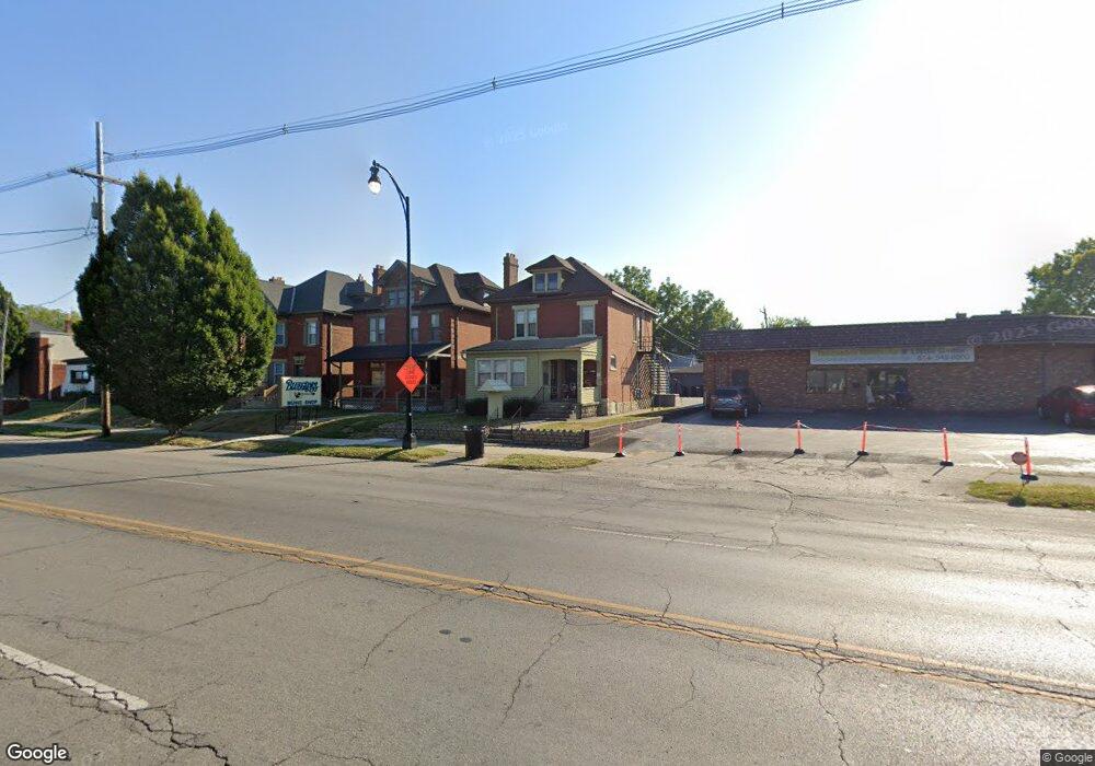
1374 S High St Columbus, OH 43207
Merion Village NeighborhoodEstimated Value: $229,165
4
Beds
2
Baths
1,776
Sq Ft
$129/Sq Ft
Est. Value
About This Home
This home is located at 1374 S High St, Columbus, OH 43207 and is currently estimated at $229,165, approximately $129 per square foot. 1374 S High St is a home located in Franklin County with nearby schools including Southwood Elementary School, South High School, and Saint Mary School German Village .
Ownership History
Date
Name
Owned For
Owner Type
Purchase Details
Closed on
Jun 13, 2018
Sold by
Dials Custom Builders Llc
Bought by
1374 South High Llc
Current Estimated Value
Purchase Details
Closed on
Sep 4, 2007
Sold by
York Mary D
Bought by
Dials William A and Dials Cynthia S
Purchase Details
Closed on
Mar 21, 1991
Bought by
York Floyd M and York Mary D
Purchase Details
Closed on
Jan 7, 1988
Purchase Details
Closed on
Apr 1, 1985
Create a Home Valuation Report for This Property
The Home Valuation Report is an in-depth analysis detailing your home's value as well as a comparison with similar homes in the area
Home Values in the Area
Average Home Value in this Area
Purchase History
| Date | Buyer | Sale Price | Title Company |
|---|---|---|---|
| 1374 South High Llc | -- | None Available | |
| Dials William A | $101,000 | Attorney | |
| York Floyd M | -- | -- | |
| -- | -- | -- | |
| -- | $65,000 | -- |
Source: Public Records
Tax History Compared to Growth
Tax History
| Year | Tax Paid | Tax Assessment Tax Assessment Total Assessment is a certain percentage of the fair market value that is determined by local assessors to be the total taxable value of land and additions on the property. | Land | Improvement |
|---|---|---|---|---|
| 2024 | $3,853 | $51,910 | $16,560 | $35,350 |
| 2023 | $3,792 | $51,905 | $16,555 | $35,350 |
| 2022 | $2,974 | $39,660 | $18,200 | $21,460 |
| 2021 | $2,987 | $39,660 | $18,200 | $21,460 |
| 2020 | $2,966 | $39,660 | $18,200 | $21,460 |
| 2019 | $2,970 | $36,060 | $16,560 | $19,500 |
| 2018 | $3,036 | $36,060 | $16,560 | $19,500 |
| 2017 | $3,159 | $36,060 | $16,560 | $19,500 |
| 2016 | $3,351 | $38,510 | $16,560 | $21,950 |
| 2015 | $3,112 | $38,510 | $16,560 | $21,950 |
| 2014 | $3,110 | $38,510 | $16,560 | $21,950 |
| 2013 | $1,541 | $38,500 | $16,555 | $21,945 |
Source: Public Records
Map
Nearby Homes
- 1357 City Park Ave Unit 359
- 1437 S High St Unit 439
- 65 Frebis Ave
- 1264 S High St
- 1420 S 4th St
- 1366 S 4th St
- 6 Hanford St Unit 6
- 1452 S 4th St
- 43 W Markison Ave
- 73-75 E Markison Ave
- 1272 S 4th St
- 1374 S 5th St
- 165 Frebis Ave
- 164 Frebis Ave
- 1543 S 4th St Unit 1543
- 1534 S 4th St Unit 1536
- 27 W Welch Ave
- 1542 S 4th St Unit 1542
- 17 E Mithoff St
- 130 E Gates St
- 1364 S High St
- 1392 S High St
- 1360 S High St Unit 2nd floor
- 1378 S High St
- 1379 City Park Ave Unit 381
- 1358 S High St
- 1358 S High St Unit 2
- 1379-1381 City Park Ave
- 1379-81 City Park Ave
- 1373 City Park Ave
- 1383 City Park Ave
- 1385 City Park Ave
- 1387 City Park Ave Unit 391
- 1371 City Park Ave Unit 1371
- 1369 City Park Ave Unit 1369
- 1382 City Park Ave
- 1345 City Park Ave
- 1386 City Park Ave Unit 388
- 1376 City Park Ave
- 1372 City Park Ave