Estimated Value: $492,000 - $515,579
3
Beds
3
Baths
1,746
Sq Ft
$289/Sq Ft
Est. Value
About This Home
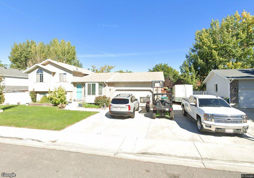
This home is located at 1374 W 1835 N, Lehi, UT 84043 and is currently estimated at $505,395, approximately $289 per square foot. 1374 W 1835 N is a home located in Utah County with nearby schools including Lehi Elementary School, Lehi Junior High School, and Lehi High School.
Ownership History
Date
Name
Owned For
Owner Type
Purchase Details
Closed on
Jun 6, 2011
Sold by
Buhler Seth C
Bought by
Buhler Seth C and Buhler Amy N
Current Estimated Value
Home Financials for this Owner
Home Financials are based on the most recent Mortgage that was taken out on this home.
Original Mortgage
$151,070
Outstanding Balance
$103,981
Interest Rate
4.75%
Mortgage Type
FHA
Estimated Equity
$401,414
Purchase Details
Closed on
Aug 28, 2007
Sold by
Quittner Peter D and Quittner Gayla L
Bought by
Lavallee Richard B and Lavallee Sherrie L
Home Financials for this Owner
Home Financials are based on the most recent Mortgage that was taken out on this home.
Original Mortgage
$240,900
Interest Rate
6.67%
Mortgage Type
Purchase Money Mortgage
Purchase Details
Closed on
Aug 2, 1999
Sold by
Dietz T Matthew and Patrice Dietz L
Bought by
Quittner Peter D and Quittner Gayla L
Create a Home Valuation Report for This Property
The Home Valuation Report is an in-depth analysis detailing your home's value as well as a comparison with similar homes in the area
Home Values in the Area
Average Home Value in this Area
Purchase History
| Date | Buyer | Sale Price | Title Company |
|---|---|---|---|
| Buhler Seth C | -- | First American Orem | |
| Buhler Seth C | -- | First American Castlewood | |
| Lavallee Richard B | -- | Wasatch Land & Title | |
| Quittner Peter D | -- | Mountain West Title Co |
Source: Public Records
Mortgage History
| Date | Status | Borrower | Loan Amount |
|---|---|---|---|
| Open | Buhler Seth C | $151,070 | |
| Closed | Buhler Seth C | $151,070 | |
| Previous Owner | Lavallee Richard B | $240,900 |
Source: Public Records
Tax History Compared to Growth
Tax History
| Year | Tax Paid | Tax Assessment Tax Assessment Total Assessment is a certain percentage of the fair market value that is determined by local assessors to be the total taxable value of land and additions on the property. | Land | Improvement |
|---|---|---|---|---|
| 2025 | $2,027 | $246,840 | $174,000 | $274,800 |
| 2024 | $2,027 | $237,160 | $0 | $0 |
| 2023 | $1,902 | $241,615 | $0 | $0 |
| 2022 | $1,989 | $244,970 | $0 | $0 |
| 2021 | $1,785 | $332,400 | $100,700 | $231,700 |
| 2020 | $1,682 | $309,700 | $93,200 | $216,500 |
| 2019 | $1,471 | $281,500 | $93,200 | $188,300 |
| 2018 | $1,393 | $252,100 | $88,400 | $163,700 |
| 2017 | $1,269 | $122,100 | $0 | $0 |
| 2016 | $1,304 | $116,380 | $0 | $0 |
| 2015 | $1,286 | $108,900 | $0 | $0 |
| 2014 | $1,187 | $99,935 | $0 | $0 |
Source: Public Records
Map
Nearby Homes
- 1272 W 1800 N
- 1249 W 1800 N
- 1332 W 1500 N
- 1610 N 1125 W
- 1011 W Mountain Way Unit 316
- 1627 W Boxwood Dr Unit 110
- 1659 W Boxwood Dr Unit 109
- 1094 W 1425 N
- 1542 N 1900 W
- 1817 W Bad Rock Cir
- 5312 N Springview Ct Unit 106
- 1027 N 3685 W Unit 248
- 2191 W Swift Fox Dr Unit 274
- 999 Empire St
- 2184 W Cape Fox Way N Unit 220
- 1060 N Canvasback Dr Unit 405
- 1089 N 3685 W Unit 253
- 500 S Center St E
- 1077 N 3685 W Unit 252
- 1672 S 70 W