Estimated Value: $149,131 - $167,000
3
Beds
1
Bath
1,086
Sq Ft
$147/Sq Ft
Est. Value
About This Home
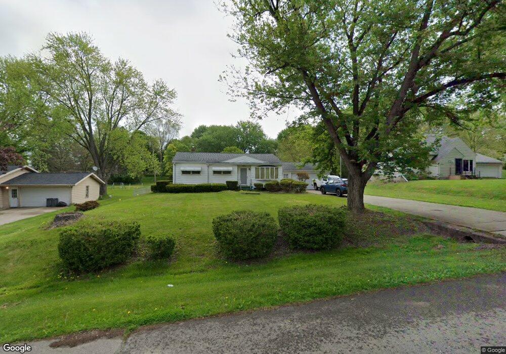
This home is located at 1374 Westwood Dr, Flint, MI 48532 and is currently estimated at $159,283, approximately $146 per square foot. 1374 Westwood Dr is a home located in Genesee County with nearby schools including Carman-Ainsworth High School, Genesee STEM Academy, and Linden Charter Academy.
Ownership History
Date
Name
Owned For
Owner Type
Purchase Details
Closed on
Jul 27, 2000
Sold by
Loftin Helen L
Bought by
Evans Rosemary
Current Estimated Value
Home Financials for this Owner
Home Financials are based on the most recent Mortgage that was taken out on this home.
Original Mortgage
$90,000
Outstanding Balance
$32,114
Interest Rate
8.19%
Mortgage Type
Purchase Money Mortgage
Estimated Equity
$127,169
Purchase Details
Closed on
May 10, 2000
Sold by
Loftin Kernie and Loftin Debra
Bought by
Loftin Helen L
Create a Home Valuation Report for This Property
The Home Valuation Report is an in-depth analysis detailing your home's value as well as a comparison with similar homes in the area
Home Values in the Area
Average Home Value in this Area
Purchase History
| Date | Buyer | Sale Price | Title Company |
|---|---|---|---|
| Evans Rosemary | $105,000 | First American Title Ins Co | |
| Loftin Helen L | -- | -- |
Source: Public Records
Mortgage History
| Date | Status | Borrower | Loan Amount |
|---|---|---|---|
| Open | Evans Rosemary | $90,000 |
Source: Public Records
Tax History Compared to Growth
Tax History
| Year | Tax Paid | Tax Assessment Tax Assessment Total Assessment is a certain percentage of the fair market value that is determined by local assessors to be the total taxable value of land and additions on the property. | Land | Improvement |
|---|---|---|---|---|
| 2025 | $1,523 | $65,000 | $0 | $0 |
| 2024 | $754 | $62,000 | $0 | $0 |
| 2023 | $719 | $53,200 | $0 | $0 |
| 2022 | $690 | $42,800 | $0 | $0 |
| 2021 | $1,347 | $37,000 | $0 | $0 |
| 2020 | $646 | $37,400 | $0 | $0 |
| 2019 | $637 | $34,200 | $0 | $0 |
| 2018 | $1,253 | $29,600 | $0 | $0 |
| 2017 | $1,206 | $29,600 | $0 | $0 |
| 2016 | $1,240 | $29,100 | $0 | $0 |
| 2015 | $1,070 | $29,100 | $0 | $0 |
| 2014 | $635 | $26,800 | $0 | $0 |
| 2012 | -- | $29,500 | $29,500 | $0 |
Source: Public Records
Map
Nearby Homes
- 5021 Forest Side Dr
- 2174 Mill Rd
- 1159 N Linden Rd
- 5104 Shady Oak Trail
- 1090 Cabot Dr
- 2008 Beekman Ct
- 1246 Dyemeadow Ln
- 1058 Cora Dr
- 4022 Beecher Rd
- 1391 Dye Krest Cir
- Graham Rd N Graham Rd
- 1068 S Graham Rd
- 2051 Lavelle Rd
- 1193 Normandy Terrace Dr
- 3528 Beecher Rd
- 2 Charter Dr
- 1136 Gilbert St
- 1194 Woodkrest Dr
- 2218 Disch St
- 5297 Oaktree Dr
- 1384 Westwood Dr
- 1394 Westwood Dr
- 1348 Westwood Dr
- 1415 Autumn Dr
- 1421 Autumn Dr
- 1409 Autumn Dr
- 1404 Westwood Dr
- 1336 Westwood Dr
- 1369 Westwood Dr
- 1379 Westwood Dr
- 1431 Autumn Dr
- 1389 Westwood Dr
- 1359 Westwood Dr
- 1403 Autumn Dr
- 1314 Westwood Dr
- 1414 Westwood Dr
- 1399 Westwood Dr
- 1347 Westwood Dr
- 1439 Autumn Dr
- 1304 Westwood Dr