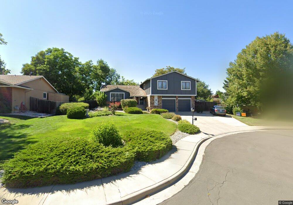
13741 Basalt Ct Broomfield, CO 80020
Country Estates NeighborhoodEstimated Value: $670,321 - $935,000
4
Beds
4
Baths
2,602
Sq Ft
$304/Sq Ft
Est. Value
About This Home
This home is located at 13741 Basalt Ct, Broomfield, CO 80020 and is currently estimated at $790,330, approximately $303 per square foot. 13741 Basalt Ct is a home located in Broomfield County with nearby schools including Aspen Creek K-8 School, Broomfield High School, and Nativity: Faith and Reason.
Ownership History
Date
Name
Owned For
Owner Type
Purchase Details
Closed on
Nov 18, 2002
Sold by
Kagy Gisella E
Bought by
Mooney John and Mooney Erin
Current Estimated Value
Home Financials for this Owner
Home Financials are based on the most recent Mortgage that was taken out on this home.
Original Mortgage
$246,150
Outstanding Balance
$93,439
Interest Rate
4.75%
Estimated Equity
$696,891
Purchase Details
Closed on
Jun 27, 1997
Purchase Details
Closed on
Aug 13, 1984
Purchase Details
Closed on
Feb 18, 1981
Create a Home Valuation Report for This Property
The Home Valuation Report is an in-depth analysis detailing your home's value as well as a comparison with similar homes in the area
Home Values in the Area
Average Home Value in this Area
Purchase History
| Date | Buyer | Sale Price | Title Company |
|---|---|---|---|
| Mooney John | $290,000 | Land Title | |
| -- | $186,500 | -- | |
| -- | $138,000 | -- | |
| -- | $113,800 | -- |
Source: Public Records
Mortgage History
| Date | Status | Borrower | Loan Amount |
|---|---|---|---|
| Open | Mooney John | $246,150 |
Source: Public Records
Tax History Compared to Growth
Tax History
| Year | Tax Paid | Tax Assessment Tax Assessment Total Assessment is a certain percentage of the fair market value that is determined by local assessors to be the total taxable value of land and additions on the property. | Land | Improvement |
|---|---|---|---|---|
| 2025 | $3,735 | $41,640 | $13,400 | $28,240 |
| 2024 | $3,735 | $39,860 | $12,270 | $27,590 |
| 2023 | $3,728 | $45,170 | $13,900 | $31,270 |
| 2022 | $3,218 | $33,290 | $10,080 | $23,210 |
| 2021 | $3,202 | $34,250 | $10,370 | $23,880 |
| 2020 | $2,985 | $31,730 | $9,300 | $22,430 |
| 2019 | $2,979 | $31,950 | $9,360 | $22,590 |
| 2018 | $2,640 | $27,970 | $7,200 | $20,770 |
| 2017 | $2,600 | $30,920 | $7,960 | $22,960 |
| 2016 | $2,628 | $27,870 | $7,430 | $20,440 |
Source: Public Records
Map
Nearby Homes
- 146 Keystone Trail
- 147 Keystone Trail
- 13971 Telluride Dr
- 36 Carla Way
- 267 Powderhorn Trail
- 49 Carla Way
- 583 Redstone Dr
- 1732 Peregrine Ln
- 46 Douglas Dr S
- 53 Douglas Dr S
- 30 Douglas Dr N
- 1719 Daisy Ct
- 1490 Saint Andrews Dr
- 23 Scott Dr N
- 20 Scott Dr N
- 1660 Emerald St
- 1747 Whistlepig Ln
- 114 E 14th Ct
- 37 E 14th Place
- 1757 Whistlepig Ln
- 13731 Basalt Ct
- 23 Minturn Ave
- 2210 Outlook Trail
- 2200 Outlook Trail
- 2220 Outlook Trail
- 2190 Snowmass Cir
- 13721 Basalt Ct
- 33 Minturn Ave
- 13740 Basalt Ct
- 2230 Outlook Trail
- 13730 Basalt Ct
- 2170 Snowmass Cir
- 10 Ophir Ave
- 20 Ophir Ave
- 13711 Basalt Ct
- 113 Minturn Ave
- 100 Breckenridge Trail
- 105 Wolf Creek Trail
- 2240 Outlook Trail
- 30 Ophir Ave