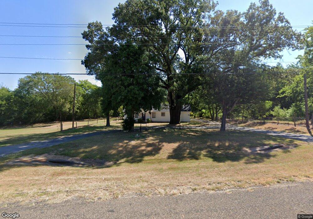
13741 State Highway 110 S Whitehouse, TX 75791
Estimated Value: $181,000 - $262,000
--
Bed
1
Bath
1,486
Sq Ft
$148/Sq Ft
Est. Value
About This Home
This home is located at 13741 State Highway 110 S, Whitehouse, TX 75791 and is currently estimated at $220,027, approximately $148 per square foot. 13741 State Highway 110 S is a home located in Smith County with nearby schools including H.L. Higgins Elementary School, J.W. Holloway Sixth Grade School, and Whitehouse High School.
Ownership History
Date
Name
Owned For
Owner Type
Purchase Details
Closed on
Sep 30, 2021
Sold by
Pittman Sue Ann and Lewis Helen Lafaye
Bought by
Dornak Mollie Nicole and Dornack Michael Craig
Current Estimated Value
Home Financials for this Owner
Home Financials are based on the most recent Mortgage that was taken out on this home.
Original Mortgage
$180,000
Outstanding Balance
$163,429
Interest Rate
2.8%
Mortgage Type
New Conventional
Estimated Equity
$56,598
Create a Home Valuation Report for This Property
The Home Valuation Report is an in-depth analysis detailing your home's value as well as a comparison with similar homes in the area
Home Values in the Area
Average Home Value in this Area
Purchase History
| Date | Buyer | Sale Price | Title Company |
|---|---|---|---|
| Dornak Mollie Nicole | $239,400 | None Listed On Document |
Source: Public Records
Mortgage History
| Date | Status | Borrower | Loan Amount |
|---|---|---|---|
| Open | Dornak Mollie Nicole | $180,000 |
Source: Public Records
Tax History Compared to Growth
Tax History
| Year | Tax Paid | Tax Assessment Tax Assessment Total Assessment is a certain percentage of the fair market value that is determined by local assessors to be the total taxable value of land and additions on the property. | Land | Improvement |
|---|---|---|---|---|
| 2025 | $1,742 | $156,162 | $32,109 | $124,053 |
| 2024 | $1,742 | $128,172 | $32,109 | $125,838 |
| 2023 | $1,434 | $106,810 | $32,109 | $74,701 |
| 2022 | $1,733 | $112,312 | $32,109 | $80,203 |
| 2021 | $1,579 | $94,025 | $31,668 | $62,357 |
| 2020 | $1,657 | $94,409 | $31,668 | $62,741 |
| 2019 | $1,739 | $94,793 | $31,668 | $63,125 |
| 2018 | $1,717 | $93,971 | $31,668 | $62,303 |
| 2017 | $1,574 | $97,926 | $31,668 | $66,258 |
| 2016 | $1,574 | $97,885 | $31,668 | $66,217 |
| 2015 | $252 | $95,982 | $31,668 | $64,314 |
| 2014 | $252 | $93,925 | $31,668 | $62,257 |
Source: Public Records
Map
Nearby Homes
- 9823 County Road 2228
- 10903 Oakdale Dr
- 5832 Mustang Trail
- 5793 Palo Pinto Dr
- 13460 County Road 2122
- 3123 Oak Bend
- 10906 N Forty
- 10988 N Forty
- 10877 N Forty
- 10905 N Forty
- 10880 N Forty
- 10923 N Forty
- Lot Unit 8 County Road 2123
- 7012 Hillside Ave
- 3114 Arbor Oak Dr
- 14553 County Road 2191
- 2921 Guinn Farms Rd
- 5803 Persimmon Dr
- 7173 Alexander Dr
- 2834 Guinn Farms Rd
- 13970 Texas 110
- 13970 State Highway 110 S
- 14034 State Highway 110 S
- 14034 Texas 110
- 10045 County Road 2228
- 9971 County Road 2228
- 3542 Star Rd
- 9868 9868 County Road 2228
- 9868 County Road 2228
- 9823 9823 County Road 2228
- 9862 County Road 2228
- 9703 County Road 2228
- 14195 State Highway 110 S
- 14186 Texas 110
- 9663 County Road 2228
- 6427 Sydney Rd
- 6427 6427 Sydney Dr
- 13601 S Hwy 110 S
- 9824 County Road 2228
- 9554 9554 Pleasant Hill Cir