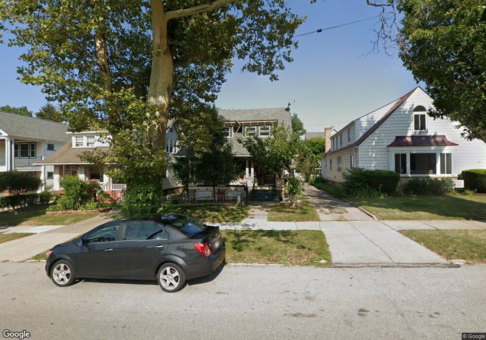
1375 Andrews Ave Lakewood, OH 44107
Estimated Value: $296,000 - $362,000
3
Beds
1
Bath
1,302
Sq Ft
$247/Sq Ft
Est. Value
About This Home
This home is located at 1375 Andrews Ave, Lakewood, OH 44107 and is currently estimated at $321,931, approximately $247 per square foot. 1375 Andrews Ave is a home located in Cuyahoga County with nearby schools including Grant Elementary School, Harding Middle School, and Lakewood High School.
Ownership History
Date
Name
Owned For
Owner Type
Purchase Details
Closed on
Dec 28, 2016
Sold by
Margosian Paul
Bought by
Margosian Diane and Margosian Paul
Current Estimated Value
Purchase Details
Closed on
Oct 5, 2009
Sold by
Boris John A and Boris Mary V
Bought by
Margosian Paul M
Home Financials for this Owner
Home Financials are based on the most recent Mortgage that was taken out on this home.
Original Mortgage
$123,960
Outstanding Balance
$81,397
Interest Rate
5.19%
Mortgage Type
VA
Estimated Equity
$240,534
Purchase Details
Closed on
Feb 7, 2002
Sold by
Estate Of Hermine Kalnins and Ceceris Karlis V
Bought by
Boris John A and Boris Mary
Home Financials for this Owner
Home Financials are based on the most recent Mortgage that was taken out on this home.
Original Mortgage
$84,900
Interest Rate
7.23%
Purchase Details
Closed on
Jan 1, 1975
Bought by
Kalnins Hermine
Create a Home Valuation Report for This Property
The Home Valuation Report is an in-depth analysis detailing your home's value as well as a comparison with similar homes in the area
Home Values in the Area
Average Home Value in this Area
Purchase History
| Date | Buyer | Sale Price | Title Company |
|---|---|---|---|
| Margosian Diane | -- | None Available | |
| Margosian Paul M | $120,000 | Mutual Title Agency Inc | |
| Boris John A | $100,000 | Midland Title Security Inc | |
| Kalnins Hermine | -- | -- |
Source: Public Records
Mortgage History
| Date | Status | Borrower | Loan Amount |
|---|---|---|---|
| Open | Margosian Paul M | $123,960 | |
| Previous Owner | Boris John A | $84,900 |
Source: Public Records
Tax History Compared to Growth
Tax History
| Year | Tax Paid | Tax Assessment Tax Assessment Total Assessment is a certain percentage of the fair market value that is determined by local assessors to be the total taxable value of land and additions on the property. | Land | Improvement |
|---|---|---|---|---|
| 2024 | $5,189 | $90,580 | $19,985 | $70,595 |
| 2023 | $4,416 | $68,010 | $16,770 | $51,240 |
| 2022 | $4,476 | $68,010 | $16,770 | $51,240 |
| 2021 | $4,431 | $68,010 | $16,770 | $51,240 |
| 2020 | $3,761 | $52,710 | $12,990 | $39,730 |
| 2019 | $3,686 | $150,600 | $37,100 | $113,500 |
| 2018 | $3,681 | $52,710 | $12,990 | $39,730 |
| 2017 | $3,057 | $41,930 | $10,430 | $31,500 |
| 2016 | $3,036 | $41,930 | $10,430 | $31,500 |
| 2015 | $3,036 | $41,930 | $10,430 | $31,500 |
| 2014 | $2,797 | $38,120 | $9,490 | $28,630 |
Source: Public Records
Map
Nearby Homes
- 1337 Cook Ave
- 1284 Warren Rd
- 1269 Virginia Ave
- 1272 Virginia Ave
- 1480 Warren Rd Unit 206
- 1480 Warren Rd Unit 313
- 1480 Warren Rd
- 1209 Warren Rd
- 1205 Warren Rd
- 1175 Andrews Ave
- 1594 Victoria Ave
- 1450 Orchard Grove Ave
- 1244 Brockley Ave
- 1542 Westwood Ave
- 1415 Olivewood Ave Unit 17
- 14724 Clifton Blvd
- 1545 Marlowe Ave
- 1437 Woodward Ave
- 1547 Orchard Grove Ave
- 1465 Woodward Ave
- 1371 Andrews Ave
- 1381 Andrews Ave
- 1367 Andrews Ave
- 1376 Gladys Ave
- 1370 Gladys Ave
- 1365 Andrews Ave
- 1380 Gladys Ave
- 1366 Gladys Ave
- 1382 Gladys Ave
- 1361 Andrews Ave
- 1362 Gladys Ave
- 1358 Gladys Ave
- 1355 Andrews Ave
- 1364 Andrews Ave
- 15100 Detroit Ave Unit 8
- 15100 Detroit Ave Unit 7
- 15100 Detroit Ave Unit 4
- 15100 Detroit Ave Unit 3
- 15100 Detroit Ave Unit 5
- 15100 Detroit Ave Unit 2