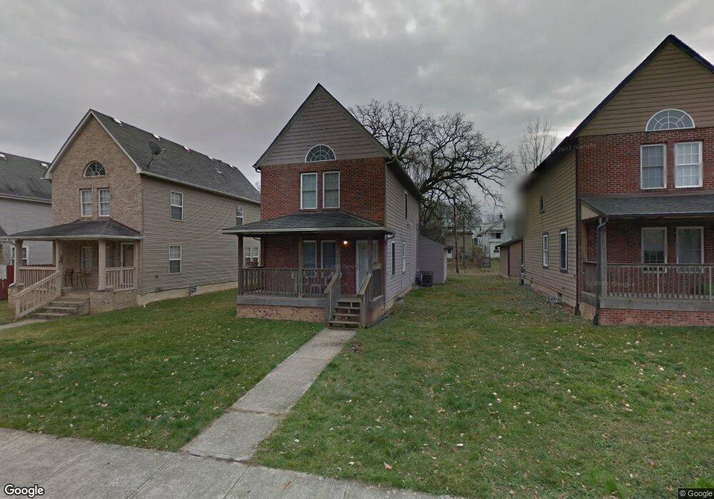
1375 Carrie Ave Columbus, OH 43205
Franklin Park NeighborhoodEstimated Value: $255,492 - $536,000
3
Beds
2
Baths
1,368
Sq Ft
$277/Sq Ft
Est. Value
About This Home
This home is located at 1375 Carrie Ave, Columbus, OH 43205 and is currently estimated at $379,373, approximately $277 per square foot. 1375 Carrie Ave is a home located in Franklin County with nearby schools including Ohio Avenue Elementary School, Champion Middle School, and East High School.
Ownership History
Date
Name
Owned For
Owner Type
Purchase Details
Closed on
Jan 6, 2003
Sold by
Buckeye Community Hope Foundation
Bought by
Gordon Joyce
Current Estimated Value
Purchase Details
Closed on
Mar 11, 2002
Sold by
City Of Columbus Ohio
Bought by
Buckeye Community Hope Foundation
Purchase Details
Closed on
May 23, 1994
Create a Home Valuation Report for This Property
The Home Valuation Report is an in-depth analysis detailing your home's value as well as a comparison with similar homes in the area
Home Values in the Area
Average Home Value in this Area
Purchase History
| Date | Buyer | Sale Price | Title Company |
|---|---|---|---|
| Gordon Joyce | $105,000 | -- | |
| Buckeye Community Hope Foundation | -- | -- | |
| -- | -- | -- |
Source: Public Records
Tax History
| Year | Tax Paid | Tax Assessment Tax Assessment Total Assessment is a certain percentage of the fair market value that is determined by local assessors to be the total taxable value of land and additions on the property. | Land | Improvement |
|---|---|---|---|---|
| 2025 | $2,809 | $62,580 | $22,610 | $39,970 |
| 2024 | $2,809 | $62,580 | $22,610 | $39,970 |
| 2023 | $2,773 | $62,580 | $22,610 | $39,970 |
| 2022 | $1,899 | $36,610 | $1,750 | $34,860 |
| 2021 | $1,902 | $36,610 | $1,750 | $34,860 |
| 2020 | $1,905 | $36,610 | $1,750 | $34,860 |
| 2019 | $1,850 | $30,490 | $1,440 | $29,050 |
| 2018 | $1,613 | $30,490 | $1,440 | $29,050 |
| 2017 | $1,849 | $30,490 | $1,440 | $29,050 |
| 2016 | $1,521 | $22,960 | $1,820 | $21,140 |
| 2015 | $1,381 | $22,960 | $1,820 | $21,140 |
| 2014 | $1,384 | $22,960 | $1,820 | $21,140 |
| 2013 | $719 | $24,185 | $1,925 | $22,260 |
Source: Public Records
Map
Nearby Homes
- 939 E Rich St
- 1469 E Rich St
- 336 Loeffler Ave
- 838 Bryden Rd
- 380 Kendall Place
- 347 Kendall Place
- 1456-1458 Bryden Rd
- 372 Miller Ave
- 1230 E Main St
- 266 Miller Ave Unit 268
- 374 Wilson Ave Unit 374-76
- 1555 E Rich St Unit 557
- 164 Wilson Ave
- 1571 Franklin Ave
- 1174 E Rich St Unit 1172-1174
- 138 Wilson Ave
- 1258 Oak St
- 1170 Bryden Rd
- 0 E Fulton St
- 1345 E Fulton St
- 1371 Carrie Ave
- 1381 Carrie Ave
- 1385 Carrie Ave
- 1365 Carrie Ave
- 1389 Carrie Ave
- 1361 Carrie Ave Unit 3
- 1361 Carrie Ave
- 1370 E Rich St
- 1372 E Rich St
- 1364 E Rich St
- 1357 Carrie Ave Unit 59
- 1357 Carrie Ave
- 1376 E Rich St Unit 378
- 1376 E Rich St Unit 2
- 1376 & 78 E Rich St Unit 378
- 1381 Bryden Rd
- 1377 Bryden Rd
- 1367 Carrie Ave
- 1363 Carrie Ave
- 1360 E Rich St
Your Personal Tour Guide
Ask me questions while you tour the home.