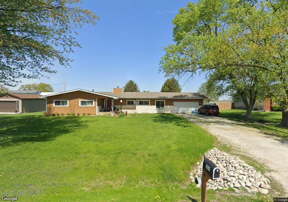
1376 Airport Rd Lincoln, IL 62656
Estimated Value: $176,000 - $241,000
4
Beds
2
Baths
1,894
Sq Ft
$111/Sq Ft
Est. Value
About This Home
This home is located at 1376 Airport Rd, Lincoln, IL 62656 and is currently estimated at $210,958, approximately $111 per square foot. 1376 Airport Rd is a home located in Logan County with nearby schools including Chester-East Lincoln Elementary School, Lincoln Community High School, and Carroll Catholic School.
Ownership History
Date
Name
Owned For
Owner Type
Purchase Details
Closed on
Jan 14, 2021
Sold by
Kohl Jill
Bought by
Kohl Eric
Current Estimated Value
Purchase Details
Closed on
Sep 2, 2011
Sold by
Bailey Daniel D and Bailey Larry L
Bought by
Kohl Eric J and Kohl Jill A
Home Financials for this Owner
Home Financials are based on the most recent Mortgage that was taken out on this home.
Original Mortgage
$10,000
Interest Rate
4.32%
Mortgage Type
Stand Alone First
Purchase Details
Closed on
Jan 21, 2011
Sold by
Bailey Daniel D and Bailey Delores A
Bought by
Bailey Daniel D and Bailey Larry L
Create a Home Valuation Report for This Property
The Home Valuation Report is an in-depth analysis detailing your home's value as well as a comparison with similar homes in the area
Home Values in the Area
Average Home Value in this Area
Purchase History
| Date | Buyer | Sale Price | Title Company |
|---|---|---|---|
| Kohl Eric | -- | None Available | |
| Kohl Eric J | $105,000 | -- | |
| Bailey Daniel D | -- | -- |
Source: Public Records
Mortgage History
| Date | Status | Borrower | Loan Amount |
|---|---|---|---|
| Closed | Kohl Eric J | $10,000 | |
| Open | Kohl Eric J | $99,101 |
Source: Public Records
Tax History Compared to Growth
Tax History
| Year | Tax Paid | Tax Assessment Tax Assessment Total Assessment is a certain percentage of the fair market value that is determined by local assessors to be the total taxable value of land and additions on the property. | Land | Improvement |
|---|---|---|---|---|
| 2024 | $3,870 | $59,180 | $8,370 | $50,810 |
| 2023 | $3,595 | $54,800 | $7,750 | $47,050 |
| 2022 | $3,119 | $47,730 | $7,240 | $40,490 |
| 2021 | $2,986 | $49,160 | $6,950 | $42,210 |
| 2020 | $2,945 | $48,440 | $6,850 | $41,590 |
| 2019 | $2,851 | $47,490 | $6,720 | $40,770 |
| 2018 | $2,812 | $43,390 | $6,590 | $36,800 |
| 2017 | $2,825 | $43,390 | $6,590 | $36,800 |
| 2016 | $2,823 | $43,340 | $6,580 | $36,760 |
| 2015 | $2,450 | $39,630 | $6,270 | $33,360 |
| 2014 | $2,450 | $39,630 | $6,270 | $33,360 |
| 2013 | $2,450 | $37,620 | $5,950 | $31,670 |
| 2012 | $2,450 | $38,300 | $6,060 | $32,240 |
Source: Public Records
Map
Nearby Homes
- 2354 Railsplitter Ave
- 2294 Railsplitter Ave
- 1354 Airport Rd
- 103 Crestwood Dr
- 102 Crestwood Dr
- 145 Half Moon St
- 180 Regent St
- 1503 N Kankakee St
- 1431 N Ottawa St
- 1208 N Kankakee St
- 1019 N Mclean St
- 1204 N Ottawa St
- 1107 N Kankakee St
- 1842 Castle Pine Place
- 311 Davenport St
- 6 Meadow Ln
- 915 Peoria St
- 1624 Delavan St
- 315 N Sherman St
- 620 Tremont St
- 1378 Airport Rd
- 1372 Airport Rd
- 275 Heritage Ave
- 265 Heritage Ave
- 285 Heritage Ave
- 1380 Airport Rd
- 255 Heritage Ave
- 1370 Airport Rd
- 245 Heritage Ave
- 235 Heritage Ave
- 1382 Airport Rd
- 270 Heritage Ave
- 260 Heritage Ave
- 280 Heritage Ave
- 250 Heritage Ave
- 225 Heritage Ave
- 240 Heritage Ave
- 1368 Airport Rd
- 230 Heritage Ave
- 215 Heritage Ave