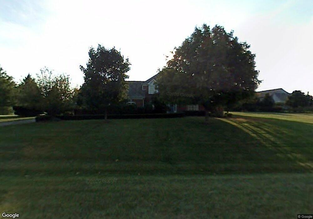
1376 Manassas Ln Long Grove, IL 60047
Estimated Value: $957,413 - $1,027,000
--
Bed
3
Baths
3,468
Sq Ft
$285/Sq Ft
Est. Value
About This Home
This home is located at 1376 Manassas Ln, Long Grove, IL 60047 and is currently estimated at $990,103, approximately $285 per square foot. 1376 Manassas Ln is a home located in Lake County with nearby schools including Kildeer Countryside Elementary School, Woodlawn Middle School, and Adlai E Stevenson High School.
Ownership History
Date
Name
Owned For
Owner Type
Purchase Details
Closed on
Aug 6, 2002
Sold by
Cole Taylor Bank
Bought by
Charles Jeffrey W
Current Estimated Value
Home Financials for this Owner
Home Financials are based on the most recent Mortgage that was taken out on this home.
Original Mortgage
$550,000
Interest Rate
4.85%
Mortgage Type
Negative Amortization
Create a Home Valuation Report for This Property
The Home Valuation Report is an in-depth analysis detailing your home's value as well as a comparison with similar homes in the area
Home Values in the Area
Average Home Value in this Area
Purchase History
| Date | Buyer | Sale Price | Title Company |
|---|---|---|---|
| Charles Jeffrey W | $687,500 | Chicago Title Insurance Co |
Source: Public Records
Mortgage History
| Date | Status | Borrower | Loan Amount |
|---|---|---|---|
| Previous Owner | Charles Jeffrey W | $550,000 |
Source: Public Records
Tax History Compared to Growth
Tax History
| Year | Tax Paid | Tax Assessment Tax Assessment Total Assessment is a certain percentage of the fair market value that is determined by local assessors to be the total taxable value of land and additions on the property. | Land | Improvement |
|---|---|---|---|---|
| 2024 | $25,283 | $280,285 | $71,899 | $208,386 |
| 2023 | $21,241 | $264,470 | $67,842 | $196,628 |
| 2022 | $21,241 | $225,164 | $57,759 | $167,405 |
| 2021 | $20,532 | $222,736 | $57,136 | $165,600 |
| 2020 | $20,068 | $223,496 | $57,331 | $166,165 |
| 2019 | $19,540 | $222,672 | $57,120 | $165,552 |
| 2018 | $20,442 | $241,167 | $62,088 | $179,079 |
| 2017 | $20,078 | $235,538 | $60,639 | $174,899 |
| 2016 | $19,375 | $225,547 | $58,067 | $167,480 |
| 2015 | $18,977 | $210,930 | $54,304 | $156,626 |
| 2014 | $19,155 | $210,013 | $58,322 | $151,691 |
| 2012 | $19,001 | $210,434 | $58,439 | $151,995 |
Source: Public Records
Map
Nearby Homes
- 1514 Sumter Dr
- 1242 Antietam Dr
- 1545 Chickamauga Ln
- 1728 Holly Ct
- 1357 Bristol Ln Unit Q4
- 887 Saybrook Ln Unit 2
- 1325 Fairfax Ln
- 1324 Fairfax Ln Unit B32
- 12 Cloverdale Ct
- 5107 N Arlington Heights Rd
- 1032 Courtland Dr Unit 9
- 800 Clohesey Dr
- 2426 Lexington Dr
- 2408 Cumberland Cir
- 1141 Devonshire Rd
- 890 Knollwood Dr
- 931 Shady Grove Ln
- 1265 Devonshire Rd
- 1112 Auburn Ln
- 610 Checker Dr
- 1380 Manassas Ln
- 1351 Manassas Ln
- 1378 Manassas Ln
- 1381 Manassas Ln
- 1375 Manassas Ct
- 1353 Bridgewater Ln
- 1383 Manassas Ln
- 1382 Manassas Ln
- 1379 Manassas Ct
- 1358 Bridgewater Ln
- 1377 Manassas Ct
- 1352 Bridgewater Ln
- 1385 Manassas Ln
- 1355 Bridgewater Ln
- 1384 Manassas Ln
- 1354 Bridgewater Ln
- 1362 Gettysburg Rd
- 1388 Gettysburg Rd
- 1364 Gettysburg Rd
- 1386 Manassas Ln