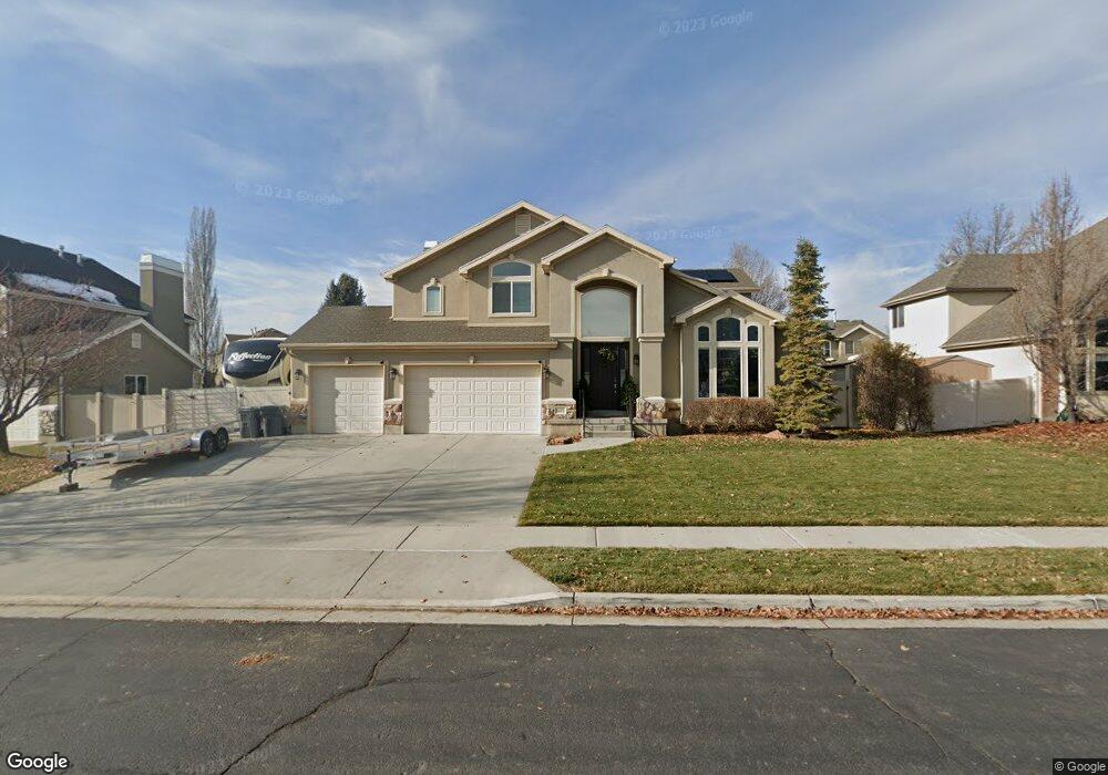
1377 N 70 E American Fork, UT 84003
Estimated Value: $722,000 - $786,710
4
Beds
3
Baths
3,751
Sq Ft
$204/Sq Ft
Est. Value
About This Home
This home is located at 1377 N 70 E, American Fork, UT 84003 and is currently estimated at $764,237, approximately $203 per square foot. 1377 N 70 E is a home located in Utah County with nearby schools including Legacy Elementary School, American Fork Junior High School, and American Fork High School.
Ownership History
Date
Name
Owned For
Owner Type
Purchase Details
Closed on
Jan 31, 2023
Sold by
Scott R Okelberry R and Scott Debra C
Bought by
Okelberry Family Trust
Current Estimated Value
Purchase Details
Closed on
Feb 24, 2018
Sold by
Okelberry Scott R and Okelberry Debra C
Bought by
Oklebery Scott and Oklebery Debra
Purchase Details
Closed on
Feb 19, 2003
Sold by
New Mark Development Inc
Bought by
Okelberry Scott R and Okelberry Debra C
Home Financials for this Owner
Home Financials are based on the most recent Mortgage that was taken out on this home.
Original Mortgage
$223,900
Interest Rate
5.89%
Create a Home Valuation Report for This Property
The Home Valuation Report is an in-depth analysis detailing your home's value as well as a comparison with similar homes in the area
Home Values in the Area
Average Home Value in this Area
Purchase History
| Date | Buyer | Sale Price | Title Company |
|---|---|---|---|
| Okelberry Family Trust | -- | -- | |
| Oklebery Scott | -- | None Available | |
| Okelberry Scott R | -- | Century Title |
Source: Public Records
Mortgage History
| Date | Status | Borrower | Loan Amount |
|---|---|---|---|
| Previous Owner | Okelberry Scott R | $223,900 |
Source: Public Records
Tax History
| Year | Tax Paid | Tax Assessment Tax Assessment Total Assessment is a certain percentage of the fair market value that is determined by local assessors to be the total taxable value of land and additions on the property. | Land | Improvement |
|---|---|---|---|---|
| 2025 | $3,209 | $395,615 | -- | -- |
| 2024 | $3,209 | $356,565 | $0 | $0 |
| 2023 | $2,990 | $352,275 | $0 | $0 |
| 2022 | $3,447 | $400,730 | $0 | $0 |
| 2021 | $2,760 | $501,200 | $168,000 | $333,200 |
| 2020 | $2,652 | $467,000 | $155,600 | $311,400 |
| 2019 | $2,506 | $456,400 | $145,000 | $311,400 |
| 2018 | $2,306 | $401,600 | $130,800 | $270,800 |
| 2017 | $2,279 | $214,225 | $0 | $0 |
| 2016 | $2,349 | $205,095 | $0 | $0 |
| 2015 | $2,451 | $203,170 | $0 | $0 |
| 2014 | $2,246 | $183,645 | $0 | $0 |
Source: Public Records
Map
Nearby Homes
- 35 W 1350 N
- 9643 N 5650 W
- 5995 W 9600 N
- 1065 N 100 E
- 9796 N 5800 W
- 894 N 60 E
- 5537 W Kensington Cir
- 4650 W Magnolia Drive Dr Unit 8
- 10238 N 6530 W Unit 15
- 5277 N 11200 W Unit 4
- 5284 N 11200 W Unit 3
- 6079 W Whisper Ln Unit 404
- 1220 E 700 N
- 6111 W Whisper Ln Unit 402
- 603 S 370 E
- 234 W 1080 N
- 822 N 150 E Unit 5
- 1016 N 250 W
- 1023 N 250 W
- 780 N 100 E
Your Personal Tour Guide
Ask me questions while you tour the home.