
Seller's Agent in 2025
Chase Sutfin
MounTerra Real Estate
(530) 290-6765
67 Total Sales
Estimated Value: $497,000 - $512,000
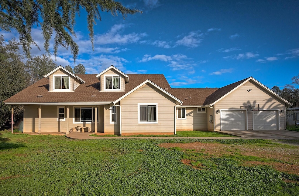
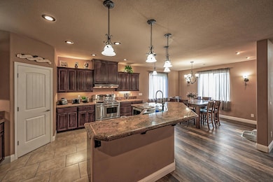
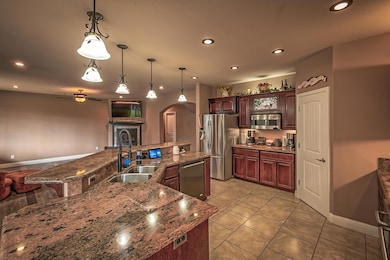
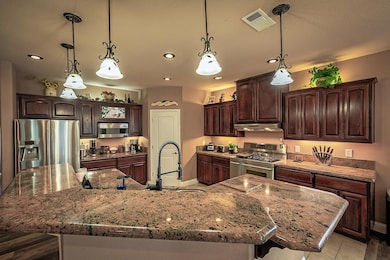
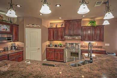
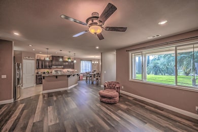
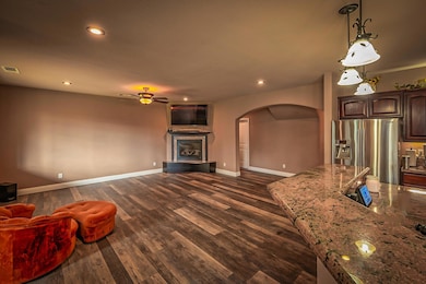
Nestled in a friendly neighborhood with dual master suites, each a private sanctuary with large closets and exquisite amenities. This expansive home offers massive square footage designed for those who value space and sophisticated living. The heart of this residence is a large kitchen equipped with ample counter and cabinet space, perfect for culinary explorations. It flows into a grand great-room and dining area, providing a seamless space for hosting gatherings. Additional spacious rooms offer versatility for any need, all within minutes of I-5, shopping, and the serene Shasta Lake. Embrace a lifestyle of unparalleled comfort and convenience in this stunning home.
Last Agent to Sell the Property
MounTerra Real Estate License #01996536 Listed on: 11/14/2025
| Date | Buyer | Sale Price | Title Company |
|---|---|---|---|
| Martinez Ramyr | $500,000 | First American Title | |
| Farr Virginia Marie | -- | None Available | |
| Farr Virginia | -- | None Available | |
| Farr Robert L | $31,000 | First American Title Co |
| Date | Status | Borrower | Loan Amount |
|---|---|---|---|
| Open | Martinez Ramyr | $475,000 | |
| Previous Owner | Farr Robert L | $64,921 |
| Date | Event | Price | List to Sale | Price per Sq Ft |
|---|---|---|---|---|
| 12/18/2025 12/18/25 | Sold | $500,000 | +2.0% | $158 / Sq Ft |
| 11/24/2025 11/24/25 | Pending | -- | -- | -- |
| 11/14/2025 11/14/25 | For Sale | $490,000 | -- | $155 / Sq Ft |
| Year | Tax Paid | Tax Assessment Tax Assessment Total Assessment is a certain percentage of the fair market value that is determined by local assessors to be the total taxable value of land and additions on the property. | Land | Improvement |
|---|---|---|---|---|
| 2025 | $3,718 | $347,279 | $16,581 | $330,698 |
| 2024 | $3,648 | $340,470 | $16,256 | $324,214 |
| 2023 | $3,648 | $333,795 | $15,938 | $317,857 |
| 2022 | $3,551 | $327,251 | $15,626 | $311,625 |
| 2021 | $3,504 | $320,835 | $15,320 | $305,515 |
| 2020 | $3,490 | $317,546 | $15,163 | $302,383 |
| 2019 | $3,382 | $311,320 | $14,866 | $296,454 |
| 2018 | $3,383 | $305,217 | $14,575 | $290,642 |
| 2017 | $3,327 | $299,234 | $14,290 | $284,944 |
| 2016 | $3,181 | $293,367 | $14,010 | $279,357 |
| 2015 | $3,056 | $288,961 | $13,800 | $275,161 |
| 2014 | $3,077 | $283,301 | $13,530 | $269,771 |
Seller's Agent in 2025
Chase Sutfin
MounTerra Real Estate
(530) 290-6765
67 Total Sales
R
Buyer's Agent in 2025
Ramyr Martinez
eXp Realty of Northern California, Inc.
(346) 205-4388
1 Total Sale
Source: Shasta Association of REALTORS®
MLS Number: 25-5103
APN: 306-030-004-000
Disclaimer: Certain information contained herein is derived from information provided by parties other than Homes.com. All information provided is deemed reliable, but is not guaranteed to be accurate and should be independently verified.
![]() IDX information is provided exclusively for personal, non-commercial use, and may not be used for any purpose other than to identify prospective properties consumers may be interested in purchasing. Information is deemed reliable but not guaranteed.
IDX information is provided exclusively for personal, non-commercial use, and may not be used for any purpose other than to identify prospective properties consumers may be interested in purchasing. Information is deemed reliable but not guaranteed.
Ask me questions while you tour the home.