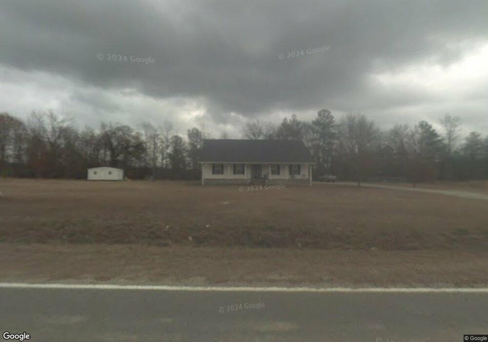
1379 Old Wire Rd W Junction City, GA 31812
Estimated Value: $240,218 - $350,000
3
Beds
2
Baths
2,052
Sq Ft
$145/Sq Ft
Est. Value
About This Home
This home is located at 1379 Old Wire Rd W, Junction City, GA 31812 and is currently estimated at $298,406, approximately $145 per square foot. 1379 Old Wire Rd W is a home with nearby schools including Taylor County Primary School, Taylor County Upper Elementary School, and Taylor County Middle School.
Ownership History
Date
Name
Owned For
Owner Type
Purchase Details
Closed on
Jul 2, 1999
Sold by
Parsons Parsons and Parsons Glanton
Bought by
Clark Toby Phillip
Current Estimated Value
Purchase Details
Closed on
Jul 1, 1999
Sold by
Parker Maybelle
Bought by
Clark Toby Etal
Purchase Details
Closed on
Sep 30, 1994
Bought by
Clark Toby Phillip
Create a Home Valuation Report for This Property
The Home Valuation Report is an in-depth analysis detailing your home's value as well as a comparison with similar homes in the area
Home Values in the Area
Average Home Value in this Area
Purchase History
| Date | Buyer | Sale Price | Title Company |
|---|---|---|---|
| Clark Toby Phillip | -- | -- | |
| Clark Toby Etal | -- | -- | |
| Clark Toby Phillip | -- | -- |
Source: Public Records
Tax History Compared to Growth
Tax History
| Year | Tax Paid | Tax Assessment Tax Assessment Total Assessment is a certain percentage of the fair market value that is determined by local assessors to be the total taxable value of land and additions on the property. | Land | Improvement |
|---|---|---|---|---|
| 2024 | $1,546 | $75,160 | $5,320 | $69,840 |
| 2023 | $1,283 | $59,280 | $3,320 | $55,960 |
| 2022 | $1,297 | $56,480 | $3,320 | $53,160 |
| 2021 | $1,199 | $52,960 | $2,760 | $50,200 |
| 2020 | $1,209 | $52,960 | $2,760 | $50,200 |
| 2019 | $1,229 | $52,960 | $2,760 | $50,200 |
| 2018 | $1,275 | $52,960 | $2,760 | $50,200 |
| 2017 | $1,141 | $49,978 | $2,788 | $47,190 |
| 2016 | $1,150 | $49,977 | $2,788 | $47,190 |
| 2015 | -- | $49,977 | $2,788 | $47,190 |
| 2014 | -- | $56,933 | $3,097 | $53,836 |
| 2013 | -- | $57,623 | $3,097 | $54,526 |
Source: Public Records
Map
Nearby Homes
- 1146 Wesley Church Rd
- 00 County Line Rd
- 1942 Wesley Church Rd
- 98 ACRES +/- George Smith Rd
- 650+/- Highway 80
- 650+/- AC Talbotton Hwy
- 1083 Talbotton Hwy
- 896 Talbotton Hwy
- 0 Talbotton Hwy Unit 24477771
- 0 George Smith Rd Unit 23355703
- 475 Rock Church Rd
- 5576 Pobiddy Rd
- 766 Parks Rd
- 776 Allen Rd
- 0 Georgia 127 Unit 25831251
- 0 County Line Rd Unit 10627883
- 103 ACRES Po Biddy Rd
- 40 ACRES Po Biddy Rd
- 0 Georgia 137
- 202 S Taylor Rd