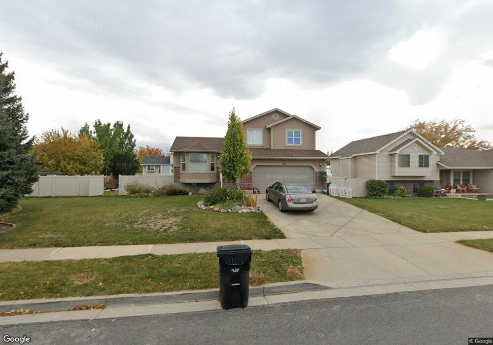
1379 W 2100 S Woods Cross, UT 84087
Estimated Value: $532,000 - $554,000
4
Beds
4
Baths
1,954
Sq Ft
$278/Sq Ft
Est. Value
About This Home
This home is located at 1379 W 2100 S, Woods Cross, UT 84087 and is currently estimated at $543,050, approximately $277 per square foot. 1379 W 2100 S is a home located in Davis County with nearby schools including Odyssey School, South Davis Junior High School, and Woods Cross High School.
Ownership History
Date
Name
Owned For
Owner Type
Purchase Details
Closed on
Oct 6, 2022
Sold by
Roberts Robin
Bought by
Robin Roberts Living Trust
Current Estimated Value
Purchase Details
Closed on
Sep 24, 2021
Sold by
Cowan Andrea F and Cowan Andrea
Bought by
Roberts Robin
Purchase Details
Closed on
Aug 20, 2021
Sold by
Cowan Andrea F
Bought by
Roberts Robin
Purchase Details
Closed on
May 22, 2017
Sold by
Cowan Gordon and Cowan Andrea
Bought by
Cowan Andrew
Purchase Details
Closed on
Jun 23, 2014
Sold by
Maddy Jennifer and Maddy Brad
Bought by
Cowan Gordon E and Cowan Andrea F
Home Financials for this Owner
Home Financials are based on the most recent Mortgage that was taken out on this home.
Original Mortgage
$209,700
Interest Rate
4.16%
Mortgage Type
New Conventional
Purchase Details
Closed on
Sep 15, 2009
Sold by
Shaw Jonathan A and Shaw Jaclyn N
Bought by
Maddy Jennifer and Maddy Brad
Home Financials for this Owner
Home Financials are based on the most recent Mortgage that was taken out on this home.
Original Mortgage
$187,850
Interest Rate
5.18%
Mortgage Type
New Conventional
Purchase Details
Closed on
Feb 22, 2005
Sold by
Morris Nathanial S and Morris Amy R
Bought by
Shaw Jonathan A and Shaw Jaclyn N
Home Financials for this Owner
Home Financials are based on the most recent Mortgage that was taken out on this home.
Original Mortgage
$26,700
Interest Rate
5.65%
Mortgage Type
Credit Line Revolving
Purchase Details
Closed on
Jan 7, 2003
Sold by
Carroll Alan
Bought by
Morris Nathanial S and Morris Amy R
Home Financials for this Owner
Home Financials are based on the most recent Mortgage that was taken out on this home.
Original Mortgage
$146,450
Interest Rate
6.06%
Purchase Details
Closed on
May 1, 2002
Sold by
Santa Rosa Development Llc
Bought by
Carroll Alan
Create a Home Valuation Report for This Property
The Home Valuation Report is an in-depth analysis detailing your home's value as well as a comparison with similar homes in the area
Home Values in the Area
Average Home Value in this Area
Purchase History
| Date | Buyer | Sale Price | Title Company |
|---|---|---|---|
| Robin Roberts Living Trust | -- | -- | |
| Roberts Robin | -- | Real Advantage Title | |
| Roberts Robin | -- | Real Advantage Title | |
| Cowan Andrew | -- | -- | |
| Cowan Gordon E | -- | None Available | |
| Maddy Jennifer | -- | Wasatch Title Insuranc | |
| Shaw Jonathan A | -- | None Available | |
| Morris Nathanial S | -- | Aspen Title Insurance Agency | |
| Carroll Alan | -- | Aspen Title Insurance Agency |
Source: Public Records
Mortgage History
| Date | Status | Borrower | Loan Amount |
|---|---|---|---|
| Previous Owner | Cowan Gordon E | $209,700 | |
| Previous Owner | Maddy Jennifer | $187,850 | |
| Previous Owner | Shaw Jonathan A | $26,700 | |
| Previous Owner | Shaw Jonathan A | $142,800 | |
| Previous Owner | Morris Nathanial S | $146,450 | |
| Closed | Carroll Alan | $0 |
Source: Public Records
Tax History Compared to Growth
Tax History
| Year | Tax Paid | Tax Assessment Tax Assessment Total Assessment is a certain percentage of the fair market value that is determined by local assessors to be the total taxable value of land and additions on the property. | Land | Improvement |
|---|---|---|---|---|
| 2025 | $3,017 | $261,800 | $110,643 | $151,157 |
| 2024 | $2,838 | $251,899 | $117,753 | $134,146 |
| 2023 | $2,663 | $241,450 | $85,696 | $155,753 |
| 2022 | $2,768 | $254,100 | $67,729 | $186,371 |
| 2021 | $2,474 | $361,000 | $99,301 | $261,699 |
| 2020 | $2,193 | $316,000 | $94,490 | $221,510 |
| 2019 | $2,277 | $324,000 | $88,273 | $235,727 |
| 2018 | $2,189 | $300,000 | $86,827 | $213,173 |
| 2016 | $1,772 | $136,510 | $36,777 | $99,733 |
| 2015 | $1,677 | $124,575 | $36,777 | $87,798 |
| 2014 | $1,858 | $142,541 | $36,326 | $106,215 |
| 2013 | -- | $111,324 | $25,709 | $85,615 |
Source: Public Records
Map
Nearby Homes
- 1384 W 2175 S
- 1255 W 2050 S
- 1984 S 1500 W
- 1998 S 1600 W
- 1422 W 1300 S
- 1334 W 1300 S
- 1309 W 1200 S
- 2024 S 925 W
- 916 W 2025 S
- 1846 W 2280 S
- 913 W 2025 S
- 1288 S 1050 W
- 1623 S 925 W
- 826 W Ivywell Ln Unit 219
- 1971 W 1870 S
- 828 W Ivywell Ln Unit 220
- 1153 N Meridian Ln Unit 120
- 1137 S 1050 W
- 1160 N Clifton Dr Unit 114
- 1156 N Clifton Dr Unit 115
- 1363 W 2100 S
- 1363 W 2100 S Unit 228
- 1393 W 2100 S
- 1393 W 2100 S Unit 230
- 1372 W 2175 S
- 1372 W 2175 S Unit 224
- 1384 W 2175 S Unit 223
- 1364 W 2175 S
- 1364 W 2175 S Unit 225
- 1378 W 2100 S Unit 232
- 1396 W 2175 S
- 1396 W 2175 S Unit 222
- 1357 W 2100 S
- 1368 W 2100 S
- 1368 W 2100 S Unit 233
- 2126 S 1350 W
- 1407 W 2100 S
- 1384 W 2100 S
- 1384 W 2100 S Unit 231
- 1352 W 2175 S