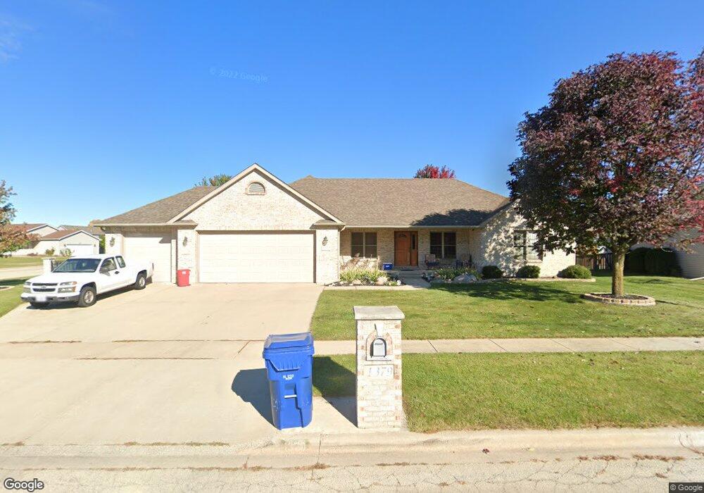
1379 Walnut St Dekalb, IL 60115
Estimated Value: $330,992 - $389,000
Studio
--
Bath
--
Sq Ft
0.37
Acres
About This Home
This home is located at 1379 Walnut St, Dekalb, IL 60115 and is currently estimated at $347,248. 1379 Walnut St is a home located in DeKalb County with nearby schools including Founders Elementary School, Huntley Middle School, and De Kalb High School.
Ownership History
Date
Name
Owned For
Owner Type
Purchase Details
Closed on
Nov 1, 2005
Sold by
Spangler Gary
Bought by
Lothson Neil and Bennett Sindneya B
Current Estimated Value
Home Financials for this Owner
Home Financials are based on the most recent Mortgage that was taken out on this home.
Original Mortgage
$216,800
Outstanding Balance
$118,353
Interest Rate
5.98%
Mortgage Type
New Conventional
Estimated Equity
$228,895
Purchase Details
Closed on
Jun 10, 2005
Sold by
Hamilton William D
Bought by
Spangler Gary and Spangler Laurie
Create a Home Valuation Report for This Property
The Home Valuation Report is an in-depth analysis detailing your home's value as well as a comparison with similar homes in the area
Home Values in the Area
Average Home Value in this Area
Purchase History
| Date | Buyer | Sale Price | Title Company |
|---|---|---|---|
| Lothson Neil | $268,500 | -- | |
| Spangler Gary | $60,000 | -- |
Source: Public Records
Mortgage History
| Date | Status | Borrower | Loan Amount |
|---|---|---|---|
| Open | Lothson Neil | $216,800 |
Source: Public Records
Tax History Compared to Growth
Tax History
| Year | Tax Paid | Tax Assessment Tax Assessment Total Assessment is a certain percentage of the fair market value that is determined by local assessors to be the total taxable value of land and additions on the property. | Land | Improvement |
|---|---|---|---|---|
| 2024 | $7,572 | $104,661 | $14,500 | $90,161 |
| 2023 | $7,325 | $91,256 | $12,643 | $78,613 |
| 2022 | $7,325 | $83,316 | $14,429 | $68,887 |
| 2021 | $7,446 | $78,143 | $13,533 | $64,610 |
| 2020 | $7,594 | $76,897 | $13,317 | $63,580 |
| 2019 | $7,396 | $73,876 | $12,794 | $61,082 |
| 2018 | $7,772 | $71,371 | $12,360 | $59,011 |
| 2017 | $7,816 | $68,606 | $11,881 | $56,725 |
| 2016 | $7,711 | $66,874 | $11,581 | $55,293 |
| 2015 | -- | $63,364 | $10,973 | $52,391 |
| 2014 | -- | $63,525 | $15,877 | $47,648 |
| 2013 | -- | $66,728 | $16,678 | $50,050 |
Source: Public Records
Map
Nearby Homes
- 1723 Goldenrod Turn
- 1734 Sunglow Ln
- 910 Dawn Ct
- 1663 Furrow St
- 1692 Furrow St
- 451 Thresher St
- 476 Thresher St
- 1177 Golf Ct
- 1169 Golf Ct
- 399 Bantam St
- 430 Turnbury Ct E
- 1205 S 1st St
- 100 Warren Place
- 110 Pooler Ave
- 720 S 2nd St
- 528 College Ave
- 1118 Holmes Place
- 356 Augusta Ave
- 612 Russell Rd
- 126 Park Ave
- 676 Knolls St W
- 1367 Walnut St
- 722 Magnolia St
- 1354 Knolls Ave S
- 689 Knolls St W
- 1366 Knolls Ave S
- 1351 Walnut St
- 663 Knolls St W
- LOT 245 Walnut St
- LOT245 Walnut St
- 1346 Knolls Ave S
- 716 Magnolia St
- 647 Knolls St W
- 688 Magnolia St
- 1335 Walnut St
- 611 Knolls St W
- 648 Magnolia St
- 1363 Knolls Ave S
- 1322 Knolls Ave S
- 626 Magnolia St