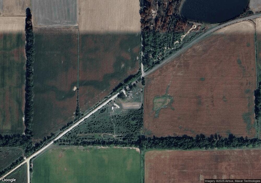
13793 W 20 N Linton, IN 47441
Estimated Value: $201,000 - $236,322
--
Bed
--
Bath
1,632
Sq Ft
$137/Sq Ft
Est. Value
About This Home
This home is located at 13793 W 20 N, Linton, IN 47441 and is currently estimated at $223,581, approximately $136 per square foot. 13793 W 20 N is a home with nearby schools including Linton-Stockton Elementary School, Linton-Stockton High School, and Zion'S Hill Baptist School.
Ownership History
Date
Name
Owned For
Owner Type
Purchase Details
Closed on
Sep 10, 2019
Sold by
Grounds Chad B
Bought by
Grounds Chad B and Grounds Angela S
Current Estimated Value
Purchase Details
Closed on
Jan 8, 2016
Sold by
Grounds Andela S
Bought by
Grounds Chad B
Home Financials for this Owner
Home Financials are based on the most recent Mortgage that was taken out on this home.
Original Mortgage
$135,000
Outstanding Balance
$107,263
Interest Rate
3.93%
Mortgage Type
New Conventional
Estimated Equity
$116,318
Purchase Details
Closed on
Nov 1, 2014
Sold by
Grounds Angela S
Bought by
Grounds Chad B and Grounds Angela S
Purchase Details
Closed on
Aug 1, 2014
Sold by
Goodman Larry J and Goodman Audrey S
Bought by
Grounds Angela S
Home Financials for this Owner
Home Financials are based on the most recent Mortgage that was taken out on this home.
Original Mortgage
$137,655
Interest Rate
4.11%
Mortgage Type
New Conventional
Create a Home Valuation Report for This Property
The Home Valuation Report is an in-depth analysis detailing your home's value as well as a comparison with similar homes in the area
Home Values in the Area
Average Home Value in this Area
Purchase History
| Date | Buyer | Sale Price | Title Company |
|---|---|---|---|
| Grounds Chad B | -- | Regional Land Title | |
| Grounds Chad B | -- | -- | |
| Grounds Chad B | -- | -- | |
| Grounds Angela S | -- | -- |
Source: Public Records
Mortgage History
| Date | Status | Borrower | Loan Amount |
|---|---|---|---|
| Open | Grounds Chad B | $135,000 | |
| Closed | Grounds Angela S | $137,655 |
Source: Public Records
Tax History Compared to Growth
Tax History
| Year | Tax Paid | Tax Assessment Tax Assessment Total Assessment is a certain percentage of the fair market value that is determined by local assessors to be the total taxable value of land and additions on the property. | Land | Improvement |
|---|---|---|---|---|
| 2024 | $1,238 | $115,800 | $39,300 | $76,500 |
| 2023 | $1,214 | $115,100 | $39,300 | $75,800 |
| 2022 | $920 | $101,300 | $23,100 | $78,200 |
| 2021 | $826 | $92,900 | $22,000 | $70,900 |
| 2020 | $832 | $95,400 | $22,000 | $73,400 |
| 2019 | $827 | $92,400 | $23,400 | $69,000 |
| 2018 | $820 | $92,900 | $23,700 | $69,200 |
| 2017 | $811 | $93,600 | $24,900 | $68,700 |
| 2016 | $767 | $92,000 | $25,900 | $66,100 |
| 2014 | $721 | $92,900 | $25,900 | $67,000 |
| 2013 | -- | $90,800 | $24,500 | $66,300 |
Source: Public Records
Map
Nearby Homes
- 13684 W Auburn Ridge Ct
- 000 Westview Dr
- 13971 W 150 N
- 00 W Echles Ave
- 2 8th St NW
- 691 W Vincennes St
- 1260 W Gabbard Rd
- 14518 County Road 400 N
- 670 A St NW
- 0000 Glenburn Rd
- 410 4th St NW
- 291 S State Road 59
- 0 SE 1st St
- 963 1st St SE
- 649 4th St NW
- 689 4th St NW
- 740 3rd St NW
- 410 I St NW
- 279 A St SE
- 1160 5th St SE
- 438 N 1375 W
- 490 N 1375 W
- 491 N 1375 W
- 13947 W 50 N
- 13681 W Auburn Ridge Ct
- 595 N 1375 W
- 109 N 1330 W
- 0 W Auburn Ridge Ct
- 14025 W 50 N
- 313 N 1330 W
- 561 N Auburn Ridge Dr
- 637 N 1375 W
- 269 N 1330 W
- 309 N 1330 W
- 22 N 1330 W
- 14221 W 50 N
- 40 N St SW
- 675 N Auburn Ridge Dr
- 688 N Auburn Ridge Dr
- 373 N 1330 W
