Estimated Value: $139,863 - $295,000
2
Beds
2
Baths
2,045
Sq Ft
$99/Sq Ft
Est. Value
About This Home
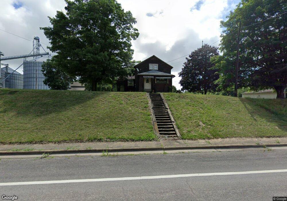
This home is located at 13795 State Route 534, Salem, OH 44460 and is currently estimated at $203,466, approximately $99 per square foot. 13795 State Route 534 is a home located in Mahoning County with nearby schools including West Branch Middle School and West Branch High School.
Ownership History
Date
Name
Owned For
Owner Type
Purchase Details
Closed on
Oct 28, 2024
Sold by
Mather Amelia M
Bought by
Heritage Cooperative Inc
Current Estimated Value
Purchase Details
Closed on
Apr 4, 2014
Sold by
Estate Of Earl W Mather
Bought by
Mather Amelia M
Create a Home Valuation Report for This Property
The Home Valuation Report is an in-depth analysis detailing your home's value as well as a comparison with similar homes in the area
Home Values in the Area
Average Home Value in this Area
Purchase History
| Date | Buyer | Sale Price | Title Company |
|---|---|---|---|
| Heritage Cooperative Inc | $48,000 | None Listed On Document | |
| Heritage Cooperative Inc | $48,000 | None Listed On Document | |
| Mather Amelia M | -- | None Available |
Source: Public Records
Tax History Compared to Growth
Tax History
| Year | Tax Paid | Tax Assessment Tax Assessment Total Assessment is a certain percentage of the fair market value that is determined by local assessors to be the total taxable value of land and additions on the property. | Land | Improvement |
|---|---|---|---|---|
| 2024 | $1,107 | $37,880 | $1,190 | $36,690 |
| 2023 | $1,072 | $37,880 | $1,190 | $36,690 |
| 2022 | $932 | $29,880 | $1,190 | $28,690 |
| 2021 | $905 | $29,880 | $1,190 | $28,690 |
| 2020 | $908 | $29,880 | $1,190 | $28,690 |
| 2019 | $696 | $23,430 | $1,190 | $22,240 |
| 2018 | $693 | $23,430 | $1,190 | $22,240 |
| 2017 | $614 | $23,430 | $1,190 | $22,240 |
| 2016 | $558 | $20,880 | $1,190 | $19,690 |
| 2015 | $543 | $20,880 | $1,190 | $19,690 |
| 2014 | $545 | $20,880 | $1,190 | $19,690 |
| 2013 | $543 | $20,880 | $1,190 | $19,690 |
Source: Public Records
Map
Nearby Homes
- 14930 S Pricetown Rd
- 14831 Smith Goshen Rd
- 14965 Seacrist Rd
- 14980 Salem Alliance Rd
- 29979 Salem-Alliance Rd
- 30051 Sr 62
- 17394 State Route 62
- 27443 State Route 62
- 28339 Misty Morning Ln
- 15772 Cleveland - East Liverpool Rd
- 18061 Derr Ave
- 17880 State Route 62
- 35 Bayview Dr
- 18 Boxwood Dr
- 14609 S Duck Creek Rd
- 11 Redwood St
- 57 Redwood St
- 73 Redwood St
- 26223 Wildwood Dr
- 726 N 12th St
- 13782 S Pricetown Rd
- 13810 State Route 534
- 13811 State Route 534
- 15963 Front St
- 13839 State Route 534
- 13734 State Route 534
- 13853 State Route 534
- 13853 S Pricetown Rd
- 13535 S Pricetown Rd
- 13535 State Route 534
- 13925 State Route 534
- 13926 State Route 534
- 418-420 Third St
- 13948 S Pricetown Rd
- 13945 S Pricetown Rd
- 15830 Garfield Rd
- 13985 S Pricetown Rd
- 15970 Garfield Rd
- 16024 W Garfield Rd
- 16024 Garfield Rd