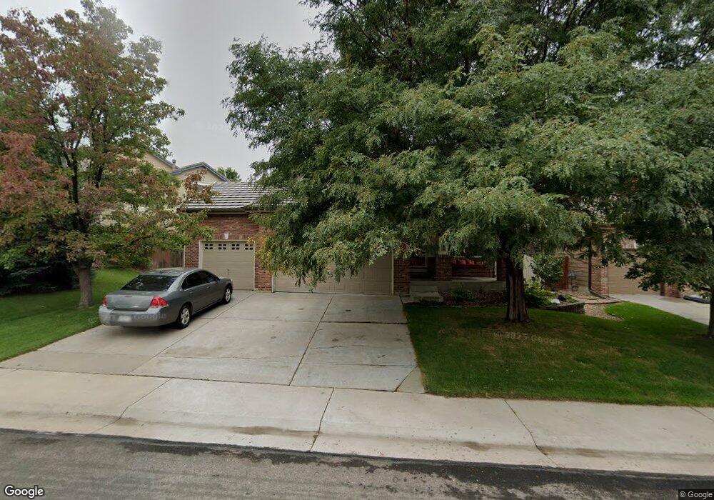
13799 Cook St Thornton, CO 80602
Cherrywood Park NeighborhoodEstimated Value: $555,006 - $593,000
5
Beds
4
Baths
1,858
Sq Ft
$308/Sq Ft
Est. Value
About This Home
This home is located at 13799 Cook St, Thornton, CO 80602 and is currently estimated at $572,252, approximately $307 per square foot. 13799 Cook St is a home located in Adams County with nearby schools including Prairie Hills Elementary School, Rocky Top Middle School, and Horizon High School.
Ownership History
Date
Name
Owned For
Owner Type
Purchase Details
Closed on
Mar 22, 2024
Sold by
Byers Robert H and Byers Krista R
Bought by
Byers Family Trust
Current Estimated Value
Purchase Details
Closed on
Nov 28, 2001
Sold by
Richmond American Homes Of Colorado Inc
Bought by
Byers Robert H and Byers Krista R A
Home Financials for this Owner
Home Financials are based on the most recent Mortgage that was taken out on this home.
Original Mortgage
$239,450
Interest Rate
6.57%
Create a Home Valuation Report for This Property
The Home Valuation Report is an in-depth analysis detailing your home's value as well as a comparison with similar homes in the area
Home Values in the Area
Average Home Value in this Area
Purchase History
| Date | Buyer | Sale Price | Title Company |
|---|---|---|---|
| Byers Family Trust | -- | None Listed On Document | |
| Byers Robert H | $252,070 | Stewart Title |
Source: Public Records
Mortgage History
| Date | Status | Borrower | Loan Amount |
|---|---|---|---|
| Previous Owner | Byers Robert H | $239,450 |
Source: Public Records
Tax History Compared to Growth
Tax History
| Year | Tax Paid | Tax Assessment Tax Assessment Total Assessment is a certain percentage of the fair market value that is determined by local assessors to be the total taxable value of land and additions on the property. | Land | Improvement |
|---|---|---|---|---|
| 2024 | $3,789 | $34,940 | $6,560 | $28,380 |
| 2023 | $3,750 | $40,320 | $6,770 | $33,550 |
| 2022 | $3,133 | $28,440 | $6,600 | $21,840 |
| 2021 | $3,236 | $28,440 | $6,600 | $21,840 |
| 2020 | $3,137 | $28,120 | $6,790 | $21,330 |
| 2019 | $3,143 | $28,120 | $6,790 | $21,330 |
| 2018 | $2,886 | $25,080 | $7,490 | $17,590 |
| 2017 | $2,624 | $25,080 | $7,490 | $17,590 |
| 2016 | $2,176 | $20,250 | $3,820 | $16,430 |
| 2015 | $2,173 | $20,250 | $3,820 | $16,430 |
| 2014 | $2,008 | $18,190 | $3,580 | $14,610 |
Source: Public Records
Map
Nearby Homes
- 13758 Cook St
- 13890 Madison St
- 3022 E 137th Place
- 13963 Cook St
- 13638 Garfield St Unit B
- 13638 Garfield St Unit C
- 2883 E 136th Place
- 13844 Jackson St
- 13606 Garfield St Unit E
- 13915 Harrison Dr
- 3365 E 141st Ave
- 14028 Jackson St
- 0 Colorado Blvd
- 14162 Madison Way
- 14065 Harrison St
- 13784 Ash Cir
- 13540 Detroit St
- 13731 Ash Cir
- 8346 E 135th Ct
- 4061 E 133rd Cir
- 13809 Cook St
- 13785 Cook St
- 13780 Adams St
- 13792 Adams St
- 13777 Cook St
- 3346 E 138th Ave
- 13764 Adams St
- 13806 Cook St
- 13798 Cook St
- 13769 Cook St
- 13790 Cook St
- 3313 E 138th Ave
- 3325 E 138th Ave
- 13756 Adams St
- 3372 E 138th Ave
- 3337 E 138th Ave
- 3303 E 138th Ave
- 13761 Cook St
- 13774 Cook St
- 3264 E 138th Ave