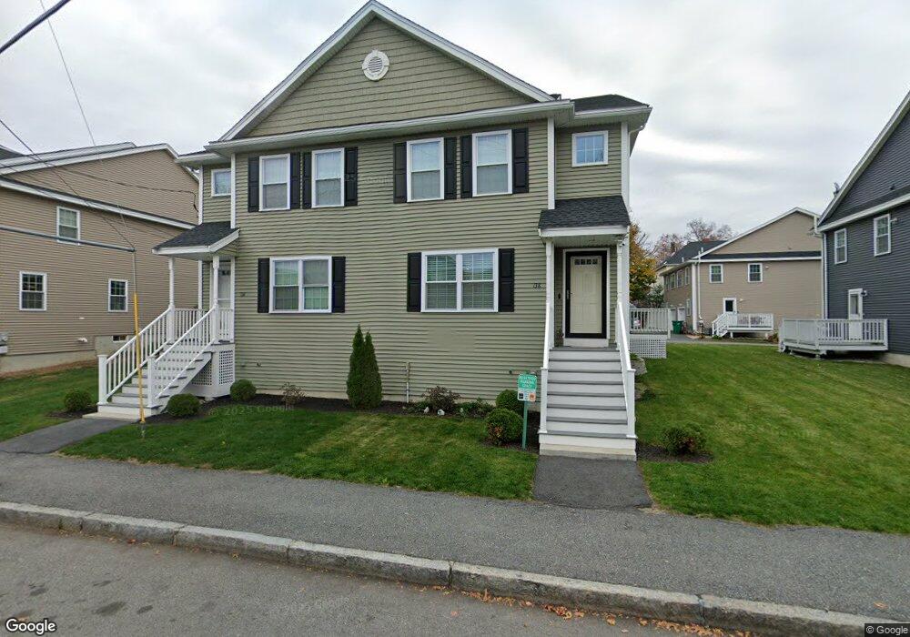
138 Andrews St Lowell, MA 01852
Sacred Heart NeighborhoodEstimated Value: $461,000 - $512,882
3
Beds
3
Baths
1,704
Sq Ft
$287/Sq Ft
Est. Value
About This Home
This home is located at 138 Andrews St, Lowell, MA 01852 and is currently estimated at $488,471, approximately $286 per square foot. 138 Andrews St is a home located in Middlesex County with nearby schools including Moody Elementary School, Abraham Lincoln Elementary School, and S. Christa McAuliffe Elementary School.
Ownership History
Date
Name
Owned For
Owner Type
Purchase Details
Closed on
Nov 8, 2022
Sold by
Nigrelli Frank J
Bought by
Nigrelli Ft
Current Estimated Value
Purchase Details
Closed on
Aug 15, 2022
Sold by
F & L Ft
Bought by
Nigrelli Frank J
Purchase Details
Closed on
Apr 23, 2020
Sold by
Nigrelli Frank J and Lunderville Laurie A
Bought by
F & L Ft
Purchase Details
Closed on
Jan 15, 2016
Sold by
C & F Rt
Bought by
Nigrelli Frank J and Lunderville Laurie A
Home Financials for this Owner
Home Financials are based on the most recent Mortgage that was taken out on this home.
Original Mortgage
$200,000
Interest Rate
3.97%
Mortgage Type
New Conventional
Create a Home Valuation Report for This Property
The Home Valuation Report is an in-depth analysis detailing your home's value as well as a comparison with similar homes in the area
Home Values in the Area
Average Home Value in this Area
Purchase History
| Date | Buyer | Sale Price | Title Company |
|---|---|---|---|
| Nigrelli Ft | -- | None Available | |
| Nigrelli Frank J | -- | None Available | |
| F & L Ft | -- | None Available | |
| Nigrelli Frank J | $269,900 | -- |
Source: Public Records
Mortgage History
| Date | Status | Borrower | Loan Amount |
|---|---|---|---|
| Previous Owner | Nigrelli Frank J | $200,000 |
Source: Public Records
Tax History Compared to Growth
Tax History
| Year | Tax Paid | Tax Assessment Tax Assessment Total Assessment is a certain percentage of the fair market value that is determined by local assessors to be the total taxable value of land and additions on the property. | Land | Improvement |
|---|---|---|---|---|
| 2025 | $5,127 | $446,600 | $0 | $446,600 |
| 2024 | $4,887 | $410,300 | $0 | $410,300 |
| 2023 | $4,556 | $366,800 | $0 | $366,800 |
| 2022 | $4,376 | $344,800 | $0 | $344,800 |
| 2021 | $4,208 | $312,600 | $0 | $312,600 |
| 2020 | $4,087 | $305,900 | $0 | $305,900 |
| 2019 | $4,035 | $287,400 | $0 | $287,400 |
| 2018 | $3,839 | $266,800 | $0 | $266,800 |
| 2017 | $3,687 | $247,100 | $0 | $247,100 |
Source: Public Records
Map
Nearby Homes
- 136 Andrews St
- 132 Andrews St Unit 132
- 132 Andrews St Unit 1
- 130 Andrews St Unit 1
- 132 Andrews St
- 130 Andrews St
- 130 Andrews St Unit 130
- 144 Andrews St
- 146 Andrews St
- 180 Moore St
- 135 Andrews St
- 182 Moore St
- 139 Andrews St
- 139 Andrews St Unit 1
- 129 Andrews St
- 126 Andrews St Unit 126
- 126 Andrews St Unit 1
- 126 Andrews St
- 124 Andrews St
- 147 Andrews St Unit 1