Estimated Value: $142,253 - $250,000
2
Beds
1
Bath
1,663
Sq Ft
$131/Sq Ft
Est. Value
About This Home
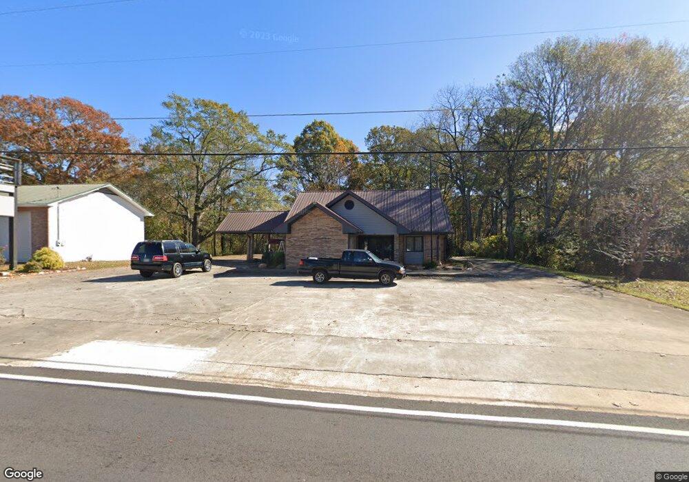
This home is located at 138 Atlantic Ave, Waco, GA 30182 and is currently estimated at $217,063, approximately $130 per square foot. 138 Atlantic Ave is a home located in Haralson County with nearby schools including Haralson County High School.
Ownership History
Date
Name
Owned For
Owner Type
Purchase Details
Closed on
Jan 1, 2023
Sold by
Kilgore Elijah Dale
Bought by
Thompson Aaron Ray
Current Estimated Value
Purchase Details
Closed on
Mar 8, 2018
Sold by
Britt Angela Mechelle
Bought by
Kilgore Elijah Dale
Purchase Details
Closed on
Sep 9, 2016
Sold by
James M
Bought by
Britt Angela Mechelle
Home Financials for this Owner
Home Financials are based on the most recent Mortgage that was taken out on this home.
Original Mortgage
$65,000
Interest Rate
3.45%
Mortgage Type
New Conventional
Purchase Details
Closed on
May 2, 2007
Sold by
First National Bank Of Geo
Bought by
Stephenson James M
Home Financials for this Owner
Home Financials are based on the most recent Mortgage that was taken out on this home.
Original Mortgage
$170,843
Interest Rate
6.12%
Mortgage Type
New Conventional
Purchase Details
Closed on
Jun 12, 1992
Bought by
First National Bank Of Haralson County
Create a Home Valuation Report for This Property
The Home Valuation Report is an in-depth analysis detailing your home's value as well as a comparison with similar homes in the area
Home Values in the Area
Average Home Value in this Area
Purchase History
| Date | Buyer | Sale Price | Title Company |
|---|---|---|---|
| Thompson Aaron Ray | $88,000 | -- | |
| Kilgore Elijah Dale | $88,000 | -- | |
| Britt Angela Mechelle | $75,000 | -- | |
| Stephenson James M | $170,000 | -- | |
| First National Bank Of Haralson County | -- | -- |
Source: Public Records
Mortgage History
| Date | Status | Borrower | Loan Amount |
|---|---|---|---|
| Previous Owner | Britt Angela Mechelle | $65,000 | |
| Previous Owner | Stephenson James M | $170,843 |
Source: Public Records
Tax History Compared to Growth
Tax History
| Year | Tax Paid | Tax Assessment Tax Assessment Total Assessment is a certain percentage of the fair market value that is determined by local assessors to be the total taxable value of land and additions on the property. | Land | Improvement |
|---|---|---|---|---|
| 2024 | $2,209 | $70,994 | $5,088 | $65,906 |
| 2023 | $1,788 | $80,262 | $4,800 | $75,462 |
| 2022 | $1,784 | $62,881 | $4,800 | $58,081 |
| 2021 | $1,674 | $56,508 | $4,800 | $51,708 |
| 2020 | $1,720 | $57,964 | $4,800 | $53,164 |
| 2019 | $1,052 | $54,800 | $4,800 | $50,000 |
| 2018 | $1,746 | $54,180 | $4,800 | $49,380 |
| 2017 | $1,600 | $47,526 | $4,800 | $42,726 |
| 2016 | $1,188 | $38,786 | $4,800 | $33,986 |
| 2015 | $1,190 | $38,802 | $4,800 | $34,003 |
| 2014 | $2,434 | $80,658 | $8,000 | $72,658 |
Source: Public Records
Map
Nearby Homes
- 163 Atlantic Ave
- 145 Wall St
- 67 Depot St
- 381 King St
- 586 Old Bushmill Rd
- 0 Stonebridge Blvd Unit 143588
- 0 Mt Zion St Unit 7399245
- 707 Mill Stone Way
- 101 Bush Creek Way
- 180 Five Notch Dr
- 273 Sewell Rd
- 6315 Highway 78
- 327 Crest Pointe S
- 321 Stonebridge Blvd
- 319 Stonebridge Blvd
- 522 Atlantic Ave
- 0 Nitra Rd Unit 9546245
- 305 Crest Pointe S
- 153 Crest Pointe
- 330 Kensington Cir
- 150 Atlantic Ave
- 158 Atlantic Ave
- 135 Atlantic Ave
- 121 Atlantic Ave
- 164 Atlantic Ave
- 149 Atlantic Ave
- 176 Atlantic Ave
- 31 McBurnett St
- 167 Carrollton St
- 188 Atlantic Ave
- 158 Wall St
- 158 Wall St
- 148 Carrollton St
- 198 Atlantic Ave
- 35 McBurnett St
- 164 Carrollton St
- 189 Carrollton St
- 71 Atlantic Ave
- 79 Atlantic Ave
- 14 Bowdon St