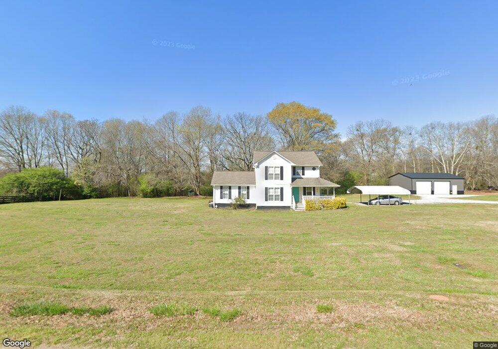
138 Carlan Rd Commerce, GA 30530
Estimated Value: $381,576 - $446,000
4
Beds
4
Baths
2,046
Sq Ft
$199/Sq Ft
Est. Value
About This Home
This home is located at 138 Carlan Rd, Commerce, GA 30530 and is currently estimated at $407,144, approximately $198 per square foot. 138 Carlan Rd is a home located in Banks County with nearby schools including Banks County Primary School, Banks County Elementary School, and Banks County Middle School.
Ownership History
Date
Name
Owned For
Owner Type
Purchase Details
Closed on
Oct 30, 2009
Sold by
Smallwood Glenda Dale
Bought by
Ledford Devon C
Current Estimated Value
Home Financials for this Owner
Home Financials are based on the most recent Mortgage that was taken out on this home.
Original Mortgage
$140,213
Outstanding Balance
$90,480
Interest Rate
4.93%
Mortgage Type
FHA
Estimated Equity
$316,664
Create a Home Valuation Report for This Property
The Home Valuation Report is an in-depth analysis detailing your home's value as well as a comparison with similar homes in the area
Home Values in the Area
Average Home Value in this Area
Purchase History
| Date | Buyer | Sale Price | Title Company |
|---|---|---|---|
| Ledford Devon C | $142,800 | -- |
Source: Public Records
Mortgage History
| Date | Status | Borrower | Loan Amount |
|---|---|---|---|
| Open | Ledford Devon C | $140,213 |
Source: Public Records
Tax History Compared to Growth
Tax History
| Year | Tax Paid | Tax Assessment Tax Assessment Total Assessment is a certain percentage of the fair market value that is determined by local assessors to be the total taxable value of land and additions on the property. | Land | Improvement |
|---|---|---|---|---|
| 2025 | $2,425 | $127,003 | $19,092 | $107,911 |
| 2024 | $2,425 | $119,761 | $17,357 | $102,404 |
| 2023 | $2,360 | $102,634 | $14,676 | $87,958 |
| 2022 | $1,862 | $88,605 | $13,238 | $75,367 |
| 2021 | $1,744 | $78,080 | $9,611 | $68,469 |
| 2020 | $1,306 | $56,950 | $7,848 | $49,102 |
| 2019 | $1,312 | $56,950 | $7,848 | $49,102 |
| 2018 | $1,298 | $55,401 | $6,261 | $49,140 |
| 2017 | $1,335 | $54,622 | $5,444 | $49,178 |
| 2016 | $1,373 | $54,622 | $5,444 | $49,178 |
| 2015 | $1,364 | $53,368 | $5,444 | $47,924 |
| 2014 | $1,364 | $57,816 | $9,892 | $47,924 |
| 2013 | -- | $57,816 | $9,892 | $47,924 |
Source: Public Records
Map
Nearby Homes
- 0 Highway 59 Unit 10257590
- 0 Highway 59 Unit 10257605
- 161 Meadow Lake Dr
- 139 Meadow Lake Dr
- 731 Borders Rd
- 2100 Westbrook Rd
- 1065 Hebron Rd
- 0 Varner Rd
- 823 Highway 63
- 1111 Georgia 63
- 333 Sims Bridge Rd
- 2090 Southern Seed Way
- 0 Freedom Ln Unit 9B
- 0 Freedom Ln Unit 18C 10380663
- 0 Freedom Ln Unit 9D
- 0 Freedom Ln Unit 9C
- 0 Freedom Ln Unit 18B 10379747
- 0 Freedom Ln Unit 9E
- 166 Freedom Ln
- 0 Bennett Rd Unit 23200799
- 197 Carlan Rd
- 118 Carlan Rd
- 243 Carlan Rd
- 0 Carlan Rd Tract 4
- 0 Carlan Rd Tract 3
- 0 Carlan Rd Tract 2
- 3271 Highway 59
- 3482 Georgia 59
- 3482 Highway 59
- 3191 Highway 59
- 3131 Ga Hwy 59
- 3481 Highway 59
- 572 Carlan Rd
- 3189 Highway 59
- 560 Carlan Rd
- 3658 Highway 59
- 3658 Highway 59
- 3669 Highway 59
- 0 Wrights Mill Rd Unit 939498
- 0 Wrights Mill Rd Unit 976825