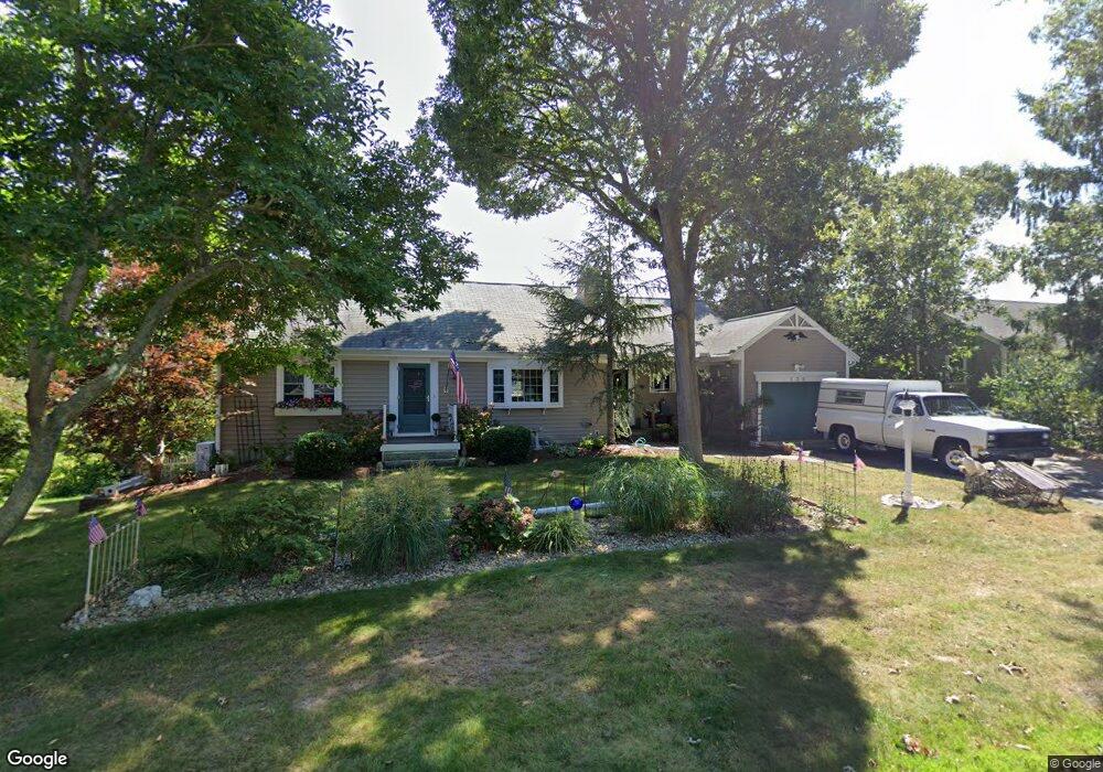
138 Eileen St Yarmouth Port, MA 02675
Yarmouth Port NeighborhoodEstimated Value: $600,000 - $703,000
3
Beds
2
Baths
1,201
Sq Ft
$522/Sq Ft
Est. Value
About This Home
This home is located at 138 Eileen St, Yarmouth Port, MA 02675 and is currently estimated at $626,347, approximately $521 per square foot. 138 Eileen St is a home located in Barnstable County with nearby schools including Dennis-Yarmouth Regional High School, St. Pius X. School, and Trinity Christian Academy of Cape Cod.
Ownership History
Date
Name
Owned For
Owner Type
Purchase Details
Closed on
Apr 15, 2005
Sold by
Miller Edward R
Bought by
Beriau Maureen A and Beriau William F
Current Estimated Value
Home Financials for this Owner
Home Financials are based on the most recent Mortgage that was taken out on this home.
Original Mortgage
$200,000
Interest Rate
5.78%
Mortgage Type
Purchase Money Mortgage
Purchase Details
Closed on
May 13, 1997
Sold by
Est Yankun Anne R and Nichols Jeffreys R
Bought by
Miller Edward R
Home Financials for this Owner
Home Financials are based on the most recent Mortgage that was taken out on this home.
Original Mortgage
$107,100
Interest Rate
7.88%
Mortgage Type
Purchase Money Mortgage
Create a Home Valuation Report for This Property
The Home Valuation Report is an in-depth analysis detailing your home's value as well as a comparison with similar homes in the area
Home Values in the Area
Average Home Value in this Area
Purchase History
| Date | Buyer | Sale Price | Title Company |
|---|---|---|---|
| Beriau Maureen A | $305,000 | -- | |
| Miller Edward R | $119,900 | -- |
Source: Public Records
Mortgage History
| Date | Status | Borrower | Loan Amount |
|---|---|---|---|
| Open | Miller Edward R | $225,000 | |
| Closed | Beriau Maureen A | $200,000 | |
| Previous Owner | Miller Edward R | $31,200 | |
| Previous Owner | Miller Edward R | $121,600 | |
| Previous Owner | Miller Edward R | $107,100 |
Source: Public Records
Tax History Compared to Growth
Tax History
| Year | Tax Paid | Tax Assessment Tax Assessment Total Assessment is a certain percentage of the fair market value that is determined by local assessors to be the total taxable value of land and additions on the property. | Land | Improvement |
|---|---|---|---|---|
| 2025 | $3,675 | $519,100 | $151,200 | $367,900 |
| 2024 | $3,742 | $507,100 | $131,500 | $375,600 |
| 2023 | $3,753 | $462,800 | $119,500 | $343,300 |
| 2022 | $3,434 | $374,100 | $114,000 | $260,100 |
| 2021 | $3,370 | $352,500 | $114,000 | $238,500 |
| 2020 | $3,308 | $330,800 | $120,600 | $210,200 |
| 2019 | $3,711 | $305,900 | $120,600 | $185,300 |
| 2018 | $2,941 | $285,800 | $100,500 | $185,300 |
| 2017 | $2,864 | $285,800 | $100,500 | $185,300 |
| 2016 | $2,772 | $277,800 | $92,500 | $185,300 |
| 2015 | $2,630 | $262,000 | $88,400 | $173,600 |
Source: Public Records
Map
Nearby Homes
- 21 Boxwood Cir
- 800 Route 6a
- 800 Route 6a
- 25 Oak Glen
- 25 Oak Glen Village Unit 25
- 28 Oak Glen
- 4208 Heatherwood
- 14 Many Oaks Cir
- 2 Pine Grove
- 8 Rowley Ln
- 17 Kates Path Unit A
- 20 Trophy Ln
- 68 Seminole Dr
- 228 Kates Path
- 64 Kates Path
- 55 W West Woods Cir
- 18 Crab Creek Ln
- 55 W Woods
- 158 Kates Path
- 30 W Woods Cir Unit 30