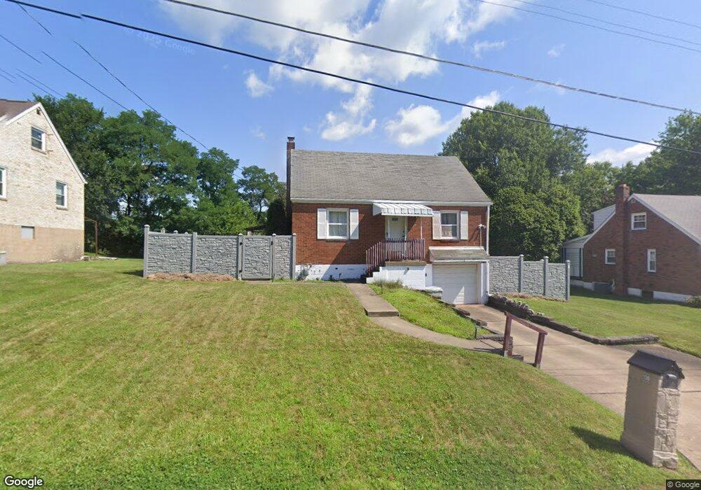
138 Lily Dr Glenshaw, PA 15116
Shaler Township NeighborhoodEstimated Value: $221,000 - $296,000
3
Beds
1
Bath
1,425
Sq Ft
$190/Sq Ft
Est. Value
About This Home
This home is located at 138 Lily Dr, Glenshaw, PA 15116 and is currently estimated at $270,388, approximately $189 per square foot. 138 Lily Dr is a home located in Allegheny County with nearby schools including Shaler Area Elementary School, Scott Primary School, and Shaler Area Middle School.
Ownership History
Date
Name
Owned For
Owner Type
Purchase Details
Closed on
Jul 30, 2007
Sold by
Knauer Bernard S
Bought by
Smith Stephen G
Current Estimated Value
Home Financials for this Owner
Home Financials are based on the most recent Mortgage that was taken out on this home.
Original Mortgage
$140,887
Outstanding Balance
$89,521
Interest Rate
6.73%
Mortgage Type
FHA
Estimated Equity
$180,867
Create a Home Valuation Report for This Property
The Home Valuation Report is an in-depth analysis detailing your home's value as well as a comparison with similar homes in the area
Home Values in the Area
Average Home Value in this Area
Purchase History
| Date | Buyer | Sale Price | Title Company |
|---|---|---|---|
| Smith Stephen G | $142,000 | -- |
Source: Public Records
Mortgage History
| Date | Status | Borrower | Loan Amount |
|---|---|---|---|
| Open | Smith Stephen G | $140,887 |
Source: Public Records
Tax History Compared to Growth
Tax History
| Year | Tax Paid | Tax Assessment Tax Assessment Total Assessment is a certain percentage of the fair market value that is determined by local assessors to be the total taxable value of land and additions on the property. | Land | Improvement |
|---|---|---|---|---|
| 2025 | $3,230 | $98,100 | $41,500 | $56,600 |
| 2024 | $3,230 | $98,100 | $41,500 | $56,600 |
| 2023 | $3,115 | $98,100 | $41,500 | $56,600 |
| 2022 | $3,115 | $98,100 | $41,500 | $56,600 |
| 2021 | $464 | $98,100 | $41,500 | $56,600 |
| 2020 | $3,115 | $98,100 | $41,500 | $56,600 |
| 2019 | $3,017 | $98,100 | $41,500 | $56,600 |
| 2018 | $464 | $98,100 | $41,500 | $56,600 |
| 2017 | $2,921 | $98,100 | $41,500 | $56,600 |
| 2016 | $464 | $98,100 | $41,500 | $56,600 |
| 2015 | $464 | $98,100 | $41,500 | $56,600 |
| 2014 | $2,802 | $98,100 | $41,500 | $56,600 |
Source: Public Records
Map
Nearby Homes
- 222 Elfinwild Ln
- 217 Belladonna Dr
- 110 Marian Ave
- 2215 Linwood Dr
- 2425 Hampton Ave
- 2915 Albine Dr
- 3305 Laurel Dr
- 122 Church Ave
- 611 W Sutter Rd
- 2118 Coventry Dr
- 3893 Ashland Ct
- 107 Albine Dr
- 3943 Bonita Dr
- 301 Coachman Rd
- 8008 Lingay Dr
- 2603 Sherwood Rd
- 2605 Mount Royal Blvd
- 106 Kings Point Rd
- 3950-3952 Mount Royal Blvd
- 2609 Autumnwood Dr