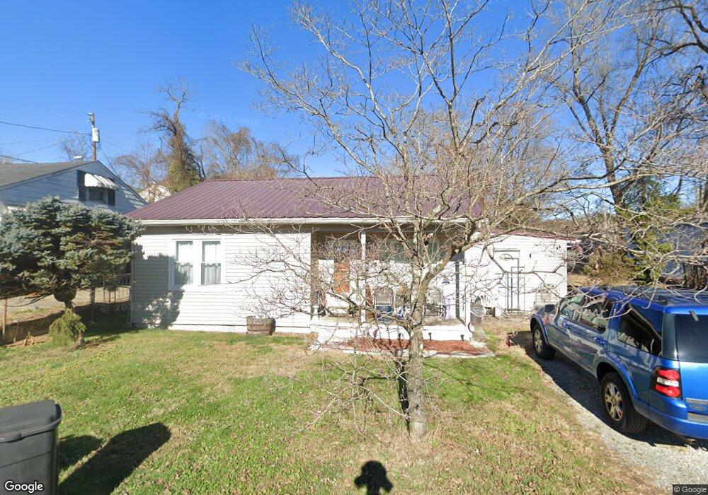
138 Locust St Coal Grove, OH 45638
Estimated Value: $96,000 - $132,000
2
Beds
1
Bath
1,030
Sq Ft
$108/Sq Ft
Est. Value
About This Home
This home is located at 138 Locust St, Coal Grove, OH 45638 and is currently estimated at $111,087, approximately $107 per square foot. 138 Locust St is a home located in Lawrence County with nearby schools including Dawson-Bryant Elementary School, Dawson-Bryant Middle School, and Dawson-Bryant High School.
Ownership History
Date
Name
Owned For
Owner Type
Purchase Details
Closed on
Mar 14, 2003
Sold by
Collins Ermil R and Collins Jan
Bought by
Collins Janice E
Current Estimated Value
Purchase Details
Closed on
May 25, 1999
Sold by
Remines Janice
Bought by
Collins Ermil R and Collins Jan
Purchase Details
Closed on
Jul 27, 1987
Sold by
Watson Garland and An Mary
Bought by
Remines Janice
Create a Home Valuation Report for This Property
The Home Valuation Report is an in-depth analysis detailing your home's value as well as a comparison with similar homes in the area
Home Values in the Area
Average Home Value in this Area
Purchase History
| Date | Buyer | Sale Price | Title Company |
|---|---|---|---|
| Collins Janice E | -- | -- | |
| Collins Ermil R | -- | -- | |
| Remines Janice | $20,000 | -- |
Source: Public Records
Tax History Compared to Growth
Tax History
| Year | Tax Paid | Tax Assessment Tax Assessment Total Assessment is a certain percentage of the fair market value that is determined by local assessors to be the total taxable value of land and additions on the property. | Land | Improvement |
|---|---|---|---|---|
| 2024 | -- | $19,970 | $4,840 | $15,130 |
| 2023 | $377 | $19,970 | $4,840 | $15,130 |
| 2022 | $387 | $19,970 | $4,840 | $15,130 |
| 2021 | $211 | $15,840 | $3,960 | $11,880 |
| 2020 | $273 | $15,840 | $3,960 | $11,880 |
| 2019 | $272 | $15,840 | $3,960 | $11,880 |
| 2018 | $231 | $14,390 | $3,590 | $10,800 |
| 2017 | $231 | $14,390 | $3,590 | $10,800 |
| 2016 | $215 | $14,390 | $3,590 | $10,800 |
| 2015 | $156 | $12,000 | $3,590 | $8,410 |
| 2014 | $148 | $12,000 | $3,590 | $8,410 |
| 2013 | $148 | $12,000 | $3,590 | $8,410 |
Source: Public Records
Map
Nearby Homes
- 125 Center St
- 514 Lane St
- 519 Lane St
- 805 1/2 High St
- 204 Dutey Dr
- 135 Lane St
- 309 High St
- 309 High St Unit LAO-5
- 119 Remy St
- 103 Carrico Dr
- 3107 S 4th St
- 342 Township Road 296
- 156 Township Road 181
- 2088 State Route 243
- 317 Ashtabula St
- 2721 S 8th St
- 2726 S 9th St
- 0 Central & Mlk
- 321 Wyanoke St
- 2626 S 11th St