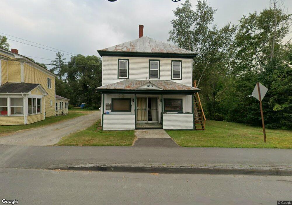
138 Main St Eustis, ME 04936
Estimated Value: $246,000 - $362,000
5
Beds
3
Baths
1,038
Sq Ft
$288/Sq Ft
Est. Value
About This Home
This home is located at 138 Main St, Eustis, ME 04936 and is currently estimated at $298,735, approximately $287 per square foot. 138 Main St is a home with nearby schools including Stratton Elementary School.
Ownership History
Date
Name
Owned For
Owner Type
Purchase Details
Closed on
Apr 22, 2025
Sold by
Truskowski Kimberly A
Bought by
Earley Thomas
Current Estimated Value
Purchase Details
Closed on
May 16, 2005
Sold by
Vannah Lincoln W and Hergenrother Jeanne A
Bought by
Truskowski Kimberly A
Home Financials for this Owner
Home Financials are based on the most recent Mortgage that was taken out on this home.
Original Mortgage
$58,125
Interest Rate
6.05%
Mortgage Type
Purchase Money Mortgage
Create a Home Valuation Report for This Property
The Home Valuation Report is an in-depth analysis detailing your home's value as well as a comparison with similar homes in the area
Purchase History
| Date | Buyer | Sale Price | Title Company |
|---|---|---|---|
| Earley Thomas | $250,000 | Red Door Title | |
| Earley Thomas | $250,000 | Red Door Title | |
| Truskowski Kimberly A | -- | -- | |
| Truskowski Kimberly A | -- | -- | |
| Truskowski Kimberly A | -- | -- |
Source: Public Records
Mortgage History
| Date | Status | Borrower | Loan Amount |
|---|---|---|---|
| Previous Owner | Truskowski Kimberly A | $58,125 |
Source: Public Records
Tax History
| Year | Tax Paid | Tax Assessment Tax Assessment Total Assessment is a certain percentage of the fair market value that is determined by local assessors to be the total taxable value of land and additions on the property. | Land | Improvement |
|---|---|---|---|---|
| 2024 | $1,890 | $216,000 | $37,400 | $178,600 |
| 2023 | $1,935 | $216,200 | $37,400 | $178,800 |
| 2022 | $2,372 | $249,700 | $37,400 | $212,300 |
| 2021 | $1,211 | $93,900 | $29,500 | $64,400 |
| 2020 | $1,174 | $93,900 | $29,500 | $64,400 |
| 2019 | $1,136 | $93,900 | $29,500 | $64,400 |
| 2018 | $1,231 | $94,000 | $29,500 | $64,500 |
| 2017 | $1,222 | $94,000 | $29,500 | $64,500 |
| 2016 | $1,200 | $94,000 | $29,500 | $64,500 |
| 2015 | $1,241 | $94,000 | $29,500 | $64,500 |
| 2014 | $1,035 | $94,100 | $29,500 | $64,600 |
| 2009 | -- | $97,600 | $31,500 | $66,100 |
Source: Public Records
Map
Nearby Homes
- 186 Main St
- 9 Tranquility Ln
- 14 Dam Rd
- 12 Bog Rd
- 11 Porcupine Trail
- 27 Peabody Rd
- 27 Reed Rd
- 81 B Red Pine Ln
- 6-01 Eustis Ridge Rd
- 60&66 Gravel Pit Rd
- 484 Eustis Ridge Rd
- 64 Ip Rd
- 233 Porter Nadeau Rd
- 95-4 Lot D Porter Nadeau Rd
- 54 Eustis Village Rd
- 59 Eustis Village Rd
- 118 Glidden Rd
- 1480 Arnold Trail
- 42 Rabbit Hollow Rd
- 4004 Bigelow Station
Your Personal Tour Guide
Ask me questions while you tour the home.