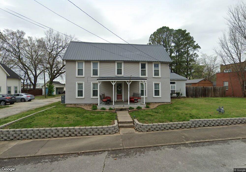
138 N Neal St Prairie Grove, AR 72753
Estimated Value: $389,240 - $446,000
3
Beds
3
Baths
2,764
Sq Ft
$152/Sq Ft
Est. Value
About This Home
This home is located at 138 N Neal St, Prairie Grove, AR 72753 and is currently estimated at $420,560, approximately $152 per square foot. 138 N Neal St is a home located in Washington County with nearby schools including Prairie Grove Elementary School, Prairie Grove Middle School, and Prairie Grove Junior High School.
Ownership History
Date
Name
Owned For
Owner Type
Purchase Details
Closed on
May 23, 2016
Sold by
Hemsley Robert W and Hemsley Sharon L
Bought by
Hemsley Robert W and Hemsley Sharon L
Current Estimated Value
Purchase Details
Closed on
Oct 4, 1991
Bought by
Hemsley Robert W
Purchase Details
Closed on
May 19, 1978
Bought by
Beaver Beal L and Beaver Margrette L
Purchase Details
Closed on
Feb 15, 1975
Bought by
Lehn David Guy and Frances Kathryn
Purchase Details
Closed on
Jan 31, 1946
Bought by
Marrs Agnes La Dona
Purchase Details
Closed on
Oct 19, 1904
Bought by
Marrs J T
Create a Home Valuation Report for This Property
The Home Valuation Report is an in-depth analysis detailing your home's value as well as a comparison with similar homes in the area
Home Values in the Area
Average Home Value in this Area
Purchase History
| Date | Buyer | Sale Price | Title Company |
|---|---|---|---|
| Hemsley Robert W | -- | None Available | |
| Hemsley Robert W | $16,000 | -- | |
| Beaver Beal L | -- | -- | |
| Lehn David Guy | -- | -- | |
| Marrs Agnes La Dona | -- | -- | |
| Marrs J T | -- | -- |
Source: Public Records
Tax History Compared to Growth
Tax History
| Year | Tax Paid | Tax Assessment Tax Assessment Total Assessment is a certain percentage of the fair market value that is determined by local assessors to be the total taxable value of land and additions on the property. | Land | Improvement |
|---|---|---|---|---|
| 2025 | $848 | $61,820 | $11,900 | $49,920 |
| 2024 | $971 | $61,820 | $11,900 | $49,920 |
| 2023 | $1,102 | $61,820 | $11,900 | $49,920 |
| 2022 | $1,152 | $43,170 | $4,900 | $38,270 |
| 2021 | $1,152 | $43,170 | $4,900 | $38,270 |
| 2020 | $1,146 | $43,170 | $4,900 | $38,270 |
| 2019 | $1,163 | $28,280 | $4,000 | $24,280 |
| 2018 | $1,188 | $28,280 | $4,000 | $24,280 |
| 2017 | $1,174 | $28,280 | $4,000 | $24,280 |
| 2016 | $1,174 | $28,280 | $4,000 | $24,280 |
| 2015 | $1,174 | $28,280 | $4,000 | $24,280 |
| 2014 | $1,261 | $29,880 | $4,000 | $25,880 |
Source: Public Records
Map
Nearby Homes
- 208 N Neal St
- 4.66 +/- AC Tract 5 Hwy 62 & S Mock St
- TBD Kate Smith St
- 106 S Ozark St
- 204 Armstrong St
- 107 S Ozark St
- Lot 2 Holmes St
- 606 1/2 E Buchanan St
- 303 E Center St
- 901 E Buchanan St
- 881 E Buchanan St
- 201 E Douglas St
- 0 Douglas St Unit 1293623
- 304 S Summit St
- 224 Stapleton Dr
- 308 S Summit St
- 680 Marcella St
- 710 Marcella St
- 711 Marcella St
- 211 Boston St
- 16991 Kinion Lake Rd
- 3550 E Heritage Pkwy
- 0 Kinion Lake Rd
- 146 N Neal St
- 141 N Neal St
- 139 N Neal St
- 136 N Neal St
- 203 E Parks St
- 131 N Neal St
- 145 N Neal St
- 211 E Parks St Unit A
- 211 E Parks St Unit A & B
- 00 S Neal St
- 109 W Parks St
- 109 E Parks St
- 149 N Neal St
- 107 E Parks St
- 200 E Parks St
- 140 E Buchanan St
- 210 E Parks St