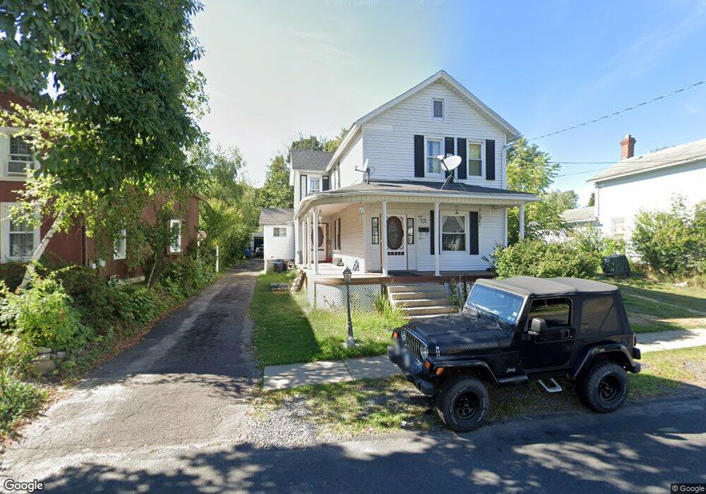
138 S Merrifield Ave Unit L18 Scranton, PA 18504
Keyser Valley NeighborhoodEstimated Value: $128,000 - $204,448
3
Beds
2
Baths
1,793
Sq Ft
$96/Sq Ft
Est. Value
About This Home
This home is located at 138 S Merrifield Ave Unit L18, Scranton, PA 18504 and is currently estimated at $171,362, approximately $95 per square foot. 138 S Merrifield Ave Unit L18 is a home located in Lackawanna County with nearby schools including Isaac Tripp Elementary School, West Scranton Intrmd School, and West Scranton High School.
Ownership History
Date
Name
Owned For
Owner Type
Purchase Details
Closed on
Jun 9, 2023
Sold by
Strein Frederick C and Strein Judith
Bought by
Strein Justin
Current Estimated Value
Home Financials for this Owner
Home Financials are based on the most recent Mortgage that was taken out on this home.
Original Mortgage
$149,600
Outstanding Balance
$145,600
Interest Rate
6.39%
Mortgage Type
New Conventional
Estimated Equity
$25,762
Create a Home Valuation Report for This Property
The Home Valuation Report is an in-depth analysis detailing your home's value as well as a comparison with similar homes in the area
Home Values in the Area
Average Home Value in this Area
Purchase History
| Date | Buyer | Sale Price | Title Company |
|---|---|---|---|
| Strein Justin | $187,000 | None Listed On Document |
Source: Public Records
Mortgage History
| Date | Status | Borrower | Loan Amount |
|---|---|---|---|
| Open | Strein Justin | $149,600 |
Source: Public Records
Tax History Compared to Growth
Tax History
| Year | Tax Paid | Tax Assessment Tax Assessment Total Assessment is a certain percentage of the fair market value that is determined by local assessors to be the total taxable value of land and additions on the property. | Land | Improvement |
|---|---|---|---|---|
| 2025 | $2,318 | $7,000 | $1,450 | $5,550 |
| 2024 | $2,123 | $7,000 | $1,450 | $5,550 |
| 2023 | $2,123 | $7,000 | $1,450 | $5,550 |
| 2022 | $2,076 | $7,000 | $1,450 | $5,550 |
| 2021 | $2,076 | $7,000 | $1,450 | $5,550 |
| 2020 | $2,039 | $7,000 | $1,450 | $5,550 |
| 2019 | $1,919 | $7,000 | $1,450 | $5,550 |
| 2018 | $1,919 | $7,000 | $1,450 | $5,550 |
| 2017 | $1,886 | $7,000 | $1,450 | $5,550 |
| 2016 | $618 | $7,000 | $1,450 | $5,550 |
| 2015 | $1,099 | $7,000 | $1,450 | $5,550 |
| 2014 | -- | $7,000 | $1,450 | $5,550 |
Source: Public Records
Map
Nearby Homes
- 138 S Keyser Ave
- 2613 Jackson St
- 2133 35 Jackson St
- 2127 Price St
- 310 Dale Ave
- 142 S Van Buren Ave
- 444 N Cameron Ave
- 133 S Van Buren Ave
- 2749 Jackson St
- 0 Marginal Rd Unit GSBSC253025
- 120 N Van Buren Ave
- 2503 2505 Swetland St Unit L 2
- 1924 Luzerne St
- 1919 Price St
- 138-140 S Everett Ave
- 0 Crisp Ave and Division St Unit 22-3646
- 0 Way
- 1819 Luzerne St
- 1809 Washburn St
- 1809 Academy St
- 142 S Merrifield Ave
- 134 S Merrifield Ave
- 144 S Merrifield Ave
- 2416 Washburn St
- 139 S Merrifield Ave
- 137 S Cameron Ave
- 143 S Merrifield Ave
- 141 S Cameron Ave
- 135 S Cameron Ave
- 133 S Cameron Ave
- 145 S Merrifield Ave
- 124 S Merrifield Ave
- 129-131 S Cameron Ave
- 2401 Washburn St
- 129 S Cameron Ave Unit 131
- 145 S Cameron Ave
- 147 S Merrifield Ave
- 149 S Merrifield Ave
- 120 S Merrifield Ave
- 127 S Merrifield Ave