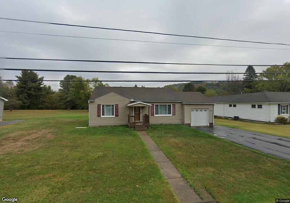
138 Shawmut Rd Brockport, PA 15823
Estimated Value: $95,000 - $174,000
2
Beds
1
Bath
--
Sq Ft
0.26
Acres
About This Home
This home is located at 138 Shawmut Rd, Brockport, PA 15823 and is currently estimated at $129,939. 138 Shawmut Rd is a home located in Elk County with nearby schools including Brockway Area Elementary School, Brockway Area Junior/Senior High School, and Hillside School.
Ownership History
Date
Name
Owned For
Owner Type
Purchase Details
Closed on
Feb 21, 2006
Sold by
Carlini George M and Carlini Joan L
Bought by
Nesbitt Michael C and Shefcyk Michelle
Current Estimated Value
Home Financials for this Owner
Home Financials are based on the most recent Mortgage that was taken out on this home.
Original Mortgage
$40,560
Outstanding Balance
$22,766
Interest Rate
6.15%
Mortgage Type
New Conventional
Estimated Equity
$107,173
Create a Home Valuation Report for This Property
The Home Valuation Report is an in-depth analysis detailing your home's value as well as a comparison with similar homes in the area
Home Values in the Area
Average Home Value in this Area
Purchase History
| Date | Buyer | Sale Price | Title Company |
|---|---|---|---|
| Nesbitt Michael C | -- | None Available |
Source: Public Records
Mortgage History
| Date | Status | Borrower | Loan Amount |
|---|---|---|---|
| Open | Nesbitt Michael C | $40,560 |
Source: Public Records
Tax History Compared to Growth
Tax History
| Year | Tax Paid | Tax Assessment Tax Assessment Total Assessment is a certain percentage of the fair market value that is determined by local assessors to be the total taxable value of land and additions on the property. | Land | Improvement |
|---|---|---|---|---|
| 2025 | $920 | $17,950 | $650 | $17,300 |
| 2024 | $920 | $17,950 | $650 | $17,300 |
| 2023 | $889 | $17,950 | $650 | $17,300 |
| 2022 | $883 | $17,950 | $650 | $17,300 |
| 2021 | $867 | $17,950 | $650 | $17,300 |
| 2020 | $867 | $17,950 | $650 | $17,300 |
| 2019 | $836 | $17,950 | $650 | $17,300 |
| 2018 | $813 | $17,950 | $650 | $17,300 |
| 2017 | $789 | $17,950 | $650 | $17,300 |
| 2016 | $688 | $17,950 | $650 | $17,300 |
| 2015 | -- | $17,950 | $650 | $17,300 |
| 2013 | -- | $17,950 | $650 | $17,300 |
Source: Public Records
Map
Nearby Homes
- 101 Howard Rd
- 425 Zuccolotto Ln
- 47 Caruso Rd
- 3323 Mount Daniels Rd
- 1083 Rattlesnake Rd
- 924 Elm St
- 1549 Main St
- 3585 Shawmut Rd
- 970 Baghdad Rd
- 0 U S 219
- 1074 10th Ave
- 7956 U S 219
- 266 South St
- 0 Cap Haitien Rd Unit SEC 17 LOT 14
- 601 Sandbank Rd
- 598 Sandbank Rd
- 537 Lynyard Ln Bonefish Rd
- Section 19 Lot 181 Dolphin Head Rd
- 181 Dolphin Head Rd
- 129 Dolphin Head Rd