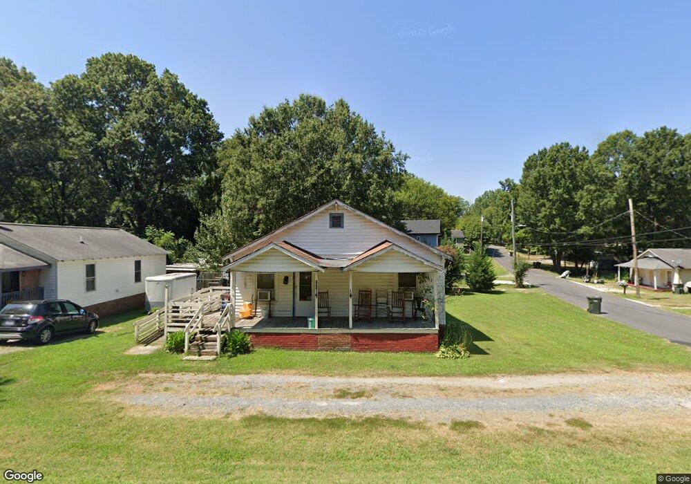
138 White St SW Concord, NC 28027
Estimated Value: $155,627 - $313,000
2
Beds
1
Bath
1,289
Sq Ft
$172/Sq Ft
Est. Value
About This Home
This home is located at 138 White St SW, Concord, NC 28027 and is currently estimated at $221,657, approximately $171 per square foot. 138 White St SW is a home located in Cabarrus County with nearby schools including Wolf Meadow Elementary School, Roberta Road Middle School, and The Daniel Academy of Concord.
Ownership History
Date
Name
Owned For
Owner Type
Purchase Details
Closed on
Nov 13, 2012
Sold by
Tyson Frank and Tyson Janet
Bought by
Barrier Connie
Current Estimated Value
Purchase Details
Closed on
Aug 27, 2012
Sold by
Branch Banking And Trust Co
Bought by
Tyson Frank
Purchase Details
Closed on
Aug 22, 2012
Sold by
Branch Banking And Trust Co
Bought by
Tyson Frank
Purchase Details
Closed on
Apr 26, 2012
Sold by
Cook Bryan Douglas
Bought by
Branch Banking & Trust Company
Purchase Details
Closed on
Apr 5, 2005
Sold by
Cook Bryan D
Bought by
Cook Bryan D
Create a Home Valuation Report for This Property
The Home Valuation Report is an in-depth analysis detailing your home's value as well as a comparison with similar homes in the area
Home Values in the Area
Average Home Value in this Area
Purchase History
| Date | Buyer | Sale Price | Title Company |
|---|---|---|---|
| Barrier Connie | -- | None Available | |
| Tyson Frank | $23,000 | Bridgetrust Title Group | |
| Tyson Frank | $23,000 | Bridgetrust Title Group | |
| Branch Banking & Trust Company | $25,545 | None Available | |
| Cook Bryan D | -- | -- |
Source: Public Records
Tax History
| Year | Tax Paid | Tax Assessment Tax Assessment Total Assessment is a certain percentage of the fair market value that is determined by local assessors to be the total taxable value of land and additions on the property. | Land | Improvement |
|---|---|---|---|---|
| 2025 | $1,197 | $120,130 | $48,000 | $72,130 |
| 2024 | $1,197 | $120,130 | $48,000 | $72,130 |
| 2023 | $695 | $56,970 | $15,000 | $41,970 |
| 2022 | $695 | $56,970 | $15,000 | $41,970 |
| 2021 | $695 | $56,970 | $15,000 | $41,970 |
| 2020 | $695 | $56,970 | $15,000 | $41,970 |
| 2019 | $676 | $55,450 | $10,500 | $44,950 |
| 2018 | $665 | $55,450 | $10,500 | $44,950 |
| 2017 | $654 | $55,450 | $10,500 | $44,950 |
| 2016 | $388 | $56,410 | $12,500 | $43,910 |
| 2015 | $666 | $56,410 | $12,500 | $43,910 |
| 2014 | $666 | $56,410 | $12,500 | $43,910 |
Source: Public Records
Map
Nearby Homes
- 142 Swink St SW
- 12 Bost Ave SW
- 146 Swink St SW
- 149 Swink St SW
- 704 Old Charlotte Rd SW
- 708 Old Charlotte Rd SW
- 449 Cabarrus Ave W Unit 3
- 1015 Rockland Cir SW
- 41 Fleetwood Dr SW
- 49 2nd St NW
- 368 Office Dr SW
- 64 Robinson Dr SW
- 400 Union Cemetery Rd SW
- 207 Highland Ave SW
- 7 Scott St SW
- 933 Old Charlotte Rd
- 554 Splicewood Dr SW
- 782 Chalice St SW
- 0 Malvern Dr SW
- 10 Gold St SW
- 142 White St SW
- 613 Palmer Ave SW Unit 1
- 144 White St SW
- 126 White St SW
- 148 White St SW
- 135 White St SW
- 140 Raklock Ct
- 201 Brown St SW
- 208 Brown St SW
- 209 Brown St SW
- 199 Brown St SW
- 145 White St SW
- 129 White St SW
- 213 Brown St SW
- 127 White St SW
- 628 Palmer Ave SW
- 116 White St SW
- 116 White St SW
- 630 Sunderland Rd
- 600 Sunderland Rd SW
Your Personal Tour Guide
Ask me questions while you tour the home.