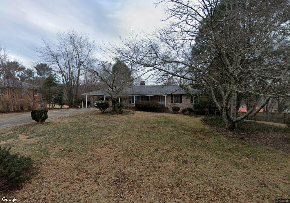
138 Wynnbrook Dr Hendersonville, NC 28792
Estimated Value: $337,611 - $395,000
3
Beds
2
Baths
1,689
Sq Ft
$217/Sq Ft
Est. Value
About This Home
This home is located at 138 Wynnbrook Dr, Hendersonville, NC 28792 and is currently estimated at $367,153, approximately $217 per square foot. 138 Wynnbrook Dr is a home located in Henderson County with nearby schools including Clear Creek Elementary School, Apple Valley Middle School, and North Henderson High School.
Ownership History
Date
Name
Owned For
Owner Type
Purchase Details
Closed on
Feb 16, 2024
Sold by
Lamb Ellen S
Bought by
Ellen S Lamb Revocable Trust and Lamb
Current Estimated Value
Purchase Details
Closed on
Sep 23, 2011
Sold by
Lamb Leon
Bought by
Lamb Ellen Sweeney
Purchase Details
Closed on
Sep 14, 2009
Bought by
Lamb Leon
Purchase Details
Closed on
Sep 11, 2009
Bought by
Lamb Leon
Create a Home Valuation Report for This Property
The Home Valuation Report is an in-depth analysis detailing your home's value as well as a comparison with similar homes in the area
Home Values in the Area
Average Home Value in this Area
Purchase History
| Date | Buyer | Sale Price | Title Company |
|---|---|---|---|
| Ellen S Lamb Revocable Trust | -- | None Listed On Document | |
| Ellen S Lamb Revocable Trust | -- | None Listed On Document | |
| Lamb Ellen Sweeney | -- | -- | |
| Lamb Leon | $60,000 | -- | |
| Lamb Leon | $60,000 | -- |
Source: Public Records
Tax History Compared to Growth
Tax History
| Year | Tax Paid | Tax Assessment Tax Assessment Total Assessment is a certain percentage of the fair market value that is determined by local assessors to be the total taxable value of land and additions on the property. | Land | Improvement |
|---|---|---|---|---|
| 2025 | $1,307 | $239,400 | $60,200 | $179,200 |
| 2024 | $1,307 | $239,400 | $60,200 | $179,200 |
| 2023 | $1,307 | $239,400 | $60,200 | $179,200 |
| 2022 | $1,197 | $175,700 | $48,900 | $126,800 |
| 2021 | $1,197 | $175,700 | $48,900 | $126,800 |
| 2020 | $1,197 | $175,700 | $0 | $0 |
| 2019 | $1,197 | $175,700 | $0 | $0 |
| 2018 | $1,018 | $148,600 | $0 | $0 |
| 2017 | $1,018 | $148,600 | $0 | $0 |
| 2016 | $1,018 | $148,600 | $0 | $0 |
| 2015 | -- | $148,600 | $0 | $0 |
| 2014 | -- | $144,500 | $0 | $0 |
Source: Public Records
Map
Nearby Homes
- 65 Brookside Dr Unit 35
- 1042 Brookside Camp Rd
- 103 Oakwood Place Unit 3
- 103 Oakwood Place Unit 4
- 111 Laura Trace
- 125 Fulton Dr
- 231 Kimberly Ann Dr
- 208 Bragg Ct
- 49 Gosling Cir E
- 324 Whispering Hills Dr
- 701 Salisbury Rd
- 3204 Hickory Hill Rd
- 3119 Hickory Hill Rd
- 2049 Brookside Camp Rd
- 3017 Chestnut Tree Rd
- 21 Fox Run Dr
- 3224 Hickory Hill Rd
- 741 Zelda Ct
- 0 Empress Ln
- LOT 149 Willow Bend Unit 149
- 144 Wynnbrook Dr
- 132 Wynnbrook Dr
- 162 Brookside Dr
- 188 Brookside Dr
- 143 Wynnbrook Dr
- 148 Wynnbrook Dr
- 131 Wynnbrook Dr
- 148 Wynnbrook Dr
- 126 Wynnbrook Dr
- 109 Wynnbrook Dr
- 208 Brookside Dr
- 124 Brookside Dr
- 149 Wynnbrook Dr
- 125 Wynnbrook Dr
- 152 Wynnbrook Dr
- 152 Wynnbrook Dr
- 173 Brookside Dr
- 120 Wynnbrook Dr
- 153 Wynnbrook Dr
- 119 Wynnbrook Dr