Estimated Value: $285,000 - $307,000
3
Beds
3
Baths
1,829
Sq Ft
$162/Sq Ft
Est. Value
About This Home
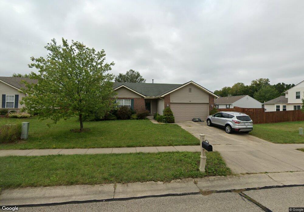
This home is located at 1380 Sterling Commons Blvd, Xenia, OH 45385 and is currently estimated at $296,868, approximately $162 per square foot. 1380 Sterling Commons Blvd is a home located in Greene County with nearby schools including Xenia High School and Summit Academy Community School for Alternative Learners - Xenia.
Ownership History
Date
Name
Owned For
Owner Type
Purchase Details
Closed on
Nov 15, 2017
Sold by
Mcglothen Dustin S and Mcglothen Theresa A
Bought by
Allen Bryan L
Current Estimated Value
Home Financials for this Owner
Home Financials are based on the most recent Mortgage that was taken out on this home.
Original Mortgage
$154,745
Outstanding Balance
$129,772
Interest Rate
3.88%
Mortgage Type
New Conventional
Estimated Equity
$167,096
Purchase Details
Closed on
Nov 9, 2011
Sold by
Mcglothen Dustin S
Bought by
Mcglothen Dustin S and Mcglothen Theresa A
Purchase Details
Closed on
Dec 30, 2003
Sold by
Wolf Robert E and Wolf Ann M
Bought by
Mcglothen Dustin S
Home Financials for this Owner
Home Financials are based on the most recent Mortgage that was taken out on this home.
Original Mortgage
$139,100
Interest Rate
5.84%
Mortgage Type
FHA
Create a Home Valuation Report for This Property
The Home Valuation Report is an in-depth analysis detailing your home's value as well as a comparison with similar homes in the area
Home Values in the Area
Average Home Value in this Area
Purchase History
| Date | Buyer | Sale Price | Title Company |
|---|---|---|---|
| Allen Bryan L | $157,600 | -- | |
| Mcglothen Dustin S | -- | Attorney | |
| Mcglothen Dustin S | $141,300 | Midwest Abstract Company |
Source: Public Records
Mortgage History
| Date | Status | Borrower | Loan Amount |
|---|---|---|---|
| Open | Allen Bryan L | $154,745 | |
| Previous Owner | Mcglothen Dustin S | $139,100 |
Source: Public Records
Tax History Compared to Growth
Tax History
| Year | Tax Paid | Tax Assessment Tax Assessment Total Assessment is a certain percentage of the fair market value that is determined by local assessors to be the total taxable value of land and additions on the property. | Land | Improvement |
|---|---|---|---|---|
| 2024 | $3,469 | $75,270 | $17,480 | $57,790 |
| 2023 | $3,469 | $75,270 | $17,480 | $57,790 |
| 2022 | $2,838 | $56,580 | $11,660 | $44,920 |
| 2021 | $3,123 | $56,580 | $11,660 | $44,920 |
| 2020 | $2,756 | $56,580 | $11,660 | $44,920 |
| 2019 | $2,503 | $48,370 | $8,930 | $39,440 |
| 2018 | $2,513 | $48,370 | $8,930 | $39,440 |
| 2017 | $2,440 | $48,370 | $8,930 | $39,440 |
| 2016 | $2,454 | $46,360 | $8,930 | $37,430 |
| 2015 | $2,461 | $46,360 | $8,930 | $37,430 |
| 2014 | $2,357 | $46,360 | $8,930 | $37,430 |
Source: Public Records
Map
Nearby Homes
- 0 Berkshire Dr Unit 942854
- 2784 Greystoke Dr
- 2540 Cornwall Dr
- 2421 Louisiana Dr
- 2540 Jenny Marie Dr
- 2821 Raxit Ct
- 2499 Jenny Marie Dr
- 1318 Prem Place
- 2705 Tennessee Dr
- 2345 Tennessee Dr
- 1248 Prem Place
- 1304 Baybury Ave
- 1298 Baybury Ave
- 2692 Kingman Dr
- 1213 Prem Place
- 1282 Baybury Ave
- 1107 Arkansas Dr
- 1161 Shannon Ln
- 1293 Baybury Ave
- 1255 Colorado Dr
- 1388 Sterling Commons Blvd
- 2703 Kearney Ln
- 2711 Kearney Ln
- 2700 Barnhill Ct
- 1406 Sterling Commons Blvd
- 2719 Kearney Ln
- 2672 Ketki Ct
- 2718 Barnhill Ct
- 2669 N Kearney Ct
- 1412 Sterling Commons Blvd
- 2727 Kearney Ln
- 2664 Ketki Ct
- 2705 Barnhill Ct
- 2661 N Kearney Ct
- 2669 Ketki Ct
- 2706 Kearney Ln
- 2741 Kearney Ln
- 2714 Kearney Ln
- 1418 Sterling Commons Blvd
- 2722 Kearney Ln