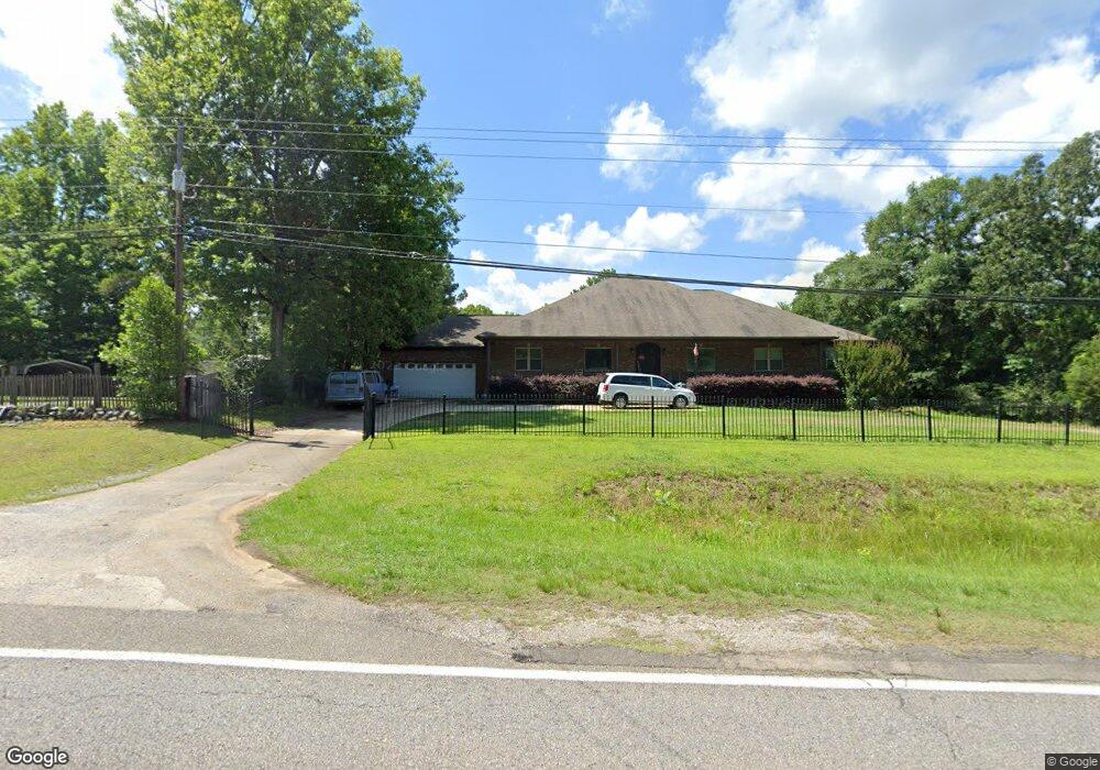
13801 Highway 11 N Cottondale, AL 35453
Estimated Value: $368,000 - $641,000
4
Beds
4
Baths
3,586
Sq Ft
$154/Sq Ft
Est. Value
About This Home
This home is located at 13801 Highway 11 N, Cottondale, AL 35453 and is currently estimated at $551,323, approximately $153 per square foot. 13801 Highway 11 N is a home located in Tuscaloosa County with nearby schools including Vance Elementary School, Brookwood Middle School, and Brookwood High School.
Ownership History
Date
Name
Owned For
Owner Type
Purchase Details
Closed on
Aug 15, 2017
Bought by
Hewitt Kelvin and Hewitt Silvia
Current Estimated Value
Home Financials for this Owner
Home Financials are based on the most recent Mortgage that was taken out on this home.
Original Mortgage
$252,543
Outstanding Balance
$210,386
Interest Rate
3.9%
Estimated Equity
$340,937
Purchase Details
Closed on
Oct 16, 2009
Sold by
King Rodney
Bought by
Hewitt Kelvin
Create a Home Valuation Report for This Property
The Home Valuation Report is an in-depth analysis detailing your home's value as well as a comparison with similar homes in the area
Home Values in the Area
Average Home Value in this Area
Purchase History
| Date | Buyer | Sale Price | Title Company |
|---|---|---|---|
| Hewitt Kelvin | -- | -- | |
| Hewitt Kelvin | $180,671 | -- |
Source: Public Records
Mortgage History
| Date | Status | Borrower | Loan Amount |
|---|---|---|---|
| Open | Hewitt Kelvin | $252,543 | |
| Closed | Hewitt Kelvin | -- |
Source: Public Records
Tax History Compared to Growth
Tax History
| Year | Tax Paid | Tax Assessment Tax Assessment Total Assessment is a certain percentage of the fair market value that is determined by local assessors to be the total taxable value of land and additions on the property. | Land | Improvement |
|---|---|---|---|---|
| 2024 | $1,872 | $104,240 | $2,060 | $102,180 |
| 2023 | $1,872 | $97,700 | $2,060 | $95,640 |
| 2022 | $1,494 | $83,800 | $2,060 | $81,740 |
| 2021 | $1,494 | $83,800 | $2,060 | $81,740 |
| 2020 | $1,308 | $36,900 | $1,030 | $35,870 |
| 2019 | $1,308 | $36,900 | $1,030 | $35,870 |
| 2018 | $1,308 | $36,900 | $1,030 | $35,870 |
| 2017 | $1,187 | $0 | $0 | $0 |
| 2016 | $1,243 | $0 | $0 | $0 |
| 2015 | $1,290 | $0 | $0 | $0 |
| 2014 | $56 | $2,060 | $2,060 | $0 |
Source: Public Records
Map
Nearby Homes
- 10802 Mallard Lake Ln
- 0 Mallard Trail
- 0 Wire Rd
- 10799 Melrose Ln
- 1 Brant Ward Rd
- 10884 W Manor Dr
- 10463 Beulah Lake Ln
- 10452 N Davis Rd
- 0 N Davis Rd
- 0 Unit 21420013
- 0 Station 32 Rd Unit 170891
- 14541 Keenes Mill Rd
- 00 Ashborough Dr
- 14194 Chapel Park Rd
- 00 Keenes Mill Rd
- 0 Keenes Mill Rd
- 8200 Eastern Hills Dr
- 0 Lancaster Rd
- 0 Eastview Dr
- 11762 Brant Ward Rd
- 10880 Mallard Dr
- 13835 Highway 11 N
- 10937 Washington Estate
- 10927 Washington Estate
- 10860 Mallard Dr
- 10939 Washington Estate
- 13855 Highway 11 N
- 10873 Mallard Dr
- 10931 Washington Estate
- 10924 Washington Estate
- 10893 Washington Estate
- 10925 Washington Estate
- 10899 Washington Estate
- 13871 Highway 11 N
- 10840 Mallard Dr
- 10922 Washington Estate
- 13777 Frierson Ln
- 10905 Washington Estate
- 10894 Washington Estate
- 13740 Wire Rd