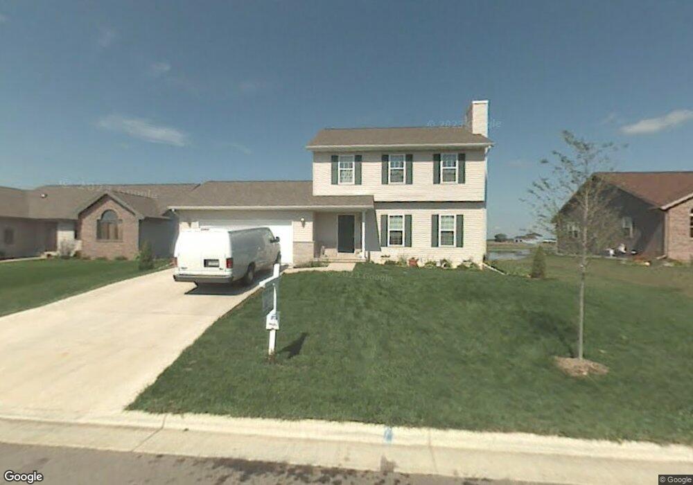
1381 Circle Dr Sun Prairie, WI 53590
Northern Sun Prairie NeighborhoodEstimated Value: $438,000 - $515,000
4
Beds
4
Baths
2,218
Sq Ft
$215/Sq Ft
Est. Value
About This Home
This home is located at 1381 Circle Dr, Sun Prairie, WI 53590 and is currently estimated at $476,375, approximately $214 per square foot. 1381 Circle Dr is a home located in Dane County with nearby schools including Bird Elementary School, Patrick Marsh Middle School, and Peace Lutheran School & Prekindergarten.
Ownership History
Date
Name
Owned For
Owner Type
Purchase Details
Closed on
Nov 24, 2008
Sold by
Mcgrane William D and Mcgrane Susan E
Bought by
Holum John and Holum Sarah
Current Estimated Value
Home Financials for this Owner
Home Financials are based on the most recent Mortgage that was taken out on this home.
Original Mortgage
$183,600
Outstanding Balance
$123,369
Interest Rate
6.48%
Mortgage Type
Purchase Money Mortgage
Estimated Equity
$353,006
Create a Home Valuation Report for This Property
The Home Valuation Report is an in-depth analysis detailing your home's value as well as a comparison with similar homes in the area
Home Values in the Area
Average Home Value in this Area
Purchase History
| Date | Buyer | Sale Price | Title Company |
|---|---|---|---|
| Holum John | $216,000 | None Available |
Source: Public Records
Mortgage History
| Date | Status | Borrower | Loan Amount |
|---|---|---|---|
| Open | Holum John | $183,600 |
Source: Public Records
Tax History Compared to Growth
Tax History
| Year | Tax Paid | Tax Assessment Tax Assessment Total Assessment is a certain percentage of the fair market value that is determined by local assessors to be the total taxable value of land and additions on the property. | Land | Improvement |
|---|---|---|---|---|
| 2024 | $8,135 | $414,700 | $75,100 | $339,600 |
| 2023 | $7,445 | $414,700 | $75,100 | $339,600 |
| 2021 | $6,766 | $309,100 | $70,300 | $238,800 |
| 2020 | $6,835 | $309,100 | $70,300 | $238,800 |
| 2019 | $7,092 | $283,300 | $63,900 | $219,400 |
| 2018 | $6,530 | $283,300 | $63,900 | $219,400 |
| 2017 | $6,213 | $283,300 | $63,900 | $219,400 |
| 2016 | $6,167 | $254,200 | $56,300 | $197,900 |
| 2015 | $5,972 | $254,200 | $56,300 | $197,900 |
| 2014 | $5,936 | $250,600 | $56,300 | $194,300 |
| 2013 | $6,022 | $250,600 | $56,300 | $194,300 |
Source: Public Records
Map
Nearby Homes
- 680 Stonehaven Dr
- 633 Stonehaven Dr
- 6532 N Bird St
- 1046 Stonehaven Dr
- 208 Scenic Ct
- 955 Liberty Blvd Unit 103
- 1171 School St Unit 1171
- 972 Chandler Ln Unit 972
- 994 Chandler Ln
- 952 Chandler Ln Unit 952
- 1048 Stonewood Crossing
- 856 Saint Albert the Great Dr Unit 856
- 1180 Patriot Way
- 1325 Bunker Hill Dr Unit 3104
- 1295 Stonehaven Dr
- 1010 Andrews Dr
- 6615 Kades Forge
- 1013 Vandenburg St
- 1294 Saint Albert the Great Dr
- 921 Pine St
- 1385 Circle Dr
- 1377 Circle Dr
- 1371 Circle Dr
- 1391 Circle Dr
- 1380 Circle Dr
- 1386 Circle Dr
- 1376 Circle Dr
- 1390 Circle Dr
- 1372 Circle Dr
- 1399 Circle Dr
- 1363 Circle Dr
- 1351 Stonewood Crossing
- 1368 Circle Dr
- 660 Stonehaven Dr
- 670 Stonehaven Dr
- 650 Stonehaven Dr
- 640 Stonehaven Dr
- 1366 Circle Dr
- 1359 Circle Dr